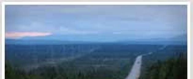
federal highway M-18 "Cola"- this is a road that leads to a harsh and mysterious land - the Russian North. Many here are looking for the lost traces of the great country of the north - Hyperborea. Following this route, you can get to an amazing place - the city of Kizhi, a monument of Russian wooden architecture. Where, having met with the extraordinary art of the ancient masters, you begin to feel and understand the spirit of the northern land.
The Kola highway is part of the large European route E 105 Kirkenes - Yalta and connects with another northern European route E 6. In addition, according to the new credentials, the M-18 Kola motorway now has the number P-21 Kola. And Petersburgers call this road - Murmansk Highway.
The total length of the M-18 highway is approximately 1592 km. It connects Karelia, Leningrad and Murmansk regions.
The M-18 motorway passes through picturesque places, in mountainous, forested and wooded-marshy areas.
The road surface is asphalt concrete, the width of the roadway is 7-8 meters.
The temperature regime is not uniform. If in the Leningrad region and Karelia the average January temperature reaches -12 degrees, then in the Murmansk region, it is already much cooler - 21 degrees. In addition, blizzards and heavy snowfalls often occur in this part of the route.
Along the M-18 highway there are entrances to the cities: Shlisselburg (5 km), Apatity (33 km), Segezha (9 km) and the village of Naziia (7 km).
Through all the water barriers that are encountered along the way, there are bridge crossings with a large carrying capacity of 60 - 100 tons. The M-18 "Kola" highway crosses the rivers: Olanka, Neva, Svir and Volkhov.
There are a number of dangerous sections on the M-18 "Kola" highway that drivers should pay attention to, these are: , 416, 430, 620 km.
In general, the M-18 federal highway does not leave anyone indifferent. On the one hand, the extraordinary, beautiful nature of the North and excellent sections of the road, and on the other, there are long stretches of off-road. But still, the bewitching beauty of Karelia will forever leave excellent impressions from trips along this highway.
On the way there are 29 medical aid stations: 48, 63, 124, 140, 178, 273, 283, 304, 320, 322, 339, 347, 384, 388, 427, 438, 443, 471, 478, 621, 721, 798, 009, 1157,1106, 1181, 1290, 1264, 1381, 1393.
Traffic police posts: 272, 384, 428, 621, 1148, 1290, 1370.
Food points are located at a distance of 35-40 km
Gas station 124, 226, 283, 384, 427, 471, 621, 720, 799, 855, 1009, 1148, 1181, 1280, 1264, 1290
STO 42, 124, 427, 520, 1009, 1159, 1264, 1388, 1388
Hotels and campsites 44, 124, 283, 386, 427, 471, 621, 720, 799, 855, 1009
Kilometers are indicated from the beginning of the route.
More accurate binding of objects and settlements to the kilometer signs of the M18 highway in the direction of St. Petersburg-Apatity (data from July 2009)
St. Petersburg (departure from the city) 0
Razmetelevo-gas station "Neste" on the right 22
Bridge across the Neva 40
Traffic police post + gas station "Slavneft" on the left 42
Gas station "Bashneft" on the right 44.5
Turn to Naziia, after the river. Naziia - parking with overpass on the right 61
Turn to Putilovo - gas station on the left 67
Dusevo, cafe on the left 83
Dusyevo - a monument to the "one and a half" 84
Sign "Volkhovsky district" 96
Gas station "Belul" on the left 96.5
Gas station "Belul" on the right 103
Kiselnya - cafe, bistro 24 hours, turn to Volkhov 108
ARIS gas station, tire service 110
Regular (without overpass) parking on the left 117
Gas station "Rosneft" on the left, regular parking 120
New Ladoga - traffic police post, gas station "Surgutneftegaz" on the right, cafe, turn on Volkhov 121
Turn to Tikhvin and Vologda right 122
Bridge across the Volkhov, cafe on the right 122.5
Turn on Nemyatovo left 124.5
Turn on Kolchanovo right 134
Syasstroy - gas station "Lukoil" on the left, the bridge over the river. Syas, car repair 135
Filling station "Slavneft" on the right, cafe 24 hours, filling station "ARIS" 137
Parking with overpass on the left 142
Selivanovo 146
Potanino 156
Pasha - gas station on the right, bridge over the river. Pasha, gas station "Linos" 175
Gas station "Rosneft" on the left 177
The plate "Lodeynopolsky district", r. Somersault 179
Domozhirovo. Gas station "Lukoil", service station, r. Oyat 185
Junction to Lodeynoye Pole 213
Turn to Tikhvin (to Tikhvin 156 km) 228
Lodeynoye Pole - gas station "Surgutneftegaz" on the left 233
Lodeynoye Pole - turn to Podporozhye and Vytegra 234
DPS post. Bridge over the river Svir, cafe 234
Parking at Vekhnozero (to the right of the road), approach to the lake (lots of rubbish) 243
Gas station "PTK" on the left, st. Inema, motel, cafe, tire service, auto parts 250
Border of Karelia 260
Traffic police post, cafe on the right, tire service, cafe on the left 268
Left turn to Olonets via Megrega 270
Megrega River 271
Turn to Olonets (road A130) 280
Turn to Kuteizha (right) and Verkhovye, r. Olonka 281
Turn to Olonets with parking (overpass and toilet), gas station "TNK" on the left 282
Leap in mileage 292
Parking with overpass and toilet on the left, cafe 306
Torosozero, r. Olonka 313
Pekki River 323
Parking with overpass on the left at the turn to Keskozero 337
Plate "Pryazha district" ~ 348
Parking with an overpass, a canopy and a toilet on the right 358
Turn to Svyatozero, to Yarn 16 km 369
Parking with overpass, carport and toilet 371
River Svyat 381
Yarn. Gas station "Ecotech", cafe, left turn to Kroshnozero and Sortavala 384
Yarn. DPS post. gas station 386
Turn to car repair on the right 387
Spring on the left (pavilion) ~392.5
Parking on the left ~ 398.5
Sailors, cafe on the left 400
Gas station "Palmira Trading" on the right 402
Shops and market 402.5
Canteen 403
Guest house and departure from Matrosov 403.5
Sign "Prionezhsky district" 407
Half, spring on the right 410
Vilga, auto parts, manufactured goods, medical center 418
Gas station "Palmira Trading" (container) on the left 419
Traffic police post at Petrozavodsk junction 421
Gas station "VD", cafe on the right 427
Turn to Suoyarvi (A133) 431
Gas station "Kitek", cafe on the right 434
Entrance to Shuya - gas station "ARIS" on the right 437
Shops, pharmacy 438
Shuya, Art. Shuiskaya, gas station "Shuiskaya" on the left 441
Tire fitting and car repair on the right 445
Turn to Luchevoe left 458
Turn to Tulguba right 460
Yanishpole, bridge across the Suna river, cafe, tire service 461
Entrance to Kondopoga - motels "Voyage" and "Mirage", cafe, service station, gas station on the left 471-472
Gas station "Ecotech" on the right, cafe, turn to Berezovka and Kondopoga left 478
Turn to Kivach 493
Sopokha - gas station on the right, cafe 493
Turn to Girvas, gas station "Kwazar" on the left, cafe 514-515
Beach at Paleozero 517
Access to the shore of Paleozero from road 519
Leap in mileage 565
Turn on Tivdino left 572
Parking with overpass and toilet on the right, r. Lizhma 578
River Niva 579
Overpass parking lot 594
Turn to Kappaselga (first) 595
Turn to Kappaselga (second) 600
Parking and cafe on the right, sign "Kondopozhsky district" 607
Chebinka River 608
Junction Yustozero (~ 66 km) - Medvezhyegorsk (~ 6 km), gas station TNK 623
Wandozero on the left, no entrances 643
Monument and small parking lot 646
Turn to Maselgskaya, in front of it on the right is Kommunarov Lake 647
Vidlozero on the right 653
Turn on Ramentsy left 657
Turn on Sumerichi left 664
Turn to Urosozero and Suglitsa 681
Turn to Taboi threshold left 702
Segezha River, no ramps ~705
Exit to garden plots at Lindozero 712
Pezega River 714
Right lapel towards the river 714.5
Gas station "TO", tire fitting, cafe, shop 716
Turn to Segezha (~ 11 km), motel, cafe, gas station 721
Spontaneous parking on the left 725
Onda River, left turn to gardening, no parking ~730
Giryu-Lambina River 741
Onigma River 742
Turn to Nadvoitsy (~ 14 km) right, cafe 748
Turn to Kochkoma (~ 8 km) 754
Plate "Belomorsky district" 767.5
River Idel 769
Tunguda River 775
Summer River 781
Turn to Letnerechensky (~ 15 km) right 786
Pushnoy, gas station TNK on the left, cafe, compressed air. 796
Pov. on Lehtu-Shuezero (~ 20 km) left, gas station "ARIS", tire service, cafe 798
Turn to Belomorsk (~ 46 km) 799
Turn to Northnavolok and Pertozero left ~805
Shuya River 822
Parking on the left 837
Sign "Kemsky district" 847
Lake near the road on the right 848
Poduzhemskaya HPP - r. Kem 855
Pov. on Kem right (~ 14 km), parking. TNK gas station - exit from the city 856
Gas station TNK 857
Turn to Kalevala (~ 160 km) 863
Lakes on both sides of the road - water for washing / washing the car 869
River Five ~ 871
Summer River 886.5
Viksh River, site 897
Drinking water - r. Black 897.5
Yalo River 902
Pongoma River 913
Turn to Kuzema (~ 33 km) right 917
Overpass parking on the left 925
Sign "Luhsky district" 932
River Kuzema 938
Upper Kuzema River ~950
Spontaneous parking on the right 976
Parking right 986
Turn to Ambarny and Engozero right 995
Spontaneous Parking 999
Lip Wide on the left, approaches to the water. Dirty, emergency parking 1006.5
Turn right on Loukhi (~ 8 km), traffic police post, gas station, snack bar 1009
Keret River 1022
Turn to Chupa 1035
Lower Kotozero 1038
Turn to the Arctic Circle, parking, tavern on the right, left turn to Nolyozero 1050
The second turn to the Arctic Circle 1056
Turn to Tedino left, cafe, toilet, shower 1057
Stele "Arctic Circle" 1067.5
Border of the Murmansk region 1068
Lesnoy settlement 1074
River Kovda 1078
Turn to Kovdu (~ 7 km) right 1081
Turn on the railway station. Kovda (~ 4 km) left 1084
Turn to Lesozavodsky (~ 10 km) right 1087
Zelenoborsky - spare parts, tire fitting, r. Prince 1105
Gas station "Rosneft", cafe 1107
Spring on the right (pavilion) 1112
Turn on st. Zhemchuzhnaya (~1.5 km) left 1116
Parking on the right 1117
Turn to Ruchi (~ 2 km) left 1126
Turn on st. White Sea (~ 7 km) right 1137
Lip Kanda 1138
Overpass parking lot 1140
Turn to Alakurtti (~ 100 km) left 1144
traffic police post, gas station "Vega", cafe, toilet 1149
Pov. Kandalaksha (~ 3 km). Kandalaksha - Statoil gas station, 20A Pronin str. 1151
Overpass parking, cafe 1175
Pov. Polar Zori (~ 3 km). Polyarn.Zori-Gas Station "Statoil" Nivsky ave. 17 1181
Turn to the Kola NPP, traffic police post 1188.5
Turn to Kovdor left 1201
Gas station "Pirenga" (container) on the left 1202
Pirenga river, parking, cafe 1202.5
Plate "Apatitsky district" 1203
Parking right ~1214
Parking on the right 1220
Bridge over the river Chupa 1221
Plate "Monchegorsk region" 1226
Turn to Apatity (~28 km) and Kirovsk (~44 km) right.
The federal highway R-21 "Kola" (until December 31, 2017, the previous registration number - "M-18" is simultaneously used) is a public highway of federal significance.
St. Petersburg - Petrozavodsk - Murmansk - Borisoglebsky. Included in the European highway E 105.
The length of the motorway is ~1592 kilometers. (The length is constantly decreasing due to the straightening of the route.)
The width of the highway M-18 (R-21) "Kola" is 7-8 meters.
Passes through the territory of the Leningrad region, Karelia and the Murmansk region.
The main road has access to the following cities and settlements:
Naziia (7 km),
Segezha (9 km),
Apatity (33 km),
Shlisselburg (5 km),
Petrozavodsk (4 km),
 A number of sections on the road are dangerous for traffic:
- with steep descents and ascents
(271 km, 329 km, 350 km, 360 km, 370 km, 380 km, 416 km, 620 km).
- with sharp turns
(272 km, 281 km, 286 km, 368 km, 372 km, 381 km, 430 km).
- limited visibility
(281 km, 297 km, 330 km).

The road crosses significant rivers:
Neva (near Kirovsk),
Volkhov (near Novaya Ladoga),
Svir (near Lodeynoye Pole),
Olanka (near Olonets).
All bridges with a length of more than 50 m have a load capacity of 60-100 tons.
Route
The beginning is the Neva overpass, which is a continuation of Narodnaya Street in St. Petersburg.

0 km St. Petersburg
20 km Vsevolozhsk A129
38 km Kirovsk A120
39 km Shlisselburg
121 km Novaya Ladoga A114
138 km Syasstroy
177 km Pasha
229 km Lodeynoye Pole R36
276 km Olonets A130
374 km Yarn R21
411 km Sailors
418 km Half
426 km Wilga
429 km New Vilga A133
417 km Petrozavodsk R19
426 km Shuya R15
521 km Spasskaya Guba
557 km Girvas
621 km Medvezhyegorsk A132
754 km Kochkoma A134
799 km Furry
856 km Kem A135
1009 km Louhi A136
1155 km Kandalaksha
1182 km Polyarnye Zori
1260 km Monchegorsk
1291 km Olenegorsk
1382 km Murmansk
1385 km Cola
1389 km P12 (to Finland)
1511 km Satellite
1517 km Pechenga
1538 km Zapolyarny
1592 km Borisoglebsky
Using the GPS tracking system locme.ru
Driving 2000 km at once is not an impossible task, but simply unnecessary. As my friend Aleksey Mochalov, a car traveler of the highest standard, says, 600 km is a threshold value for one driver. After - attentiveness is critically reduced. For myself, I chose a compromise option: drive 1000 km to Petrozavodsk, get enough sleep and with renewed vigor drive another thousand to Murmansk. I was also offered to drive along the Arkhangelsk highway, but I was embarrassed by the conflicting reviews about repairs in the Vologda region, while the Leningradskoe highway to Kirishi was well known.
At the same time, I had little understanding of what the Cola track was. In my picture of the world, it looked like a cross between the roads of the Ryazan region and the Yakutsk-Magadan highway: a mixture of off-road and despair.
Actually, such a route existed until the middle of the 20th century, when road communication with Murmansk was organized along gravel and dirt roads. The decision to build a highway that would link the cities of Leningrad, Petrozavodsk and Murmansk was made only at the end of the 50s, namely in 1958 by the Decree of the Central Committee of the CPSU and the Council of Ministers of the USSR. At the same time, design and survey work began on a highway 1,407 kilometers long.
At the beginning of 1961, the designers began surveys, the first section was from the Vite River to the Moncha River near the city of Monchegorsk. Documentation for the first section was issued in 1962 (section Monchegorsk - Chuna River), and in 1963 design estimates for the Zasheek - river section were issued. Chuna. By this time, the road builders had already laid the first 200 kilometers from Leningrad to Vytegra in Karelia.
The first section of the motorway Leningrad - Murmansk on the stretch Monchegorsk - Zasheek with a length of 85.3 km was put into operation in 1965. After that, all forces were thrown into the construction of the road on the Murmansk-Monchegorsk stretch, the construction of which was completed in 1976.
In its modern form, the route St. Petersburg - Murmansk was marked almost 35 years ago, in 1981. In 1982, the highway was given the title "Motorway Leningrad - Murmansk", route No. M-18, and then, on the basis of the Decree of the Government of the RSFSR No. 62 dated December 24, 1991 - "Motorway M-18" Kola "- from St. Petersburg through Petrozavodsk to Murmansk. In 2003, the Murmansk - Pechenga road and the section to the border with Norway with the international checkpoint "Borisoglebsk" were included in the route. With the adoption of the new classification, the road was named R-21 "Kola" St. Petersburg - Petrozavodsk - Murmansk - Pechenga - the border with the Kingdom of Norway. In 2012, another road from the Arctic became part of the Kola federal highway - the entrance to the airport in the city of Murmansk.
What I saw in September 2017 exceeded all my wildest expectations! The road is just excellent - no worse than European autobahns. Moreover, workers are doing something along the entire length of the road: they are removing garbage, cutting bushes or repairing overpasses. Dream!
The track is cut in the rocks in many places, so local drivers are very fond of building home-made seids for good luck - small turrets made of stones. They are everywhere, from very tiny to multi-ton boulders.
Thanks to the ideal roadway, you can walk along the Kolya at a consistently high speed. So we covered the second 1000 km to Murmansk 5 hours faster than to Petrozavodsk.
The only thing I missed was lighting. Half the way there and back we moved in the dark and it was very tiring.
Thanks for the photo to @_phantom.ace_ installerAnd gas stations - here they are really rare. And not only brands, any.
Our Toyota Land Cruiser 200 Executive had a diesel engine, which made it possible to move quite economically towards the Barents Sea. The average consumption on the highway was 10.9l / 100km, so we only refueled three times.
Two of the three gas stations were of a strategic nature - after them, fuel could not be found for many hundreds of kilometers.
Where to refuel on the Cola highway:
TNK near the village of Fur: 64.392768, 34.154424; – a bonus here is a good toilet, a cafe and excellent mobile internet
Kirishi car service near Lodeynoye Pole: 60.718323, 33.626972 – there is a toilet and a shop.
For entertainment, “Cola” is frankly stingy. At the exit from Petrozavodsk, you can go to the Kivach waterfall (I’ll tell you separately), a little further to the Girvas paleovolcano (we didn’t go), but closer to Murmansk -. That's all, but, fortunately, this monotony is compensated by views and speed.
Formally, cameras are installed on the track, but, as I understand it, the vast majority of them do not work - the locals are worn at supersonic speeds. I did not see any traffic police posts at all.
Such liberties with regard to the speed limit turned out to be directly proportional to the number of wreaths on the roadsides - there are a lot of them.
In summary, I want to say that in terms of transport accessibility, the harsh Kola Peninsula turned out to be quite hospitable. The road from Petrozavodsk to Murmansk took about 10 hours.
Roads in Russia can and should be of good quality!
Officially, the Kola highway (M18) is part of the European route E105 (from Norwegian Kirkenes to Ukrainian Yalta) and joins the E06 route - it passes through Sweden and Norway. Within Russia, the road links the Leningrad region, Karelia and the Murmansk region; the length of the route is 1592 km. This is a fantastic road, because it leads to the Russian North. On it you can get to Kizhi, an amazing monument of Russian wooden architecture, or to Kirovsk - one of the most famous Russian ski resorts. And on the way - visit the Valaam Monastery on Lake Ladoga, see the wooden church in Kondopoga, the nature reserve and the Kivach waterfall ... And finally get to Murmansk. This is our main non-freezing port, the city of white nights (they last here for almost three months), the hero city, picturesquely spread over the hills. Even the central square here is called unusually: Five Corners!
But to get here by car, you have to overcome one and a half thousand kilometers through plains, forests, tundra and mountains. Cross wide rivers - Neva, Svir, Volkhov. And drive along the shores of two great lakes - Ladoga and Onega.
The M18 federal highway will not leave anyone indifferent. It was opened not so long ago, in 1986, but for several years it has been in need of a major overhaul. The first section, from St. Petersburg to Medvezhyegorsk (a town on the northern tip of Lake Onega, a distance of about 580 km), can be considered simply excellent. At the 135th kilometer, a bridge is being reconstructed across the Syas River (near the town of Syasstroy in the Leningrad Region). The bridge is old, it was built back in 1958 and was recently recognized as pre-emergency. In May next year, they promise to commission a new bridge, but for now, traffic is organized along a temporary bypass overpass. The traffic flow moves without delay. Minor repair work is underway on the section to Petrozavodsk, but there are no traffic difficulties anywhere.
The real problems begin behind Medvezhyegorsk, where a wide reconstruction of the route has been launched; it will continue until late autumn, while the weather allows for active roadworks (see schedule). Another wave of repairs starts from the border of the Murmansk region. In the summer, drivers complained that on large sections of the old asphalt was removed to the primer and the trip turned into a natural rally-raid.
At the 1197th kilometer, near the turn to Kovdor, a new bridge is also being built. The old one, which connects the banks of the Wide Salma, has not met modern standards for a long time; metal trusses, installed almost half a century ago, have exhausted their resource. Further reconstruction of bridge crossings across the Kovda River (near Kandalaksha) and across the Tuloma in the village of Kola is planned.
In general, the route is considered quite safe. Perhaps also because in recent years a huge number of video recording cameras have been installed here. Moreover, in the villages they often put two: at the entrance and exit. Experienced truckers, however, argue that some of the cameras are dummies. But who knows ... Therefore, drivers slow down just in case.
The federal highway P21 "Kola" has an old account number M18, which will be valid until December 31, 2017 along with the new number P21. The Kola highway runs through the territory of Karelia, the Leningrad and Murmansk regions of the Russian Federation. Road P21 (M-18) "Kola" is part of the European road E 105 Kirkenes - Yalta. It joins the European highway E 6 and the federal highway M-10.Highway P21 (M18) starts in the city of St. Petersburg and has a direction to Petrozavodsk - Murmansk - Pechenga, ends at the Borisoglebsky checkpoint, which is the only regular automobile checkpoint on the Russian-Norwegian border.
The total length of the M-18 highway is 1592 kilometers with a carriageway width of 7-8 meters without a dividing strip on the main part of the road covered with asphalt concrete. The official opening of the federal highway took place in 1986; it is subordinate to the Russian Road Administration.
In settlements located along the M18 highway, there are exits to other routes. Motor roads depart from St. Petersburg: M10, E18, M11, E20, M20, E95. With further movement along the route, signs are installed showing the number of kilometers from the beginning of the route in this section, the name of the settlement and the registration number of the highway to which there is an exit.
The M18 road is laid in a picturesque area, starts from the swampy, wooded territory of the Leningrad Region, then passes into the taiga zone with dark coniferous trees, and on the Kola Peninsula passes into the forest tundra and tundra. In the area adjacent to the road there are many large and small lakes of glacial origin, such as Lake Ladoga and Onega. On these lakes there are masterpieces of wooden architecture - Kizhi (on Lake Onega) and the Valaam Monastery (on Lake Ladoga).
The M18 highway crosses major rivers: the Neva, Volkhov, Svir, Olanka and others. Bridges across them have a carrying capacity of 60 to 100 tons. One of these bridges - Ladoga - is a historical landmark, since in its place in 1943 there was an ice-tank crossing, which played a big role in breaking the blockade of Leningrad during the Great Patriotic War. At the Ladoga bridge there is a museum of tanks that were raised from the bottom of the Neva.
Along the M18 highway, through certain sections of the road, there are gas stations, traffic police posts, first aid and catering points.
- In contact with 0
- Google+ 0
- OK 0
- Facebook 0