Today in Astrakhan the program of celebrating the Day of the Caspian Sea has begun. Such holidays are also celebrated in the five Caspian states. Although the Caspian requires modern conditions not so much holiday events how much respect from all who inhabit its shores and exploit its riches.
"Caspian News", of course, cannot stand aside, because the attitude to the Caspian Sea is inherent in the very name and ideology of our portal. Our story about a unique reservoir is a kind of offering to the “hero of the occasion”.
The uniqueness of the Caspian lies, first of all, in the fact that it is not a sea, but a real drainless lake. The sea should have access to the World Ocean, which the Caspian does not have, on the other hand, this salty lake has all the signs of the sea, from the tides to real storms, about which sailors say: “He who has survived a storm in the Caspian Sea is not afraid of any oceanic storms ". And the oceanic relief of the bottom is convincing evidence that the Caspian, together with the Black and Azov Seas, originally belonged to a single ancient reservoir, that is, it was part of the World Ocean.
Where the Caspian Lake is now located, a deepening in the earth's crust was formed several tens of thousands of years ago. Today it is filled with the waters of the Caspian Sea. At the end of the 20th century, the water level in the Caspian Sea was 28 meters below the level of the World Ocean. Approximately six thousand years ago, the waters of the Caspian gained independence, parting with the World Ocean. Another feature that distinguishes the Caspian from the sea is that the salinity of the water in it is almost three times lower than the salinity of the sea. It's because the rivers carry their fresh water to the Caspian Sea. The Volga accounts for the largest contribution: it gives the sea-lake almost 80% of all water. And it also connects the Caspian Sea with the World Ocean through a system of canals. That is why this lake is still considered the sea!
In terms of its area and volume of water, the Caspian Sea-Lake has no equal on Earth. The volume of Caspian water is 44% of the reserve of all lake waters of the planet! If we talk about the depth of reservoirs, their area and volume of water, then the lake can compete with the Yellow, Baltic and Black Seas and surpasses the Aegean and Adriatic Seas in the same parameters.
Not every sea can boast that in its history it had as many names as the Caspian: as many as seventy! Each traveler, each expedition to the Caspian Sea and the ancient peoples inhabiting its coast gave it their names. The most famous names are: Dzhurdzhansky, Khvalynsky, Shirvansky, Derbentsky, Saraysky and finally, Khazarsky. In Azerbaijan and Iran, the Caspian Sea is still called the Khazar Sea. BUT modern name the sea received because of the tribes of Caspian horse breeders, who for a very long time inhabited the eastern parts of the Caucasus and the steppes of the Caspian territories.
The Caspian Sea is the hero of many legends and traditions in the epic of all peoples living on its shores. Legends, as a rule, tell about the love of the mighty and beautiful hero of the Caspian Sea for one of the beauties named Volga, Kura or Amu Darya - the choice is huge, since about 130 large and small rivers flow into the sea, nine of which have a mouth in the form deltas. Fantasy on the theme of love is about the same for everyone.
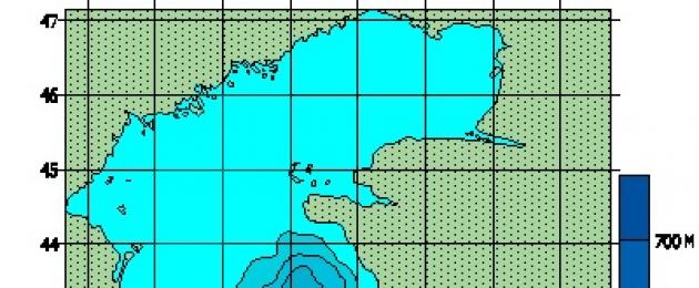
The water area of the sea is divided into three regions: the North, Middle and South Caspian. The northern Caspian is shallow. The deepest depth of the Middle Caspian in the region of the Derbent depression is about 788 m. Beyond the Absheron threshold, the South Caspian begins, it is here that the sea is the deepest: about 1025 m. For clarity, imagine three Eiffel towers stacked on top of each other.
Many secrets and mysteries are connected with the Caspian Sea. In 1939, archaeologists-divers found a flooded ancient Gostiny Dvor (caravanserai) in the Baku Bay. Many inscriptions have been preserved on the walls, indicating that the building was erected in 1234-1235. Maybe it's leftovers ancient city Sabail. Nearby, ancient quarries were discovered in the sea. And in 1940, when laying a dam on the Absheron Peninsula, an ancient cemetery was discovered at the bottom of the sea. Burials date back to the 1st century BC. It can be assumed that the level of the Caspian in those days was about four meters lower than the present one.
It is no coincidence that the inscription on geographical map, compiled in 1320, says: "The sea arrives every year on one palm, and already many good cities are flooded"
Instrumental measurement of the level of the Caspian Sea and systematic observations of its fluctuations have been carried out since 1837. Most high level of water was registered in 1882 (−25.2 m), the lowest - in 1977 (−29.0 m), since 1978 the water level has risen and in 1995 reached −26.7 m, since 1996 it again began decrease, and since 2001 - rise again and reached a mark of −26.3 m. The reasons for such "behavior" of the Caspian Sea are climate change, as well as geological and anthropogenic factors.
Another mystery of the unique sea-lake is the Caspian seal: scientists cannot answer the question of where the animal of northern latitudes came from in the Caspian Sea. In total, 1809 species of various groups of animals live in the Caspian Sea. The Caspian is also famous for its valuable fish species, in particular sturgeons. Their reserves account for up to 80% of the world's resources. The most valuable caviar is not black, as many people used to think, but white. Albino beluga caviar "Almas" has a color from light gray to white. The lighter, the more expensive: the cost of 100 grams is 2000 US dollars. This fish is caught in the Caspian Sea off the coast of Iran.
Many oil and gas fields are being developed in the Caspian Sea. The first oil well was drilled on the Absheron Peninsula near Baku back in 1820. In 1949, for the first time, they began to extract oil from the bottom of the Caspian Sea. Salt, limestone, stone, sand and clay are also mined on the coast of the Caspian Sea and the Caspian shelf.
The Caspian Sea washes the shores of five countries: Kazakhstan, Azerbaijan, Turkmenistan, Iran and Russia. Caspian Day has been celebrated in every country for several years now, reminding that the Caspian is not just a water and breadwinner for the peoples inhabiting its shores, but a very fragile ecosystem.
By the way, in 1978, World Maritime Day appeared on the calendar of world events, which refers to international days UN, designed to draw the attention of mankind to the problems of the hydraulic system. There is also an international Black Sea day: in 1996, representatives of Russia, Ukraine, Bulgaria, Romania, Turkey and Georgia signed a strategic action plan to save the Black Sea. In this series, the day of the Caspian Sea is also, rather, not a holiday, but a warning, a warning to people about how everything is interconnected in this world and how it is possible, mercilessly exploiting, to lose what is dear to everyone.
Marina Parenskaya
Caspian Sea - the largest lake on Earth, drainless, located at the junction of Europe and Asia, called the sea because of its size, and also because its bed is folded the earth's crust ocean type. The water in the Caspian is salty - from 0.05 ‰ near the mouth of the Volga to 11-13 ‰ in the southeast. The water level is subject to fluctuations, according to 2009 data it was 27.16 m below sea level. The area of the Caspian Sea is currently approximately 371,000 km², the maximum depth is 1025 m.
Geographical position
The Caspian Sea is located at the junction of two parts of the Eurasian continent - Europe and Asia. The length of the Caspian Sea from north to south is approximately 1200 kilometers (36°34 "-47°13" N), from west to east - from 195 to 435 kilometers, on average 310-320 kilometers (46°-56° v. d.). The Caspian Sea is conditionally divided according to physical and geographical conditions into 3 parts - the Northern Caspian, the Middle Caspian and the Southern Caspian. The conditional border between the North and Middle Caspian runs along the line of about. Chechnya - Cape Tyub-Karagansky, between the Middle and South Caspian - along the line of about. Residential - Cape Gan-Gulu. The area of the Northern, Middle and Southern Caspian is 25, 36, 39 percent respectively.
The length of the coastline of the Caspian Sea is estimated at about 6500-6700 kilometers, with islands - up to 7000 kilometers. The shores of the Caspian Sea in most of its territory are low-lying and smooth. In the northern part, the coastline is indented by water channels and islands of the Volga and Ural deltas, the shores are low and swampy, and the water surface is covered with thickets in many places. The east coast is dominated by limestone shores adjacent to semi-deserts and deserts. The most winding coasts are on the west coast in the area of the Apsheron Peninsula and on the east coast in the area of the Kazakh Gulf and Kara-Bogaz-Gol. The territory adjacent to the Caspian Sea is called the Caspian Sea.
Peninsulas of the Caspian Sea
Large peninsulas of the Caspian Sea:
- Agrakhan Peninsula
- The Absheron Peninsula, located on the western coast of the Caspian Sea in the territory of Azerbaijan, at the northeastern end of the Greater Caucasus, the cities of Baku and Sumgayit are located on its territory
- Buzachi
- Mangyshlak, located on the eastern coast of the Caspian Sea, on the territory of Kazakhstan, on its territory is the city of Aktau
- Miankale
- Tyub-Karagan
Islands of the Caspian Sea
There are about 50 large and medium-sized islands in the Caspian Sea with a total area of approximately 350 square kilometers. The largest islands:
- Ashur-Ada
- Garasu
- Boyuk Zira
- Zyanbil
- Cure Dashi
- Hara Zira
- Ogurchinsky
- Sengi-Mugan
- Seals
- Seal Islands
- Chechen
- Chygyl
Bays of the Caspian Sea
Large bays of the Caspian Sea:
- Agrakhan bay
- Kizlyar Bay
- Dead Kultuk (former Komsomolets, former Tsesarevich Bay)
- Kaydak
- Mangyshlak
- Kazakh
- Kenderly
- Turkmenbashi (bay) (former Krasnovodsk)
- Turkmen (bay)
- Gyzylagach (former bay named after Kirov)
- Astrakhan (bay)
- Hasan-kuli
- Gyzlar
- Hyrcanus (former Astarabad)
- Anzali (former Pahlavi)
- Kara-Bogaz-Gol
Rivers flowing into the Caspian Sea- 130 rivers flow into the Caspian Sea, of which 9 rivers have a mouth in the form of a delta. The major rivers flowing into the Caspian Sea are the Volga, Terek, Sulak, Samur (Russia), Ural, Emba (Kazakhstan), Kura (Azerbaijan), Atrek (Turkmenistan), Sefidrud (Iran) and others. largest river, which flows into the Caspian Sea - the Volga, its average annual drainage is 215-224 cubic kilometers. The Volga, Ural, Terek, Sulak and Emba provide up to 88-90% of the annual runoff to the Caspian Sea.
Physiography
Area, depth, volume of water- The area and volume of water in the Caspian Sea varies significantly depending on fluctuations in water levels. At a water level of -26.75 m, the area is approximately 371,000 square kilometers, the volume of water is 78,648 cubic kilometers, which is approximately 44% of the world's lake water reserves. The maximum depth of the Caspian Sea is in the South Caspian depression, 1025 meters from its surface level. In terms of maximum depth, the Caspian Sea is second only to Baikal (1620 m) and Tanganyika (1435 m). The average depth of the Caspian Sea, calculated from the bathygraphic curve, is 208 meters. At the same time, the northern part of the Caspian Sea is shallow, its maximum depth does not exceed 25 meters, and the average depth is 4 meters.
Water level fluctuations- The water level in the Caspian Sea is subject to significant fluctuations. According to modern science, over the past three thousand years, the magnitude of the change in the water level of the Caspian Sea has reached 15 meters. According to archeology and written sources, a high level of the Caspian Sea is recorded at the beginning of the 14th century. Instrumental measurement of the level of the Caspian Sea and systematic observations of its fluctuations have been carried out since 1837, during this time the highest water level was recorded in 1882 (−25.2 m), the lowest - in 1977 (−29.0 m), from In 1978, the water level rose and in 1995 it reached -26.7 m, since 1996 there has been a downward trend again. Scientists associate the causes of changes in the water level of the Caspian Sea with climatic, geological and anthropogenic factors. But in 2001, the sea level began to rise again, and reached -26.3 m.
Water temperature- water temperature is subject to significant latitudinal changes, most clearly expressed in winter period when the temperature changes from 0-0.5 °C at the ice edge in the north of the sea to 10-11 °C in the south, that is, the water temperature difference is about 10 °C. For shallow water areas with depths less than 25 m, the annual amplitude can reach 25-26 °C. On average, the water temperature near the western coast is 1-2 °C higher than that of the eastern coast, and in the open sea the water temperature is 2-4 °C higher than near the coasts.
Water composition- the salt composition of the waters of the closed Caspian Sea differs from that of the ocean. There are significant differences in the ratios of the concentrations of salt-forming ions, especially for the waters of areas under the direct influence of continental runoff. The process of metamorphization of sea waters under the influence of continental runoff leads to a decrease in the relative content of chlorides in the total amount of salts in sea waters, an increase in the relative amount of carbonates, sulfates, and calcium, which are the main components in the chemical composition of river waters. The most conservative ions are potassium, sodium, chloride and magnesium. The least conservative are calcium and bicarbonate ion. In the Caspian Sea, the content of calcium and magnesium cations is almost two times higher than in the Sea of Azov, and sulfate anion is three times higher.
Bottom relief- the relief of the northern part of the Caspian Sea is a shallow wavy plain with banks and accumulative islands, the average depth of the Northern Caspian is 4-8 meters, the maximum does not exceed 25 meters. The Mangyshlak threshold separates the Northern Caspian from the Middle. The Middle Caspian is quite deep, the depth of water in the Derbent depression reaches 788 meters. The Apsheron threshold separates the Middle and South Caspian. The South Caspian is considered deep water, the depth of water in the South Caspian depression reaches 1025 meters from the surface of the Caspian Sea. Shell sands are widespread on the Caspian shelf, deep-water areas are covered with silty sediments, and in some areas there is an outcrop of bedrock.
Climate- The climate of the Caspian Sea is continental in the northern part, temperate in the middle part and subtropical in the southern part. In winter, the average monthly air temperature varies from -8…-10 in the northern part to +8…+10 in the southern part, in summer - from +24…+25 in the northern part to +26…+27 in the southern part. The maximum temperature of +44 degrees was recorded on the east coast. The average annual rainfall is 200 millimeters, ranging from 90-100 millimeters in the arid eastern part to 1,700 millimeters off the southwestern subtropical coast. Evaporation of water from the surface of the Caspian Sea is about 1000 millimeters per year, the most intense evaporation in the area of the Absheron Peninsula and in the eastern part of the South Caspian is up to 1400 millimeters per year. The average annual wind speed is 3-7 meters per second, northerly winds prevail in the wind rose. In the autumn and winter months, the winds increase, the wind speed often reaches 35-40 meters per second. The most windy areas are the Apsheron Peninsula, the environs of Makhachkala and Derbent, where the highest wave 11 meters high was also recorded.
currents- The circulation of waters in the Caspian Sea is connected with the runoff and winds. Because the most of The water flow falls on the Northern Caspian, the northern currents predominate. An intense northern current carries water from the Northern Caspian along the western coast to the Absheron Peninsula, where the current is divided into two branches, one of which moves further along the western coast, the other goes to the Eastern Caspian.
Economic development of the Caspian Sea
Oil and gas-Many oil and gas fields are being developed in the Caspian Sea. The proven oil resources in the Caspian Sea are about 10 billion tons, shared resources oil and gas condensate are estimated at 18-20 billion tons. Oil production in the Caspian Sea began in 1820, when the first oil well was drilled on the Absheron shelf near Baku. In the second half of the 19th century, oil production began on an industrial scale on the Absheron Peninsula, and then on other territories. In 1949, Oil Rocks for the first time began to extract oil from the bottom of the Caspian Sea. So, on August 24 of this year, the team of Mikhail Kaverochkin started drilling a well, which on November 7 of the same year gave the long-awaited oil. In addition to oil and gas production, salt, limestone, stone, sand, and clay are also mined on the coast of the Caspian Sea and the Caspian shelf.
Shipping- Shipping is developed in the Caspian Sea. Ferry crossings operate on the Caspian Sea, in particular, Baku - Turkmenbashi, Baku - Aktau, Makhachkala - Aktau. The Caspian Sea has a navigable connection with the Sea of Azov through the Volga and Don rivers and the Volga-Don Canal.
Fishing and seafood-fishing (sturgeon, bream, carp, pike perch, sprat), caviar production, as well as seal fishing. More than 90 percent of the world's sturgeon catch is carried out in the Caspian Sea. In addition to industrial production, illegal production of sturgeon and their caviar flourishes in the Caspian Sea.
Legal status of the Caspian Sea- after the collapse of the USSR, the division of the Caspian Sea for a long time was and still remains the subject of unsettled disagreements related to the division of the resources of the Caspian shelf - oil and gas, as well as biological resources. For a long time there were negotiations between the Caspian states on the status of the Caspian Sea - Azerbaijan, Kazakhstan and Turkmenistan insisted on dividing the Caspian along the median line, Iran - on dividing the Caspian along one-fifth part between all the Caspian states. The current legal regime of the Caspian is established by the Soviet-Iranian treaties of 1921 and 1940. These treaties provide for freedom of navigation throughout the sea, freedom of fishing, with the exception of ten-mile national fishing zones, and a ban on navigation in its waters of ships flying the flag of non-Caspian states. Negotiations on the legal status of the Caspian are currently ongoing.
In dry and hot climates, a large number sea water evaporates, water molecules pass into the air. So, every year such a huge amount of water particles is carried away from the surface of the Caspian Sea that all together they would fill a bowl with a volume of several hundred cubic kilometers. This amount of water could fill ten such reservoirs, which will be Kuibyshev.
But can water from the sea surface get into the bottom layers of the Caspian, to a depth of 900-980 meters?
This is possible provided that the density of the surface layers of water is greater than the density of the bottom layers.
It is known that the density of sea water depends on salinity and temperature. The more salts the water contains, the denser it is, and therefore heavier. water with high temperature less dense than cold water. Only at low temperatures (about 0-4°C) is the reverse ratio given, when the water becomes denser as it heats up.
high salinity surface layers of the sea is created in the hot season, when water evaporates strongly, while salt remains in the sea. At this time, the salinity of surface waters is not less, and even somewhat greater than the salinity of the deep and bottom layers.
The temperature of surface waters in the warm season is the same everywhere, about 25-28 °, that is, five times higher than at a depth of 150-200 meters. With the onset of the cold season, the temperature of the surface layers decreases and in a certain period it turns out to be 5-6° above zero.
The temperature of the near-bottom and deep (deeper than 150-200 m) layers of the Caspian Sea is the same (5-6 °), practically unchanged throughout the year.
Under these conditions, the lowering of denser surface cold and highly saline water into the bottom layers is possible.
Only in the southern regions of the Caspian, the temperature of surface water, as a rule, does not drop to 5-6°C even in winter. And, although the sinking of surface waters into the depths cannot occur directly in these areas, water is brought here by deep currents, which has descended from the surface in the more northern parts of the sea.
A similar phenomenon is observed in the eastern part of the border zone between the Middle and South Caspian, where chilled surface water descend along the southern slope of the boundary underwater threshold and then follow the deep current to the southern regions of the sea.
Such widespread mixing of surface and deep waters is confirmed by the fact that oxygen has been found at all depths of the Caspian Sea.
Oxygen can get to the depths only with the surface layers of water, where it comes directly from the atmosphere or as a result of photosynthesis.
If there was no continuous supply of oxygen to the bottom layers, it would quickly be absorbed by animal organisms there or spent on oxidation. organic matter soil. Instead of oxygen, the bottom layers would be saturated with hydrogen sulfide, which is observed in the Black Sea. In it, the vertical circulation is so weak that oxygen in sufficient quantities does not reach the depth, where hydrogen sulfide is formed.
Although oxygen is found at all depths of the Caspian Sea, it is far from being in the same amount in different seasons of the year.
The water column is richest in oxygen in winter. The more severe the winter, that is, the lower the temperature on the surface, the more intense the aeration process, which reaches the deepest parts of the sea. Conversely, several warm winters in a row can cause the appearance of hydrogen sulfide in the bottom layers and even the complete disappearance of oxygen. But such phenomena are temporary and disappear in the first more or less severe winter.
The upper water column is especially rich in dissolved oxygen up to a depth of 100-150 meters. Here, the oxygen content ranges from 5 to 10 cubic meters. cm in litre. At depths of 150-450 m, oxygen is much less - from 5 to 2 cubic meters. cm in litre.
Deeper than 450 m there is very little oxygen and life is very poorly represented - several species of worms and mollusks, the smallest crustaceans.
Mixing of water masses is also caused by surge phenomena and waves.
Waves, currents, winter vertical circulation, surges, surges act constantly and are important factors water mixing. It is not surprising, therefore, that no matter where in the Caspian Sea we take a water sample, everywhere chemical composition her will be constant. If there was no mixing of waters, all living organisms of great depths would die out. Life would be possible only in the zone of photosynthesis.
Where the waters mix well and this process proceeds quickly, for example, in shallow areas of the seas and oceans, life is richer.
The constancy of the salt composition of the water of the Caspian Sea is a common property of the waters of the World Ocean. But this does not mean that the chemical composition of the Caspian is the same as in the ocean or in any sea connected to the ocean. Consider a table showing the salt content in the waters of the ocean, the Caspian and the Volga.
|
Carbonates (CaCO 3) |
Sulphates CaSO 4 , MgSO 4 |
Chlorides NaCl, KCl, MgCl 2 |
Average salinity water ‰ |
|
|
Ocean |
0,21 |
10,34 |
89,45 |
|
|
Caspian Sea |
1,24 |
30,54 |
67,90 |
12,9 |
|
Volga river |
57,2 |
33,4 |
The table shows that ocean water has very little in common with river water in terms of salt composition. In terms of salt composition, the Caspian Sea occupies an intermediate position between a river and an ocean, which is explained by the great influence of river runoff on the chemical composition of Caspian water. The ratio of salts dissolved in the water of the Aral Sea is closer to the salt composition of river water. This is understandable, since the ratio of the volume of river runoff to the volume of the waters of the Aral Sea is much larger than for the Caspian. A large amount of sulfate salts in the Caspian Sea gives its water a bitter-salty taste that distinguishes it from the waters of the oceans and the seas connected to them.
The salinity of the Caspian Sea is continuously increasing towards the south. In the pre-estuary space of the Volga, a kilogram of water contains hundredths of a gram of salts. In the eastern regions of the South and Middle Caspian, salinity reaches 13-14‰
The concentration of salts in the Caspian water is low. So, almost twenty times more salts can be dissolved in this water than there are in it.
B.A. Shlyamin. Caspian Sea. 1954
| <<Назад |
The Caspian Sea is the largest enclosed body of water. And although the water in it is salty, and the bed is lined with rocks of the oceanic type, it is located at a distance from the oceans and is a giant drainless lake.
The Caspian Sea is located in two parts of the world at once. Its western shore washes the European part of the mainland, and the eastern one is part of Asia. Its length from north to south is 1030 km, and from west to east 435 km at the maximum point. Sea coordinates: 36°34'–47°13' north latitude and 46°–56° east longitude.
You can get to the Caspian Sea from anywhere in Russia. One of the main destinations for the Russians will be Astrakhan and the region, with which both air and rail flights go from the capital and other large cities all year round. It is not so easy to get from remote cities, as often the stations do not make direct flights to Astrakhan.
Another popular route runs through Dagestan and leads to Makhachkala, Kaspiysk or Derbent - the main cities for tourists. Planes from Moscow, St. Petersburg, Yekaterinburg and Krasnoyarsk fly to the capital of the republic all year round. It is also possible to get there by train, but in summer they are usually packed with people.
Historical facts
The lake was formed from the Sarmatian Sea tens of millions of years ago, when the Caucasus Mountains did not divide it into the Black and Caspian Seas. The Sarmatian Sea itself finally lost direct access to the ocean more than 70 million years ago.
One of the first written references to the Caspian was found on clay tablets dating back to the 9th century. BC e. They were found during excavations in Assyria, the territory of which mainly belongs to modern Iraq and Syria. Later, Herodotus, Aristotle and the "father of geography" Hecateus of Miletus mention the Caspian. Their knowledge was generalized and expanded by Arab scientists in the 9th-10th centuries.
How was the Caspian Sea formed?
With the development of medieval trade relations, information about the Caspian Sea spread to Europe and Turkey. The famous navigator and traveler Marco Polo described it in the 13th century. With the further passage of time, knowledge about the lake was only replenished, more detailed and truthful maps were created.
As for the name, over the thousands of years of its existence on it, people have given the lake more than 70 names. So, the ancient peoples called it Hyrcanian, and the Arabs - Khazar. The Chinese gave it the name Sihai, the Iranians - Kolzum, the Turks - Kyuchuk-Deniz.
The Russians called it the "Blue Sea", Khvalynsky or Khozemsky. The name also changed depending on the neighboring states. At one time it was also called Sarai, Turkmen, Avar, Persian and many other names. It took its modern name from the ancient nomadic pastoral tribes - the Caspians, who lived on its right bank around the 2nd millennium BC.
Characteristic
Of all the characteristics of the Caspian, the most interesting are its unique flora and fauna, which have collected many rare species of plants and animals, the determination of its origin and the problems associated with the ecology and pollution of the reservoir.
Bottom relief and depth
The Caspian Sea is divided into three geographical zones: North, Middle and South. The north is a sea plume with an average depth of no more than 5 m. It accounts for the smallest amount of lake water - about 1%. The second largest was the Middle Caspian, where the bottom at its maximum point goes to 780 m. It contains more than 30% of water reserves. 
The southern part is equal to the Middle part in terms of area, but is deeper and has more than 60% of the water mass.
It is here that the deepest point of the lake is located today - 1025 meters under water.
The boundaries between the parts are rather arbitrary, but they exist.
Between the North and the Middle of the border were the island of Chechen and Cape Tyub-Karagansky, and between the Middle and the South - the island of Zhiloy and Cape Gan-Gulu.
The relief of the lake bottom is quite uniform, but differs in different zones.
In the North, it is flat shallow water with small alluvial areas. The middle one goes deep and is covered with silt or shells. The southern one, being the deepest one, is also covered with silt, and in some places with ledges of bedrock.
Area and length
The surface area of the lake is approximately 370,000 sq. km. The water level is subject to cyclical changes: it goes down, then it rises. Scientists have found that over the past millennium, the water level in the lake has fluctuated within a dozen meters. This is a very big indicator.
It is connected primarily with the activity of people, as well as geological factors that constantly affect the reservoir. According to confirmed data, the water level is only rising. The South, Middle and North account for 40, 35, 25% of the area, respectively.
The length of the coastline is 6700 km, and taking into account the island territories - about 7000. The coasts themselves are quite smooth, without large hills. In the north, the lowland of the coast is represented by channels and islands formed by the Volga.
The area here is swampy and covered with dense thickets of reeds. The eastern coastal areas are adjacent to deserts and are composed of limestone or shells. The most "mountainous" were the coasts of the Absheron Peninsula and the Kazakh Gulf. 
The Caspian Sea is located in an area where there are many islands and peninsulas. The largest and most significant peninsulas are: the Agrakhan Peninsula, the Absheron Peninsula, on which Baku is located, the Mangyshlak Peninsula, which has the Kazakh city of Aktau, the Buzachi, Miankale and Tyub-Karagan Peninsulas.
There are about 50 large and medium-sized islands in the lake. Their total area is 350 sq. km. The most famous of them are: Chechen, Gum, Dash, Zyanbil, Seal Islands, Chygyl, Garasu and Ashur-Ada.
Water composition
The composition of water is different from that observed in the seas and oceans. This is due not only to the fact that the Caspian Sea is closed, but also subject to a significant influence of the waters of the continental runoff. This greatly reduces the content of chlorides and salts in the water, but increases the amount of calcium, carbonates and sulfates inherent in river water.
In the Sea of Azov, for example, there are two times less calcium cations than in the Caspian. Despite this, the water in the lake is salty - from 0.05 ppm at the confluence of the Volga to 11-13 ppm in the southern part.
| Carbonates (CaCO3) | Sulphates CaSO4, MgSO4 | Chlorides NaCl, KCl, MgCl2 | Average salinity of waters ‰ | |
| Ocean | 0,21 | 10,34 | 89,45 | 35 |
| Caspian Sea | 1,24 | 30,54 | 67,90 | 12,9 |
The basin of the sea and its relationship with the oceans
The Caspian Sea basin is 3.1 million sq. km. km. It includes such rivers as the Volga, Kuma, Uluchay, Samug, Sudak, Terek. The Volga is the largest and deepest river flowing into the lake. More than two hundred large rivers flow into it, and the number of its tributaries is more than 5000.
From the Astrakhan region begins its delta, which is the largest in Europe. The Volga receives most of its water from melting snow, rain and springs. In addition to these rivers, more than 100 rivers flow into the Caspian.
To date, the Caspian Sea has no direct connection with the ocean, however, an indirect connection is provided through the Volga-Don Canal. Through it, ships and fleets can get from the Caspian and Volga to the Don, the Sea of Azov and the Black Sea.
Climate
The Caspian Sea is located in several climatic zones, and the climate depends on its parts. In the northern part, it is continental with temperatures ranging from -10 °C in winter to +25 °C in summer. In the southern part, the climate becomes subtropical. The temperature there ranges from + 8 °C in winter to +27 °C in summer. 
The middle part of the Caspian Sea is located in a temperate climate with average temperatures. The highest temperature recorded on the east coast was +44 °C.
Water temperature is also subject to significant changes and depends on latitude. During the cold season in the northern part, the water can freeze or cool to 0 - 1 °C, and in the south the temperature does not fall below 10 °C. In summer, the water warms up from +20 °C to +27 °C, depending on the region.
As for precipitation, their average annual rate is 200 mm. Again, it all depends on the climate and varies from 100 mm in the eastern part to 1700 mm in the southern subtropics. It is best to visit the Caspian Sea in the summer at the end of July or in August. Ideal resorts will be Baku, Makhachkala and Astrakhan.
Flora and fauna
The fauna of the Caspian Sea is diverse and rich. It somewhat repeats other reservoirs, but is peculiar in its own way. Ancient sturgeon and salmon species of fish live here, as well as several types of herring, carp, pike perch, carp, sprat, mullet, bream, pike, and vobla. There are about 100 species of fish in total. 
The volume of sturgeon makes up 90% of all world stocks. The only and unique species of mammal living in this area is the Caspian seal, which is the smallest of all seals. Many of the species are protected by three reserves: Astrakhan, Caspian and Gyzylagadzh.
The vegetation has more than 700 species. The most significant for maintaining favorable conditions for animals are blue-green, red, brown and diatoms. Most of the flora represents the Neogene period of the ancient Caspian, however, some species are brought into the sea on purpose or accidentally due to shipping.
Ecological situation
The current ecological situation in the Caspian Sea is not the best. The main polluting factor was oil and its processing. As you know, it began to be mined here 150 years ago in Azerbaijan.
In this regard, the suppression of the development of finoplankton and blue-green algae began, the concentration of oxygen in the water decreased, which affected the reproduction of sturgeon fish, waterfowl and other living organisms. 
A lot of troubles were also brought by the mass reproduction of the comb jelly Mnemiopsis, which penetrated into the Caspian Sea from the Black and Azov Seas through the Volga-Don Canal. The comb jelly feeds on the same plankton as the Caspian fish.
This reduced their food base and put sturgeon on the brink of extinction. The number of valuable sturgeons has also decreased due to poaching, which, according to unofficial data, accounts for more than half of the catch.
The biological and hydrocarbon riches of the Caspian, unique in nature, are also destroyed by phenols and heavy metals that enter it with wastewater from industrial enterprises located near the reservoir.
Countries washed by the Caspian Sea
The waters of the sea wash the territories of modern:

The main cities located on the coast are Astrakhan, Baku, Aktau, Bender-Anzeli, Makhachkala and Turkmenbashi.
Tourism infrastructure on the Caspian Sea
The Caspian Sea is located around developed countries and its tourist infrastructure is represented by a large number of coastal resort towns with many recreation centers and hotels. Tourists have at their disposal not only active recreation in the form of fishing or water parks, but also beaches where, for little money, you can relax from morning to late evening, renting sun loungers, hammocks or gazebos.
Resorts on the Caspian Sea
Baku has become one of the most prestigious resorts. The capital of Azerbaijan with a population of 2.5 million people provides an opportunity not only to relax on the beach, but also to visit many attractions, some of which are included in the UNESCO World Heritage List.
It is still better to go to the beaches in the suburbs of Baku, where Shikhovo, Mardakan or Zagulba are located. The resort infrastructure of the Caspian Sea is at a high level. The beaches are clean and well maintained, hotel complexes provide a wide range of accommodation near the coast. AT
All this is a 30-minute drive from Baku. Do not write off Sumgayit either. It is located 30 km from Baku, but has more extensive shell-type beaches. It has less city fuss, but service and maintenance are not inferior to the capital. 
Kazakhstan also has several resorts in major cities. Aktau and Atyrau became the most popular. Despite the fact that Aktau is located in the desert and began to recreate the tourism infrastructure relatively recently, it has new hotel complexes with a decent quality of service.
Atyrau, on the other hand, has ceased to be in demand, since the Caspian Sea has become shallow in these places and the beaches have ceased to exist. In general, Kazakh resorts are in low demand among foreign and Russian vacationers.
The Caspian Sea washes several large Turkmen cities, including Turkmenbashi and Avaza. The second city enjoys tourist demand. Here, the construction of hotels and complexes also began relatively recently, but the resort has already managed to find its adherents.
One of its features are sand and shell beaches stretching for kilometers. The resorts of Turkmenistan also cannot be called popular among foreigners, since there is a rather complicated visa system when entering the country.
In Russia, the main popular are the two resorts of Astrakhan and Dagestan, represented by Astrakhan itself, Makhachkala, Derbent, Caspian and a couple of other small towns. One of the most picturesque is Derbent. Thanks to its landscapes and ancient buildings, which are part of the UNESCO heritage, the city has become popular not only among tourists from Russia, but also among foreigners.
Beaches on the Caspian Sea
The most interesting beaches of the Russian resorts were Jami, Goryanka, Laguna and the beach of the Caspian resort, located on the territory of Dagestan. Unfortunately, according to tourists, there are few good beaches in Astrakhan, and most of the coastal areas are located in reeds. 
Jami Beach, like the Caspian, belongs to hotel and sanatorium apartments located on the coast. That is why they are well equipped in terms of recreation and service. Goryanka beach is different in that only women and boys under 6 years old can enter its territory.
Among the beaches of Kazakhstan, the beaches of Manila, Nur Plaza, Dostar, Marrakesh deserve the most attention. The beaches of Manila and new Marrakesh are very popular, as the entrance to them is free, and they are open until late in the evening.
Nur Plaza and Dostar are paid. Entrance costs from 35 to 80 rubles. This price already includes umbrellas, sun loungers and other benefits. It is possible to cheaply rent gazebos, barbecues and park cars.
The beaches of the Turkmen Avaza stretch for 30 km and have good infrastructure and huge hotel complexes. But not everything is so good. Many note the many shortcomings of hotels and service for rather high ticket prices. Among them: cold water in the sea, low population, smells from oil refineries, which are located near the Caspian Sea. 
The beaches of Azerbaijan are rightfully considered the most developed. There are a lot of them for every taste and budget. Almost the entire coastal zone of Baku is built up with hotel complexes, recreation centers and beaches.
The most famous is the beach of the water park Shikhovo. It has everything for active recreation not only for adults, but also for children. Water slides and attractions will not make you bored, and a large number of sun loungers will fit everyone who wants to just lie in the sun. But do not forget about such beaches as Nabran, Sumgaiti, Novkhani and other places.
Sights of the Caspian Sea
On the territory of Russia there are many attractions that are worth visiting when arriving at the resort. In Astrakhan, they were the Astrakhan Kremlin, the Bridge of Lovers, the Wedding Waltz fountain. In Makhachkala, you can visit the Juma mosque, many museums and theaters, and in Derbent, the ancient Naryn-Kala fortress and the 150-year-old Derbent lighthouse often become a place of visit. 
Azerbaijan has unique architectural objects of its kind. In the suburbs of Baku, there is the Maiden Tower and a whole complex of walls with the palace of the Shirvanshahs, the Gobustan landscape with ancient rock paintings. There is something to see in the city center. Here are modern hotels, galleries and museums. For example, the Carpet Museum, the TV tower, the cultural center of Heydar Aliyev.
There are not so many sights in the Turkmen Avaza. Among them are several yacht clubs, a park, a Congress Center and an aqua park with attractions. There are no special sights in Kazakh Aktau, as well as streets. The whole city is divided into districts.
Entertainment and active recreation on the Caspian Sea
For people who love outdoor activities, there are special fishing tours to Astrakhan. Prices start from 20,000 rubles. and include accommodation, boat rentals, fish freezing and cooking facilities.
In Kazakhstan, for outdoor enthusiasts, there are bases with fitness centers, shady courts and much more. Among them, the Kenderly base stands out. Its only drawback: it is located 300 km from the coast. 
On the Azerbaijani coast there is everything for a good time. Water parks Shikhov and Resort will not let children and adults who love active entertainment get bored. Like the Turkmen water park in Avaza.
Prices for hotels in the Caspian Sea
Resort prices in Russia are the cheapest. Accommodation in apartments in Astrakhan will cost 600-700 rubles, and in hotels from 1200 to 3600 rubles. per day. The most popular hotels are Corvette, Bonhotel, Novomoskovsky. In Dagestan, the average price for a hotel will be 1,500 rubles. Coastal hotels: Argo, Pegasus, Assorted, Sharhistan, Versailles.
In Kazakh Aktau there are hotels Rakhat, Aktau, Victoria. Prices depend on the quality of services, but on average they start from 2,000 thousand rubles. Renting an apartment starts from 600 rubles.
Baku hotels provide the best conditions and service, however, the prices here are by no means the highest. The average price is 2000 rubles. Popular hotels are Consul, Bosfor, Safran. It is also possible to rent apartments and individual rooms.
But Turkmen hotels are the most expensive. Prices here start at $70. Despite this, many complain that for such money the service leaves much to be desired.
The Caspian Sea is a unique body of water with its own original flora and fauna. There are 5 states on its shores, most of which provide good tourist infrastructure and services at affordable prices. In coastal cities, there are ancient sights that are a UNESCO World Heritage Site.
Article formatting: Mila Fridan
Video about the Caspian Sea
Overview of holidays on the Caspian Sea:
The Caspian Sea is one of the largest salt water bodies of the Earth, located at the junction of Europe and Asia. Its total area is about 370 thousand square meters. km. The reservoir receives more than 100 water flows. The largest rivers flowing into - Volga, Ural, Emba, Terek, Sulak, Samur, Kura, Atrek, Sefidrud.
The Volga River - the pearl of Russia
The Volga is a river that flows through the territory of the Russian Federation and partially crosses Kazakhstan. It belongs to the category of the largest and longest rivers on Earth. The total length of the Volga is more than 3500 km. The river originates in the village of Volgoverkhovye, Tver region, located on the territory of the Russian Federation. After that, it continues its movement through the territory of the Russian Federation.
It flows into the Caspian Sea, but does not have a direct outlet to the World Ocean, so it is classified as an internal drain. The watercourse receives about 200 tributaries and has more than 150 thousand drains. Today, reservoirs have been built on the river, allowing to regulate the flow, due to which the fluctuations in the water level have been sharply reduced.
The fishery of the river is diverse. Melon growing prevails in the Volga region: the fields are occupied by grain and industrial crops; salt is mined. Oil and gas fields have been discovered in the Ural region. The Volga is the largest river flowing into the Caspian Sea, so it is of great importance for Russia. The main transport facility that allows crossing this stream is the longest one in Russia.
Ural - a river in Eastern Europe
The Ural, like the Volga River, flows on the territory of two states - Kazakhstan and the Russian Federation. Historical name - Yaik. It originates in Bashkortostan at the top of the Uraltau ridge. The Ural River flows into the Caspian Sea. Its basin is the sixth largest in the Russian Federation, and the area is more than 230 square meters. km. An interesting fact: the Ural River, contrary to popular belief, belongs to the inland European river, and only its upper course in Russia belongs to Asia.
The mouth of the stream gradually becomes shallower. At this point, the river splits into several branches. This feature is typical throughout the entire length of the channel. During floods, you can watch the Ural overflow its banks, in principle, like many other Russian rivers flowing into the Caspian Sea. This is especially observed in places with a gently sloping coastline. Flooding occurs at a distance of up to 7 meters from the riverbed.

Emba - the river of Kazakhstan
Emba is a river flowing on the territory of the Republic of Kazakhstan. The name comes from the Turkmen language, literally translated as "the valley of food." The river basin with an area of 40 thousand square meters. km. The river begins its journey in the mountains of Mugodzhary and, flowing along, is lost among the swamps. Asking which rivers flow into the Caspian Sea, we can say that in full-flowing years, the Emba reaches its basin.
Natural resources such as oil and gas are being exploited along the coastline of the river. The issue of passing the border between Europe and Asia along the Emba watercourse, as in the case of the river. Ural, an open topic today. The reason for this is a natural factor: the mountains of the Ural Range, which are the main reference point for drawing borders, disappear, forming a homogeneous terrain.
Terek - mountain water stream
Terek is a river of the North Caucasus. The name literally translates from Turkic as "poplar". The Terek flows out of the glacier of Mount Zilga-Khokh, located in the Trusovsky Gorge of the Caucasus Range. passes through the lands of many states: North Ossetia, Georgia, Stavropol Territory, Kabardino-Balkaria, Dagestan and the Chechen Republic. It flows into the Caspian Sea and the Arkhangelsk Bay. The length of the river is just over 600 km, the basin area is about 43 thousand square meters. km. An interesting fact is that every 60-70 years the flow forms a new transit arm, while the old one loses its strength and disappears.
The Terek, like other rivers flowing into the Caspian Sea, is widely used to meet the economic needs of man: it is used to irrigate the arid territories of the adjacent lowlands. There are also several hydroelectric power plants on the water stream, the total average annual output of which is more than 200 million kWh. In the near future, it is planned to launch additional additional stations.

Sulak - water stream of Dagestan
Sulak is a river that connects the streams of the Avar Koisu and the Andi Koisu. It flows through the territory of Dagestan. It starts in the Main Sulak Canyon and ends its journey in the waters of the Caspian Sea. The main purpose of the river is the water supply of two cities of Dagestan - Makhachkala and Kaspiysk. Also, several hydroelectric power stations are already located on the river, it is planned to launch new ones to increase the generated capacity.
Samur - the pearl of South Dagestan
Samur is the second largest river in Dagestan. Literally, the name from the Indo-Aryan is translated as "an abundance of water." It originates at the foot of Mount Guton; It flows into the waters of the Caspian Sea in two branches - Samur and Small Samur. The total length of the river is just over 200 km.
All rivers flowing into the Caspian Sea are of great importance for the territories through which they flow. Samur is no exception. The main direction of using the river is irrigation of lands and providing residents of nearby cities with drinking water. It was because of this that a hydroelectric complex and a number of the Samur-Divichinsky canal were built.
At the beginning of the 20th century (2010), Russia and Azerbaijan signed an interstate agreement requiring both sides to rationally use the resources of the Samur River. The same agreement introduced territorial changes between these countries. The border between the two states has been moved to the middle of the hydroelectric complex.

Kura - the largest river of Transcaucasia
Asking the question which rivers flow into the Caspian Sea, I want to describe the flow of the Kuru. It flows on the land of three states at once: Turkey, Georgia, Azerbaijan. The length of the stream is more than 1000 km, the total area of the basin is about 200 thousand square meters. km. Part of the basin is located on the territory of Armenia and Iran. The source of the river is located in the Turkish province of Kars, flows into the waters of the Caspian Sea. The path of the river is thorny, laid among hollows and gorges, for which it got its name, which in translation from the Megrelian language means “to gnaw”, that is, the Kura is a river that “gnaws” itself even among the mountains.
There are many cities on it, such as Borjomi, Tbilisi, Mtskheta and others. It plays an important role in meeting the economic needs of the inhabitants of these cities: hydroelectric power stations are located, and the Mingachevir reservoir created on the river is one of the main fresh water reserves for Azerbaijan. Unfortunately, the ecological state of the stream leaves much to be desired: the level of harmful substances exceeds the permissible limits by several times.

Features of the Atrek River
Atrek is a river located on the territory of Iran and Turkmenistan. It originates in the Turkmen-Kharasan mountains. Due to the active use in economic needs for irrigation of land, the river became shallow. For this reason, it reaches the Caspian Sea only during the flood period.
Sefidrud - the abundant river of the Caspian
Sefidrud is a major river of the Iranian state. It was originally formed by the confluence of two water streams - Kyzyluzen and Shakhrud. Now it flows out of the Shabanau reservoir and flows into the depths of the Caspian Sea. The total length of the river is over 700 km. The creation of a reservoir has become a necessity. It made it possible to minimize the risks of flooding, thereby securing the cities located in the river delta. The waters are used for irrigation of land with a total area of more than 200 thousand hectares of land.

As can be seen from the presented material, the Earth's water resources are in an unsatisfactory state. The rivers flowing into the Caspian Sea are actively used by man to meet his needs. And this has a detrimental effect on their condition: watercourses are depleted and polluted. That is why scientists around the world are sounding the alarm and conducting active propaganda, calling for saving and conserving water on Earth.
- In contact with 0
- Google Plus 0
- OK 0
- Facebook 0