Economic and geographical characteristics of Algeria
1. Introduction 3
2. Natural conditions 5
3. Geography of population 8
4. Geography of industry 9
5. Geography Agriculture 11
6. Geography of transport 14
7. External economic ties 15
8. Conclusion 16
9. References 17
1. Introduction
Algeria (named after the city of Algeria, from the Arabic al-Jezair - islands), (Arabic - Al-Jumhuriyah al-Jezairiyah Democracy al-Shaabiya) -
- a state in North Africa, located in the western part of the Mediterranean basin, where important world routes pass between the Atlantic and the Middle East, Europe and African countries. Borders: in the west with Morocco and Western Sahara, in the southwest with Mauritania and Mali, in the southeast with Niger, in the east with Libya and Tunisia. From the north, the territory is washed by the Mediterranean Sea. Area 2381700 sq. km. Population 29.3 million people. (1998). The capital is the city. Algeria (3 million inhabitants). Large cities of Oran (700 thousand people), Constantine (600), Annaba (400). Arabs make up 80%, Berbers - 19% (Kabiles, Chauyas, Tuaregs), the rest - 1%.
Most of Algeria's population are Sunni Muslims (Malikis and Hanafis). A number of followers of the Ibadite sect live in the Mzab Valley, Ouargla and Algiers. The state religion of the country is Islam. There are approx. 150 thousand Christians, mostly Catholics, and approximately 1 thousand adherents of Judaism. The official language is Arabic, but it is still widely spoken French. Some Berber tribes speaking Tamahak and Tamazirt acquired their own written language. Several books have already been published in the Tamazirt dialect in Algeria. About 3/4 of the population is concentrated in the foothills of the Tell Atlas, approximately 1.5 million people live in the highlands and less than one million in the Sahara Desert. The highest density is observed near the capital and in the Kabylia region. Length railways 4.2 thousand sq. km., length of roads is 102 thousand km. Geographical position |
Algeria occupies the central part of the Atlas mountain region and 1/4 of the Sahara Desert.
The territory of the country is 2381.7 thousand square meters. km.
The climate of Northern Algeria is subtropical. The average temperature in January is 5 - 12C, in July 25C. Precipitation is 400 - 1200 mm per year. The central and southern parts of the country are occupied by the Sahara Desert, where average daily temperature fluctuations reach 30 C. The climate of the Sahara is tropical, desert (less than 50 mm of precipitation per year).
Cork oak forests (in the mountains), semi-desert and desert vegetation.
Form of government -
Republic
Administrative division - 48 wilayas (provinces)
Head of State - President
Legislature - Unicameral National People's Assembly
The country is a developing country, a key subgroup.
2.Nature
Algeria occupies the central part of the Atlas Mountains and the Sahara Desert. Washed by the Mediterranean Sea. The coastal part lies in the northern subtropical zone, the rest of the territory lies in the tropical zone of the Northern Hemisphere.
The shores are mostly high, rocky, with narrow beaches. There are no bays protruding deeply into the land along the entire coast; the number of large bays is insignificant (Oranskaya, Algierskaya, Bejaia, Annaba).
Relief. Northern Algeria is represented by folded ridges, massifs and intermountain plains of the Atlas Mountains system. Within Algeria are the largest ridges of the Atlas - Tel Atlas and the Saharan Atlas, the Varsenis massifs (Sidi Amar, 1985 m), B. Kabylia and M. Kabylia (altitudes up to 1200 m), Hodna, Ores (Shelia, 2328 m ). The mountains are cut through by deep river gorges and divided into separate dome-shaped smaller massifs. Large intermountain plains and plateaus (the so-called high plateaus) in the central parts are occupied by large salt lakes - sebkhas.
The Algerian Sahara occupies the central part of the world's largest desert region, the Sahara. Its relief is dominated by plateaus about 500 m high. In the northeast there is a large lowland filled with sands and a basin of the salt lake Schott-Melgir (26 m below sea level). To the south-east extensive volcanic the Ahaggar highlands with the Atakor massif (Takhat, 3003 m - the highest peak of Algeria), surrounded by a system of stepped plateaus (Tademait, Tassilin-Ajer, Muidir, etc.). Within Algeria there are large sandy deserts with high dune ridges (Great Western Erg, Great Eastern Erg, Igidi, Shesh ergs, etc.) and rocky deserts (Tanez Ruft in the south).
Geological structure and minerals. The territory of Algeria within the Atlas Mountains belongs to the Mediterranean geosynclinal fold belt, and in the Sahara region to the ancient African platform. There are large deposits of oil and natural gas (Hassi-Mesaoud, etc.), which constitute the main wealth of Algeria. The Atlas contains known deposits of iron (Maghreb), copper, lead and zinc ores, phosphorites, mercury, antimony, barite, kieselguhr, coal, etc.
Climate. Northern Algeria has a subtropical, Mediterranean climate with warm, rainy winters and hot, dry summers. Wed. the temperature in January on the coast is 12°C, on the intermountain plains 5°C, in July 25°C. The absolute maximum temperature is above 40°C everywhere. Severe droughts are frequent. The bulk of precipitation falls in November - January (in Tel Atlas 400 - 800 mm, in the Kabyle massifs up to 1200 mm or more per year). In winter, in mountain regions, snow remains on the peaks for up to 10-20 days or more. In the transition zone to the Algerian Sahara, the climate is more arid, semi-desert (average July temperature above 30°C, precipitation 200-400 mm per year). In the Sahara, the climate is desert, extremely dry (less than 50 mm of precipitation per year, in some years there is no rain at all). Daily temperature fluctuations reach 30°C (in summer during the day 40°C and above, at night 20°C, in winter during the day about 20°C, at night it drops to 0° and below). Dry winds often cause sandstorms.
Inland waters. All rivers of Algeria belong to the oued type. The Oueds of Northern Algeria are close to rivers of the Mediterranean type with a predominance of rain-fed water. Only in the coastal zone does the runoff of the oueds flow into the Mediterranean Sea. The rest of Algeria is a closed basin of internal drainage. Water flows in Mediterranean ouedas range from 0-2 m3. per second in summer time, up to 1000 cubic meters per second or more during floods after rains. Short but severe floods are frequent. The largest oued is Shelif (700 km), the remaining oueds rarely exceed 100 km in length (El-Hamman, Isser, Summam, El-Kebir, etc.). Dams, reservoirs and hydroelectric power stations have been built in the oueds of Northern Algeria. The waters of the oueds are used for irrigation (over 100 thousand hectares). Most salt lakes (sabkhs) lie in intermountain basins (Chott el-Shergi, Chott el-Khodna, Zakhrez-Shergi, Zakhrez-Gharbi, etc.) or depressions (Chott-Melgir). Sugar has large reserves groundwater, especially in the northern part, where the largest oases are located (Tidikelt, Touggourt, El Golea).
Soils. In Northern Algeria, the zonal soil type is brown (carbonate and leached in Tel Atlas, gray-brown in semi-desert areas). Altitudinal zonation is manifested in variants of brown and brown forest soils. In the foothills there are arrays of salt marshes around them. The Sahara is dominated by gravelly soils of subtropical deserts and drifting and semi-fixed sands.
Vegetation. On the coast the vegetation is of the Mediterranean type with dry hard-leaved forests and shrubs. In the mountains there is a well-defined altitudinal zone: up to 800-1000 m there is a belt of evergreen dry-loving thickets of bushes and low-growing trees (maquis), mostly cultivated (olive tree, pistachio, etc.), above - forests of cork and evergreen (holm) oak and deciduous species, from 1200 to 1500 m - the Aleppo pine belt, from 1500 to 2000 m - junipers and thuja, above 2000 m there are cedar forests. South of Tel Atlas, the vegetation becomes semi-desert with a predominance of cereals and wormwood. The vegetation cover is severely degraded. Only isolated tracts of forests have survived. In the Sahara - saltworts, ephemeral plants on the sands after short spring rains, cereals (Saharan gorse, ephedra, drin), shrubs - types of acacia, jujube.
Animal world. Large mammals (lions, leopards, gazelles, etc.) and birds (ostriches, cormorants) have been severely exterminated. Among the mammals preserved in Northern Algeria are the Barbary macaque (mago), the hare, and the rabbit; in the North of the Algerian Sahara - hyena, genet, jackal, fennec fox; gazelles and antelopes are rare. There are many small rodents (jerboas, etc.), bats, and birds of prey. There are a lot of reptiles (lizards, monitor lizards, more than 20 species of snakes, turtles) and insects (locusts are especially harmful), as well as phalanges, scorpions, and ticks.
3. Geography of population
Type 2 of reproduction - demographic explosion. The birth rate is 35-40 per 1000 people in 1 year. Mortality rate is 5-10 per 1000 people in 1 year. The natural increase is more than 30. The composition of the population is predominantly male. Average duration life: men - 67, women - 69.
The main population of the country is Algerians, making up more than 98% of the total population. They consist of Arabs and Berbers, who are very close to them in language and culture.
Most of the indigenous population speaks an Algerian dialect Arabic(81.5%). Dialects of the Berber language spoken. 17.9%, preserved mainly among the Berber population of the mountainous regions of the country and some oases of the Algerian Sahara (Kabiles, Chaouyas, Tuaregs). French is also widely spoken among the population of large cities (0.4% speak it). By religion, Arabs and Berbers are Sunni Muslims.
Over 4% of the population lives abroad, mainly in France and Belgium. After 1962, as a result of the massive departure of the French from Algeria, their number decreased from 1 million people. (1960) to 68.4 thousand (1966).
The population is distributed by territory. extremely uneven. Northern Algeria is home to more than 95% of the country's total population, with the bulk of it concentrated in a narrow coastal strip. Kabylia is the most densely populated region, where the density reaches more than 300 people. per 1 sq. km, with an average density in the country of 12.3 people. per 1 sq. km. In the Algerian Sahara the density is less than 1 person. per 1 sq. km. Rural residents, who make up the majority of the country's population, lead a sedentary, semi-sedentary or nomadic lifestyle. In the western and central parts of Northern Algeria, a sedentary population predominates, mainly engaged in crop farming. Semi-nomads and pastoral nomads inhabit the so-called High Plateaus, the Saharan Atlas and the Sahara. The settled population of the desert is the inhabitants of oases and mining centers. Demographic growth 2.6%,
4.Geography of industry
Industry. The mining and energy industries account for over 1/3 of the country's gross industrial output. The leading among these industries is oil and gas production. In the northern and eastern regions The Sahara is where the main Algerian oil and natural gas fields of world importance were discovered after World War II (oil reserves are estimated at about 1 billion tons, gas reserves - 3000 billion cubic meters). Annual oil production is about 60 million tons. Oil is transported through pipelines to Mediterranean ports, from where it is exported mainly to France (70% of all oil). Part of the oil goes to refineries in Algiers and El Harrash, approximately half of the petroleum products are exported.
Natural gas production also became important - 3,288 million cubic meters. m in 1968; 43 billion cubic meters m - in 1997. 3 fields are exploited - Hassi-Rmel (provides about 9/10 of all gas production), In-Amenas and Hassi-Mesaoud (along with oil). The pipeline carries methane to the coast, where most of it is liquefied at the Arzew plant and exported mainly to England and France. The use of natural gases within the country is expanding; The cities of Algiers, Oran, Mostaganem and others have been gasified.
Mining operations are concentrated in northern Algeria. Among them, the first place is occupied by the extraction of iron ore, which is mainly exported. The main mines are Huenza (over 50% of all production), Bu-Kadra. The extraction of lead-zinc ores is important. Their development is carried out in the Oued-Zunder and Oued-Abed deposits, as well as in small quantities in Sidi Kamber and in Varsenis. Phosphorite production has decreased due to the development of the El-Quif deposit. A new large deposit has been explored - Jebel Onk, which has been put into operation. There is minor mining of coal (in the city of Kenadza, in the northwestern Algerian Sahara), copper ore (in Ain Barbar near the city of Annaba, 4.6 thousand tons per year), as well as iron pyrites, barite, antimony, kieselguhr. The largest deposits of iron ore in the Maghreb (Gara-Dzhebilet, near Tindouf) and a large deposit of mercury (in Northern Algeria) have been explored. Electricity production is 1.2-1.3 billion kWh, including about 780 million kWh at thermal power plants (the most important thermal power plants are in the cities of Algeria, Annaba, Oran, Bechar).
The main branches of the manufacturing industry: food processing (about 1/2 of all products), metalworking, textiles and clothing, oil refining, chemical and leather and footwear, cement (small and partly medium-sized enterprises predominate). Distilleries and canneries, tobacco factories, grain processing and olive oil production enterprises are located in almost all cities of Northern Algeria. The textile industry, including handicraft carpet production, is located in the cities. Algeria, Oran, Annaba, Tlemcen. The metalworking industry is represented by small mechanical and repair shops, car-building and pipe-rolling plants, etc. Its main center is Algeria (assembly plants for passenger cars and trucks); in the city of El-Harrash - tractor assembly plants. In Annaba, with the assistance of the USSR and other countries, a metallurgical plant was built (in 1968, the first stage of the plant with a capacity of 400 thousand tons of steel per year was put into operation). Developing chemical industry: factories for the production of superphosphate, sulfuric acid, copper sulfate, cellulose, etc.—in Algeria, Oran and Annaba. Built (1969) large plant nitrogen fertilizers and ammonia in Arzev. Cement plants (with a total capacity of about 1 million tons annually) are located in the cities. Algeria and Oran. Algeria received a variety of economic, scientific and technical assistance from the USSR, which provided large loans and supplied the latest equipment for the enterprises under construction; The Institute of Oil and Gas was organized and operates in Boumerdes (near the capital), donated along with the technical school to the people of Algeria.
5. Geography of agriculture
Agriculture is the industry that employs the bulk of the Algerian population. Agricultural land, including forest land, is occupied. 44.2 million hectares, or about 1/5 of the entire territory, of which 7-10 million hectares (depending on climatic conditions) are cultivated lands (almost all in Northern Algeria). At the first stage of the agrarian reform (1962-64), the lands of European colonists were expropriated and collective farms headed by self-government committees were created on them. The self-governing sector in 1966 consisted of 2,200 households with a total area of 2,400 thousand hectares, including 30% of households with sizes exceeding 1-2 thousand hectares each. They are located on the most fertile lands, and half of them are in the plains of the North-West (wilaya of Oran, Mostaganem, Tiaret). On share x-v This sector accounts for 24% of all arable land, 65% of land with fruit trees, 60% of all crop production, 5% of livestock. The old peasant sector covers 650 thousand farmers, of which 600 thousand farmers have less than 10 hectares of land each, including 350 thousand farmers with less than 2 hectares.
In 1988, agrarian reform was carried out. State farms were dissolved. On their basis, 22 thousand small cooperatives were formed. Part of the land was transferred to peasants.
Agriculture provides about 3/4 of all agricultural production. Algerian products. The main place (over 4/5) in the sown areas is occupied by grain crops. Rainfed farming dominates in Algeria; irrigated land does not exceed 250-300 thousand hectares. Durum wheat is cultivated mainly in the interior regions of Tel, soft wheat - in the north-west. The grain yield in small farms on average does not exceed (except for rice) 3-8 c/ha. Algeria is forced to systematically import grain (2300 - 3000 thousand centners per year). Farms in the socialized sector produce approximately 1/3 of the total harvest of wheat, barley and oats and about 2/3 of corn, sorghum and rice.
Of particular importance are viticulture and winemaking, which gave in the 50s. about 1/3 of all gross output and 1/2 of Algerian exports (by value). The main vineyards are in the north-west. Algeria (in the area of Oran more than 1/2 of their total area).
Most of the wine is exported to France. After 1962, France noticeably reduced purchases of wine from Algeria, which acutely affected the situation of viticulture in the country. Wine exported amounts to 1.7 million hl.
The production of citrus fruits also plays a significant role, especially oranges (in the Mitija plain, in the Shelifa valley), most of which are exported to European countries.
The olive tree has long been cultivated, especially in Kabylia (about 2/5 of the total olive harvest); olive oil (on average about 20 thousand tons per year) is consumed mainly within the country. The date palm is cultivated in the oases of the Sahara. On the coast, near large cities, the cultivation of early vegetables (approx. 6 million centners per year), tomatoes, artichokes, carrots, and potatoes, sold in European markets, is developed. The socialized sector accounts for approximately 92% of the total citrus crop, 34% of olives, 8% of dates and 45% of vegetables. Of the industrial crops, tobacco is grown, mainly in Mitija and Kabylia, which is mostly exported (about 10 thousand tons per year).
Livestock farming is extensive; it produces almost 1/4 of all agricultural production. products, but in the interior, on high plains and plateaus, especially in the Sahara, it often serves as the main and even the only source of subsistence for semi-nomads and nomads. The population of the mountainous and coastal regions of northern Algeria is characterized by transhumance or mountain-pastoral cattle breeding combined with agriculture. The number of cattle is 1.5 million heads, sheep - 15 million heads.
Forestry and fisheries. Forests and shrubs (total area 3 million hectares) are preserved mainly in the Tel Atlas Mountains. Main economic importance have massifs of cork oak (harvesting 300-600 thousand centners of cork raw materials per year - 3rd place in the world). The bulk of raw materials are processed at state-owned enterprises and exported. In semi-desert regions (wilaya Tiaret, Saida, Medea), the collection and primary processing of alpha grass (total area of about 4 million hectares) is important. Alpha raw materials (90-100 thousand tons annually - 1st place in the world) are used mainly for the production of the best grades of paper, cellulose, and wicker products.
Fishing (mainly sardines, herring, anchovies) is poorly developed (average catch is about 20 thousand tons per year). Measures are being taken to increase marine fishing and fishing ports are being reconstructed (Beni Saf, Oran, Tenes, Cherchel, etc.).
Number of livestock (thousand heads)
Sheep, goats, cattle, and camels are raised.
Structure of land in use (thousand hectares)
6. Transport geography
An important role is played by railways, the total length of which is 4.2 thousand km, including the norms. track 2.6 thousand km; Main railway highway between the city of Oujda (Morocco) and the city of Gardimau (Western Tunisia) through the cities. Oran, Algeria and Constantine are connected by the most important economic centers of the North. Algeria. From Ch. The main lines extend to the north, to seaports, and to the south, to mining developments and oases of the north. Sugars. Total cargo turnover is 960-980 million t-km.
The length of the road network is 50.2 thousand km. The main highway runs along the coast, from which highways branch off in the northern and southern directions. After 1962, the Adrar - Bechar (720 km), Bechar - Tindouf (900 km), In Amenas - Ghadames highways were built.
Pipeline transport has been developed (the total length of oil pipelines is about 3 thousand km, gas pipelines are more than 1000 km). There are large oil pipelines: In-Amenas-Sehira (Tunisia), Hassi-Mesaoud - Bejaia, Hassi-Mesaoud - Arzev, Beni-Mansour - Algeria and the gas pipelines Hassi-Rmel - Arzev, Mesdar - Skikda (700 km) and gas pipeline Hassi-Rmel - Skikda.
Sea transport provides almost all foreign trade transportation. Based on the size of cargo turnover, the following ports (thousand tons) are distinguished: Bejaia - 15.3, Arzev - 9.1, Algeria - 4.4, Annaba - 19.2, Oran - 1.8.
Air transport is developing rapidly. There are 65 airfields in the country, 31 of which are civilian. Airports of international importance are located near the cities. Algiers (Dar el Beida), Annaba and Oran (La Senia).
7.External economic relations
The volume of foreign trade of countries is $5-25 billion.
Export - 100% (fuel).
Import: Machinery and equipment, food, agricultural raw materials, chemical products, etc.
Until 1962, the total volume of foreign trade turnover accounted for more than half of Algeria's gross national product. After establishing political independence, Algeria follows the path of overcoming one-sided dependence on foreign markets and capital, strengthening the state monopoly in external relations. In 1967, the state controlled 90% of exports and 75% of imports. Until 1962, France, England, Germany, Italy, Morocco and Tunisia accounted for 90% of all Algerian foreign trade turnover, including 80% to France. In the 60s this share is declining as a result of strengthening trade ties with socialist and developing countries. In 1965, France's share of Algerian imports was 70% and of exports 76%. The main export goods to the countries listed above are: oil (approx. 2/3 of the total value of Algerian exports), wine (15%), fruits and vegetables (12%), iron ore (3%), tobacco, paper. Algeria imports industrial equipment, food products (especially grain, milk, meat), as well as light industry products (synthetic fabrics, textiles) and metals (the import of the latter has been placed under strict control since 1967).
Algeria concluded agreements on economic cooperation, including financial assistance, with the USSR, China, Yugoslavia, and Bulgaria. Czechoslovakia, UAR, Kuwait. There are agreements with France, England, the USA, the International Bank for Reconstruction and Development and the European Development Fund.
Currently on foreign trade EU countries account for more than 60%, the USA - 17%. Foreign trade turnover amounts to 22.6 billion dollars (1997). Export: oil and oil products - 51.7 million tons (1997); natural gas - 43 billion cubic meters. m; wine, citrus fruits, cork, building materials.
In November 1996, the Maghreb - Spain gas pipeline was put into operation. In 1997, 4 billion cubic meters of gas were supplied to Spain. m, to Portugal - 400 million cubic meters. m.
Algeria's financial position is determined by oil and gas revenues (up to 98% of foreign exchange earnings and about 66% of the State budget revenues. Algeria's gold and foreign exchange reserves are more than 9 billion dollars.
IN last years for objective reasons, Algeria's financial situation worsened, and external debt increased significantly (34 billion in 1997). As a result of negotiations with the International Monetary Fund, the Paris and London Clubs, an agreement was reached on the re-echeloning of most of the debt.
Increasing financial and economic difficulties have led to rising inflation, prices, and a deterioration in the lives of the population (over 2.5 million unemployed, mostly young people. More than 1 million Algerians work in Western Europe. The wealth stratification of society is deepening.
Algeria is a country with an ancient history of wars of conquest and colonization by both African and Eurasian states. The main influence was the Arabs, who introduced their culture, language, and religion (Islam). Berbers - descendants of the historically indigenous population - Libyans, constitute an absolute minority.
The formation of Algeria as a state was facilitated by its beneficial geographical position- important world routes between the Atlantic and the Middle East, Europe and African countries pass here.
The ANDR is a parliamentary presidential republic with very broad powers of the president.
Algeria is a fairly developed state economically and culturally. The standard of living of the population is relatively high, supported by subsidies from the state, mainly due to the export of oil, gas, etc. Free education and medical care. Much attention is paid to education.
The ANDR is a state characterized by political instability, in containing which the army plays a major role. The main factor in political instability is the struggle for power, both between and within political movements. The main troublemakers in political life are the FIS and Hamas. They constitute the main opposition to the state course (building socialism, establishing a presidential regime, a one-party system, etc.). One of the main factors used by the opposition is unemployment, economic difficulties, etc. Instead of a constitution, they put forward Sharia laws - the Koran. The main methods of struggle of extremist Islamic organizations are international and domestic terrorism.
The economic base of Algeria is Natural resources(oil, gas, ores, etc.) and nationalized foreign holdings, firms, companies, banks, property, etc.
In recent years, the Algerian economy has seen a transition from a planned to a market economy; allowed to buy land from the state fund, unprofitable cooperatives; most of the trade passed into private hands.
There are still problems in healthcare: the fight against infectious and environmental diseases, as well as in veterinary medicine - the fight against animal diseases, including those dangerous to humans.
LITERATURE:
Asia and Africa today. Journal No. 9, pp. 19-21. M., 1996.
Africa. general review. North Africa. In the book: Countries and Peoples. Popular scientific geographical and ethnographic publication in 20 volumes. M., “Thought”. 1982. pp. 251-291.
Big Soviet Encyclopedia. In 30 volumes. 3rd edition. Volume 1. M., “Soviet Encyclopedia”, 1969. P. 422-434.
Countries of the world today. Volume 3. Africa. Algeria. M., 1999.
Countries of the world. Directory. Ed. I.S. Ivanova. M., “Republic”. 1999. pp. 13-15.
Echo of the planet. Magazine No. 3 M., 1997.
Echo of the planet. Magazine No. 4 M., 1998. P. 11.
You love holiday at sea?
You love trips ?
Would you like to do this more often ?
Do you know that at the same timeCan you still earn money?
Your additional income 10,000 - 50,000 rubles per month working at the same time as a regional representative In your city , you can start working without experience...
...or just help your friends and acquaintances select profitable last minute deals online and save up for your vacation...
________________________________________________________________________________________________________________
Description of the country
State in North Africa. In Arabic it sounds like al-Jezair "islands". This name owes its origin to small islands near the capital, the port city of Algiers. About 4/5 of the country's territory is occupied by the Sahara Desert. In the north, Algeria is washed by the Mediterranean Sea, in the east it borders with Tunisia and Libya, in the south with Mali and Niger, in the west with Mauritania, Western Sahara and Morocco. Algeria, Africa's gateway to Europe, was torn by war for half the last century and continues to be today.
Algeria is the largest port, economic and cultural center. Beautiful White City, located amphitheatrically on the slope of Mount Djurjura, stretching along the coast for 16 km. It is surrounded by greenery of gardens, parks and boulevards. Its neighborhoods are built up with multi-storey buildings and villas. The Catholic Cathedral of Notre-Dame d'Afrique rises above the city, the domes of which are far visible from the sea. Algeria is home to the country's oldest university, a national library, museums of fine arts, ancient and medieval art, ancient history and ethnography and a large botanical garden. The Kasbah (“fortress”) has been preserved - an old Muslim district with narrow crooked streets and dilapidated two-three-story houses.
Geography
ALGERIA, Algerian People's Democratic Republic (Arabic: Al-Jumhuriyah al-Jaza`iriyah ad-Dimuqratiyah ash-Sha"biyah), a state in North Africa, belongs to the Maghreb countries. It is washed by the Mediterranean Sea from the north, bordered by Tunisia, Libya, Niger , Mali, Western Sahara, Mauritania and Morocco. The area of Algeria is 2381.7 thousand km2. The capital is Algeria, Oran, Annaba, Constantine, Setif, Tizi-Ouzou, Algiers. state structure is a republic. The head of state is the president. Algeria's legislative body is the unicameral National People's Assembly. During a state of emergency, power passes to the Supreme State Council. According to the administrative-territorial division, Algeria includes 48 vilays (provinces).
Time
It lags behind Moscow in the summer - by 3 hours, in the winter - by 2 hours.
Climate

The climate of Algeria in the northern part is subtropical. Here the average annual temperature is +16 C. The average January temperature is +5-12 C, July - 25 C, precipitation up to 1200 mm. in the mountains and 200-400 mm. on the plains. The central and southern parts of the country, with a tropical climate, are occupied by the Sahara Desert, where average daily temperature fluctuations reach +30 C and precipitation falls less than 50 mm. in year. Dust storms and dry winds from desert areas are frequent.
Language
Arab. French is widely spoken. The majority of Algerians (80%) consider Arabic their native language, the rest - Berber dialects. The Berber population predominates among the highlanders and in the oases of the Sahara (Kabila, Shawiyya, Tuareg), and often the Berbers are equally fluent in Arabic. People who have received education or worked abroad, as a rule, have a good knowledge of French in addition to their native language. The spoken form of French is widely spoken in cities. State documents, books, magazines, and newspapers are published in literary Arabic.
Religion
Most of the Algerian population are Sunni Muslims (Malikis and Hanafis). A number of followers of the Ibadite sect live in the Mzab Valley, Ouargla and Algiers. The state religion of the country is Islam. There are approx. 150 thousand Christians, mostly Catholics, and approximately 1 thousand adherents of Judaism.
Population
The country's population is represented by different ethnic groups. The most numerous are Arabs (80%). Traditional look The life of Arabs in rural areas is the unification under one roof of several families of different generations. The head of the family is the father. Men work, visit public institutions and acquaintances. Women take care of the home and raise children. A woman's secluded lifestyle is dictated by the Koran. In cities, each family lives separately. The traditional clothing of women is a white hijab (veil), which covers everything except the eyes. Most townspeople wear European clothes. The second largest place (18%) is occupied by the Kabyles - the indigenous Berber population, pushed by the conquerors from the coast to the mountains of Kabylie, to the northeast of the country. This allowed them to preserve their language, original culture, customs, and morals. Kabilki are very sociable, do not cover their faces, and wear colored dresses. They do pottery and weave carpets. Men make jewelry from silver and enamel.
A special ethnic group is represented by the Mo-zabits (25 thousand people) - residents of the geographical region of Mzab, of Barbary origin, who settled in the Sahara nine centuries ago. In addition to cultivating date palms, Mozabit men engage in trade in various cities. Women are prohibited from leaving the oasis. The Tuaregs are nomads living in the Sahara. Caravan transportation of goods across the Sahara plays a large role in their life.
Electricity
The electrical network complies with Russian standards of 220 volts. Plugs and sockets generally correspond to Russian ones; if necessary, an adapter for Western sockets is available in local hotels and stores.
Emergency numbers
Connection
Internet
Russian operators do not have GPRS roaming. Regular access is not easy to obtain. According to the latest data, the state has a very strict policy regarding the use of Internet services. There is information about the presence of one provider, whose work is controlled by the state.
cellular
Communication standard GSM 900/1800. Roaming is available to subscribers of major Russian operators.
Currency exchange
Algerian dinar, equal to 100 centimes. The circulation of other currencies is prohibited.
Using credit cards and tourist traveler's checks is difficult and is only possible in the capital. Credit cards can only be used in expensive hotels and shops. There are no ATMs in Algeria at all.
Currency exchange can only be done at banks and official exchange offices.
Any foreigner entering Algeria must exchange the equivalent of 200 USD for dinars. It is imperative to save all currency exchange receipts, including those issued when exchanging money in banks.
In restaurants, it is customary to leave a tip of 10% of the bill, and luggage carriers will be grateful for 5-10 dinars.
Visa
The entry visa is valid for 30 days. Consular fee - 8 US dollars. Visa-free transit is not permitted. When crossing the border, you must present a passport with an entry visa and a completed card indicating: full name, gender, date and place of birth, citizenship, profession, address of permanent residence, passport number, time and place of issue, points route, residential address in the host country. In case of entry with children, their last names, first names, date and place of birth are indicated on the back of the card.
Russian citizens who arrived for a period of more than 3 months are registered with the local police and receive a residence permit card, paying 400 dinars; those who arrived for a period of up to 3 months are only registered. Due to the difficult situation in the Andrand Democratic Republic and the special regime of residence, movement is permitted only when accompanied by armed guards. When importing pets, you must present a veterinary certificate with a vaccination record.
Customs regulations

The import of foreign currency is not limited (declaration is required). Upon entry, a convertible currency equivalent to 1000 Algerian dinars is exchanged. Failure to comply with the minimum exchange rules will result in the refusal of the customs service to complete customs formalities. Violation of exchange rules is punishable by law, including criminal liability.
The export of foreign currency is allowed. In this case, it is necessary to present a declaration completed upon entry into the country to check the availability of currency, transactions carried out in Algeria for the exchange of exported valuable items declared upon entry into the country. Persons not residing in Algeria are required to pay for air tickets in convertible currency at the official local dinar rate.
Duty-free import (per person):
cigarettes - up to 200 pcs., up to 100 cigarettes, 50 cigars or 250 gr. one brand of tobacco
up to 2 l. wine or 1 l. strong alcoholic drinks
up to 50 gr. perfume or 250 gr. eau de toilette
5 films
5 video and 5 audio cassettes
1 carpet
personal jewelry and products made of gold, platinum and silver (filling out a declaration is mandatory),
valuable items necessary for work or leisure (video and photographic equipment) - to the extent necessary,
household and personal items within the limits of needs.
Import prohibited:
drugs
pornographic literature
weapons and ammunition
documentaries
recorded videotapes
items contrary to good taste, local customs and morals
animals and plants on the verge of extinction
classical art objects
Holidays and non-working days
All Muslim holidays, as well as
January 1 - New Year
May 1 - Labor Day
June 19 - Solidarity Day
July 5 - Independence Day
November 1 - Revolution Day
non-working days - Thursday (second half) and Friday
Transport
Transport and railways in Algeria.
The first state-owned railways were built more than a hundred years ago. In 1990, the length of the railway network was 4293 km. home railway line runs in a northwesterly direction from the border with Tunisia to the Algerian-Moroccan border. A number of branches connect it with the main ports and cities of the country.
Metro.
Currently there is no metro, but its construction is progressing at an active pace. An agreement on this was signed in the late 90s between the Algerian government and the Vinci concern, which also includes Siemens Transportation Systems and CAF (a rolling stock manufacturer). The $400 million project is due to be completed by 2010.
Traveling without a car is virtually impossible, but after the 2003 tourist kidnappings, tourists should be aware of the risks involved when driving independently. Independent travel to the deserts in the area of the Tunisian and Libyan borders, Tamanrasset, Illizi and Djanet is extremely undesirable.
Tips
Typically 10% of the bill.
The shops
A special attraction of Algeria is the large number of carpets, the design and manufacturing methods of which differ from region to region. Jewelry and woodwork are also on the list of products to look out for.
Prices and quality vary greatly. IN major cities In Algeria you can find state-run shops selling every kind of handicraft item you can imagine. Even if these stores do not offer you a very suitable price, wandering around there is still good way spend time and find out what it costs in Algeria.
National cuisine
The cuisine in Algeria is very diverse. For main courses, khubizet with cheese and spinach, or turta with meat are very popular, these are pies, potatoes baked in white sauce, with many different seasonings.
Fish dishes are very popular in Algeria. Fish is fried, steamed, stuffed, baked in various sauces and seasonings. Mostly sea fish is prepared, although river fish dishes are also not uncommon. Fish couscous is especially popular. The country produces many varieties of wine. These are mainly rosé and red table wines. Grapes have grown in Algeria since ancient times. Mention of winemaking within its borders dates back to the era of the Roman Empire.
Attractions

The capital of country - ancient city Algeria, spread out like an amphitheater on the hills near the bay of the same name. Most of the buildings are built from light-colored building materials, giving the city an elegant look. The Arabian Kasbah in the old part of the city is unique, with a bizarre confusion of narrow streets and one-story houses with flat roofs, slender mosques and other buildings in the oriental style. Among them, the mosque-tomb of Sidd Abdarrahman and the Jami al-Jadid mosque, built in the 17th century, stand out.
But still, if anyone dares to visit Algeria, they do it for the most part to see the Kasbah - Old city, the only one of its kind remaining on Earth. Full of dark dead ends and alleys, a mysterious city, the heart of Algeria. He shows only blank walls to strangers and the incurious. But, inhabited and lively, these old quarters have remained unchanged since the 16th century. This is the world of the Middle Ages, a world where night and day, shadow and light collide at every step.
Another pearl in the necklace of Algerian wonders - Constantine, one of the most beautiful and unusual cities in the world. Located in the northeast of the country, relatively close to the border with Tunisia. The city suddenly emerges and approaches due to a pile of rocks, gorges and steep cliffs.
The once turbulent Rummel River carved an island into the rocks. A city arose on the island - Xanthis. The river has gone, leaving emptiness as its eternal companion - right and left, above and below. Our Swallow's Nest very vaguely resembles this city flying above the earth. One of the streets is called “Boulevard of the Abyss”. And the Constantines joke: “In all cities, crows shit on people, but in Constantine, people shit on crows.”
Other attractions include a healing spring Hammam Meskoutine. They say it cures all diseases (including even diabetes). The water in it is the hottest after the Icelandic geysers - 98 degrees. Tourists are advised to take raw eggs with them and have them cook them in the spring as a snack. For non-believers who have previously put their hand or foot into the spring, there is a first aid station nearby.
Resorts
Setife
Setife is a city in the northeastern part of Algeria, the administrative center of the province of the same name with a population of 240 thousand people. The province is the second largest in Algeria. The city has an ancient history. It was the capital of the first Amazigh kingdom, founded after the destruction of Carthage. Later a colony for Roman army veterans was founded here. On the outskirts of Setife you can still see the ruins of a Roman mausoleum and the remains of Byzantine fortifications.
Setife is located on a high plateau (1096 m above sea level), making it one of the coldest areas in Algeria. In cold winters, up to 40 cm of snowfall falls here. In summer it is quite hot here, the air temperature can reach 40°C.
In the city itself there is a large amusement park, a zoo and an artificial lake. 
Algeria
Ancient Algeria, the capital of the state of the same name, lies like an amphitheater on the hills near a beautiful bay. A quaint jumble of narrow streets, one-story houses with flat roofs, slender mosques and intricate oriental-style buildings - the old city enchants with its festive decorations and fairy-tale atmosphere. Among the most famous architectural monuments are the Sidd Abdarrahman mosque-tomb and the Jami al-Jadid mosque, built in the 17th century, as well as the famous museum of ancient history and antiquity.
The ruins of the ancient capital of Hammadid, located in the mountains, also make an indelible impression. Founded in 1007 and destroyed in 1152, Qala Beni Hammad today offers a unique insight into an ancient Muslim city. The mosque, its prayer rooms with 13 naves and 8 rows of seats, is one of the largest in Algeria.
Timgad
Ancient name Tamugadi, Roman - Colony of Marcianus Trajan, was founded in 100 BC. e. under Emperor Trajan on the slope of the Ores mountain range to protect the southern borders of Roman Africa; its first inhabitants were veterans of one of the empire's legions. Timgad reached its heyday in the 2nd-3rd centuries. It was then that its architectural appearance took shape.
Initially, the city occupied a rectangular area surrounded by walls measuring 330 * 360 m and was laid out according to the usual pattern of a Roman military camp with intersecting main streets cardo and decuman, with a clear division into six block blocks, each of which included 24 insula houses, with triumphal arches at the entrances to the main thoroughfares, with a forum, a capitol, a theater, and baths.
Next to Timgad, on the same road 20 km from Batna, there are another ruins of a small fortress. Only the tower survived Triumphal Arch and a temple, but the state of preservation is better than in Timgad.
1. When describing a country, it is necessary to use political, physical, climatic maps, a map of natural zones and peoples. For description economic activity population - a comprehensive map.
2. Algeria is located in northern Africa. Capital Algeria. Algeria borders Morocco in the west, Mauritania and Mali in the southwest, Niger in the southeast, and Libya and Tunisia in the east.
3. The territory of the country occupies the central part of the Atlas mountain system and the Sahara desert. Northern Algeria is represented by folded ridges, massifs and intermountain plains of the Atlas Mountains system. Within Algeria are the largest ridges of the Atlas - Tel Atlas and Saharan Atlas, massifs - Varsenis (Sidi Amar, height 1985 m), Greater Kabylia and Lesser Kabylia (height up to 1200 m), Hodna, Ores (Shelia, height 2328 m
4. Northern Algeria has a subtropical, Mediterranean climate with warm, rainy winters and hot, dry summers. The average temperature in January on the coast is 12°C, on the intermountain plains 5°C, in July 25°C. The absolute maximum temperature is above 40°C everywhere. The bulk of precipitation falls in November - January (in Tel Atlas 400-800 mm, in the Kabyle massifs up to 1200 mm or more per year). In the transition zone to the Algerian Sahara, the climate is more arid, semi-desert (average July temperature above 30°C, precipitation 200-400 mm per year). In the Sahara, the climate is desert, extremely dry (less than 50 mm of precipitation per year, in some years there is no rain at all). Daily temperature fluctuations reach 30°C (in summer the temperature during the day is 40°C and above, at night 20°C, in winter during the day about 20°C, at night it drops to 0° and below). Dry winds often cause sandstorms.
5. The longest river is Shelif (700 km), the others rarely exceed 100 km in length (El Hamman, Isser, Summam, El Kebir). Most rivers are predominantly rain-fed. Dams, reservoirs and hydroelectric power stations have been built on the rivers. The waters of the oueds are used for irrigation.
Most salt lakes (sabkhs) lie in intermountain basins. These are the lakes - Chott el-Shergi, Chott el-Khodna, Zakhrez-Shergi, Zakhrez-Gharbi.
6. Natural areas. On the coast Mediterranean Sea- hard-leaved forests and shrubs, high-altitude areas and deserts.
7. The peoples of Algeria are Arabs and Berbers. Some oases of the Algerian Sahara are inhabited by Kabyles, Shawis, and Tuaregs. The population is distributed extremely unevenly throughout Algeria. More than 95% of the country's total population lives in Northern Algeria, with the bulk of it concentrated in a narrow coastal strip.
In the western and central parts of Northern Algeria, a sedentary population predominates, mainly engaged in crop farming. Semi-nomads and pastoral nomads inhabit the High Plateaus, the Saharan Atlas and the Sahara. The settled population of the desert is the inhabitants of oases and mining centers.
The population is engaged in mining, fishing, and growing citrus fruits./
Algerian People's Democratic Republic
Algeria-state in northern Africa. In the west it borders with Morocco, western Sahara, in the east with Tunisia and Libya, in the south with Niger, Mali and Mauritania.
The name of the country comes from the Arabic El-Jezair - “island”.
Capital
Square
Population
31,700 thousand people
Administrative division
It is divided into 48 wilayas (provinces).
Form of government
Republic.
Head of State
The president.
Supreme legislative body
Unicameral National Assembly.
Supreme executive body
Government.
Big cities
Oran, Constantine.
Official language
Arab.
Religion
99% profess Sunni Islam.
Ethnic composition
83% are Arabs, 16% are Berbers, less than 1% are Europeans.
Currency
Algerian dinar = 100 centimes.
Climate
The climate of Northern Algeria is subtropical. Average temperatures in January range from + 5°C to + 12°C, in July - about + 25°C. The climate of the Sahara is tropical, desert. The amount of precipitation is up to 1200 mm in the mountains and 200-400 mm on the plain. In the Sahara, precipitation falls less than 50 mm per year.
Flora
The vegetation is mainly characteristic of desert and semi-desert regions, in the north it is typical of the Mediterranean: dense thickets of bushes and low trees (evergreen mastip tree, wild olive, pistachio, acacia, etc.). The mountains are home to forests of cork oak, Aleppo pine and groves of rare Lebanese cedars.
Fauna
The fauna of Algeria is characterized by jackals, hyenas, antelopes, gazelles, and hares.
Rivers and lakes
There are no permanent rivers on the territory of the state.
Attractions
Numerous ruins of cities of the Phoenicians, Romans and Byzantines, rock frescoes in the mountain ranges, in Algeria - the old city, the Museum of Ancient History ":, and antiquity, in Oran - a large mosque and citadel. In the cities on the edge of the Sahara (the main one is Ghardaia) - examples of medieval architecture, when ornament and calligraphy became prevalent.
Useful information for tourists
The traditional way of life of Arabs in rural areas is the unification of several families of different generations under one roof. The head of the family is the father. Men work, visit public institutions and acquaintances. Women take care of the home and raise children, their secluded lifestyle is dictated by the Koran. In cities, each family lives separately. The traditional clothing of women is a white hijab (veil), which covers everything except the eyes. Most townspeople wear European clothes.
Algeria is located in northern Africa. One of largest countries continent. The total area of the country is 2,381,740 km2. The length of the coastline is 998 km.
One of the largest and most developed countries in Africa, located in the north of the continent. The country's territory occupies the central part of the Atlas mountain system and the north of the Sahara Desert. The relief of northern Algeria is represented by two main ridges - the Coastal (or Tel Atlas) and the Saharan Atlas and intermontane plains. The highest point is Mount Takhat (3003 m) in the Ahaggar highlands. The territory of the Sahara is occupied by rocky deserts - hamads and sandy ones - ergs. The river network is poorly developed (the main river is Shelif), most of the rivers regularly dry up. It borders with Morocco in the west, with Tunisia and Libya in the east, with Niger, Mali, Mauritania in the south. From the north it is washed by the waters of the Mediterranean Sea. Algeria belongs to the countries of the Maghreb ("Arab West"). The total area of Algeria is 2381.7 thousand square meters. km.
Nature of Algeria
The Tell Atlas mountain range running in the north along the coast is cut through by a few bays and plains. The lowlands around the cities of Algiers and Oran are densely populated. Small bays are used for fishing, export of iron ore and oil. Tell Atlas rises more than 1830 m above sea level and includes the Tlemcen, Greater and Lesser Kabylia and Mejerda massifs.
At mid-altitudes there are Mediterranean-type shrubs and cork oak forests. At higher elevations, cedar and pine forests once grew, but as a result of deforestation, fires and livestock grazing, many mountainous areas have turned into shrub-covered wasteland. The climate is Mediterranean, with hot, dry summers and warm, rainy winters. In winter, snow covers only the highest peaks. The range of average annual precipitation amounts is from 760 mm on the coast to 1270 mm on the seaward slopes of Tell Atlas and less than 640 mm on its internal slopes.
The southern part of Tell Atlas is a high plateau with an average height of 1070 m. This area is characterized by semi-arid climatic conditions with annual precipitation of 250–510 mm. In more humid areas, cereals and alpha grass (esparto) are cultivated, the fibers of which are used to make ropes, fabrics and high-quality paper. Salt lakes (called chotts) and salt marshes occur at lower elevations with a dry climate. Located even further south, the Saharan Atlas rises to a height of 150 m above the plateau level and then descends towards the Sahara by more than 300 m. The most elevated part of the Saharan Atlas is mountain systems Ksur, Amur and Ouled-Nail. The annual rainfall on the northern slopes is approx. 510 mm, in the south - 200 mm. Thanks to its abundant grass cover, the Saharan Atlas serves as a convenient grazing area for livestock.
Statistical indicators of Algeria
(as of 2012)
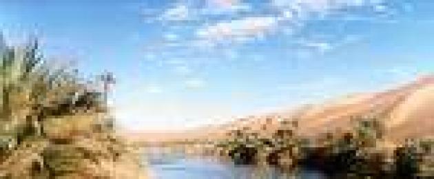
The rest of the country is occupied by the Sahara Desert. The average altitude in the Sahara is approx. 460 m. In the area of the Ahaggar (Hoggar) massif near the southern border of Algeria there is the highest peak of the country, Mount Takhat - 2908 m. Most of the Sahara is occupied by gravelly and pebble deserts (hamads and regis), and approximately 1/4 of the part is sandy deserts (ergs) . The day is hot, sometimes the temperature reaches 35°, but the nights are cool. Precipitation is extremely rare. In oases, under conditions of constant irrigation, the date palm grows. In Algeria, only a few rivers have a constant flow; the rest are fed by precipitation. Sources of water supply are wells dug in dry river beds (wadis), in many places underground water is used, coming to the surface through artesian wells and foggara - horizontal tunnels dug at a slight slope.
Geological structure of Algeria
In the territory of Algeria there are different geological structure and metallogenies of the region - Saharan (part of the ancient African platform) and Atlas (sector of the Mediterranean geosynclinal belt), separated by the South Atlas fault. In the south of the Sahara region, the Ahaggar (Hoggar) shield stands out, in the southwest - El-Eghlab (Regibat). They are composed of Archean crystalline rocks, metamorphosed volcanic-clastic and carbonate deposits of the Lower Proterozoic and Riphean-Vendian; In Ahaggar, geosynclinal-orogenic volcanic-sedimentary deposits and Taurirt granites (650-500 million years) are also widely developed. The platform cover is formed by marine terrigenous-carbonate sediments of the Riphean-Vendian (especially in the Regibat massif), lagoonal-continental and marine sediments of the Paleozoic (thickness 1.2-3.8 km), sandstones and evaporites of the Triassic, clays and sandstones of the Jurassic - Neogene.
In the cover of the Saharan plate there are syneclises (Tindouf, Western and Eastern Sahara), separated by uplifts, and the Ugarta zone, which is an aulacogen, the folding of which appeared at the end of the Carboniferous. Riphean-Vendian volcanics and granites are associated with deposits of uranium, tin, tungsten, rare metals and gold ores in Ahaggar. In the Tindouf syneclise, among the Paleozoic clay-sand deposits of the platform cover, the largest iron ore deposits are localized, and in the south of Ahaggar there are promising uranium deposits. Anticlines in the sediments of the cover on the northern plunging of Ahaggar contain unique deposits of oil (Hassi-Mesaoud) and gas (Hassi-Rmel).
In the folded Atlas region, evaporites, gypsum-salt-bearing clays and red clastic rocks of the Triassic are developed, overlain by marine terrigenous-carbonate sediments and carbonate-terrigenous flysch (Jurassic, Cretaceous, Paleogene). In the north, the Neogene is represented by marine volcanic-sedimentary, clayey-carbonate sediments, in the south - by continental sediments.
In Tel Atlas, folded rocks of the Mesozoic-Cenozoic (up to and including the Middle Miocene) form a series of tectonic nappes (nappes) moving from north to south. In the coastal zone, Neogene andesites and granitoids are slightly developed, in the Greater and Lesser Kabylia massifs - Precambrian metamorphic rocks and Paleozoic shales that protrude to the surface. To the south of Tel Atlas there is a platform block of the High Plateaus (Oran Meseta), where the folded Hercynian basement is covered by a thin, slightly deformed Mesozoic-Cenozoic cover. In the handfuls, terrigenous and volcanic-shale rocks of the Paleozoic are exposed, crushed and intruded by Hercynian granitoids. South of the High Plateaus there is a moderately folded zone of the Saharan Atlas, formed at the site of the Mesozoic trough. In general, the Atlas region is dominated by near-latitudinal folds and faults of eastern and northeastern (or “Atlas”) strike, as well as submeridional “Red Sea” faults superimposed in the northern part of Algeria on the Tel Atlas overhangs. Longitudinal and transverse faults determine the placement of volcanics, evaporite diapirs and the most important ore-bearing zones with deposits of ferrous and non-ferrous metals in the Atlas region. In Northern Algeria, deposits of iron, zinc, lead, copper, antimony, mercury and various types of non-metallic raw materials are associated with Mesozoic-Cenozoic rocks.
The territory of Algeria is characterized by high seismicity, which is associated with movement along faults and ridges in various zones of Northern Algeria. The most seismic is Tel Atlas (6-7 points), within its boundaries there are coastal zones (Tenes-Chershel, Oran-Mostaganem and Shelif).
Minerals of Algeria
In Algeria, deposits of oil, natural gas, coal, uranium ores, iron, manganese, copper, lead, zinc, mercury, antimony, gold, tin, tungsten, as well as phosphorites, barite, etc. have been discovered and explored.
Algeria ranks third in Africa in terms of oil reserves. On the territory of Algeria, 183 oil and gas fields are known, confined to the Algerian-Libyan oil and gas basin; Most of the deposits are located in the northeast of the Sahara region. The largest oil field, Hassi Mesaoud, is localized in Cambrian-Ordovician sandstones. The fields of Zarzaitin, Hassi-Tuile, Hassi-el-Agreb, Tin-Foue, Gourd-el-Bagel, etc. have significant reserves. Algeria ranks first in Africa in terms of gas reserves. The largest gas field Hassi-Rmel lies in Triassic sandstones; significant gas reserves have been explored in the Gurd-Hyc, Nezla, Oued-Numer and other fields.
Coal reserves are insignificant; its deposits (Kenadza, Abadla, Mezarif) are concentrated in the Upper Carboniferous sediments in the Beshar basin. The coals are fatty, caking, medium ash (8-20%), contain 20-35% volatile impurities and 2-3.5% sulfur.
Algeria ranks 4th in Africa in terms of uranium ore reserves. Hydrothermal vein deposits of uranium ores Timgauin, Tinef and Abankor have been explored in Ahaggar (proven reserves 12 thousand tons, U3O8 content 20%); in the south of the shield, uranium occurrences are known in Paleozoic sandstones (Tahaggart).
Algeria ranks second in Africa in terms of iron ore reserves. In Northern Algeria, metasomatic iron ore deposits have been explored in Aptian reef limestones (Jebel Ouenza, Bou Khadra), the total reserves of which are over 100 million tons, the Fe content is 40-56%. In the Tindouf syneclise, the largest Devonian sedimentary deposits of oolitic iron ores in Algeria were discovered - Gara-Dzhebilet (total reserves 2 billion tons, Fe content 50-57%) and Mesheri-Abdelaziz (2 billion tons, 50-55%). The reserves of manganese ores are insignificant; they are confined to the volcanic-hydrothermal deposit of Oued Guettara (total reserves 1.5 million tons, Fe content 40-50%) in the Bechar region.
Algeria ranks second in Africa in terms of lead and zinc ore reserves. In Northern Algeria, stratiform, vein (telethermal) and lens-shaped vein (hydrothermal) deposits of polymetallic ores are developed. Stratiform deposits of lead and zinc ores are located in carbonate deposits of the Jurassic (El-Abed, Deglen), Cretaceous (Kerzet-Yousef, Meslulla, Jebel Ishmul), veins in sandy-clayey rocks of the Cretaceous (Gerruma, Sakamody) are associated with diapirs of Triassic evaporites. Volcanogenic and plutonogenic-hydrothermal copper-polymetallic deposits in Cretaceous-Neogene rocks are associated with Miocene volcanics (Bu Sufa, Oued el-Kebir) and granitoids (Bu Douka, Ashaysh, Ain Barbar, Kef um Tebul). Ore occurrences of cuprous sandstones are known in Cretaceous and Triassic deposits (Ain Sefra, in the western Saharan Atlas), Cambrian (Ben Tajik in Ugarta) and Vendian (Khanq in the south of Regibat).
Algeria ranks 1st in Africa in terms of mercury reserves (about 4% of global reserves). Deposits of mercury ores were identified in the Azzab region among the terrigenous-clastic rocks of the Cretaceous - Paleogene and in Precambrian shales (Genish deposits - total reserves in terms of metal 4.5 thousand tons, Hg content 1.16%; Mpa-Cma, respectively, 7.7 thousand t, 3.9%; Ismail - worked out). Algeria ranks second in Africa in terms of antimony ore reserves; they are concentrated in Northern Algeria at the Khammam-Nbails telethermal field. Algeria ranks first in Africa in terms of tungsten ore reserves. In Ahaggar, quartz-cassiterite-wolframite-greisen-vein bodies Nahda (Launi), Tin-Amzi, El-Kapycca, Bashir, Tiftazunin and others, associated with Taurirt granites, have been explored. In Northern Algeria, the Belelieta skarn-scheelite deposit is known.
The most significant hydrothermal vein gold deposits - Tiririn, Tirek, Amesmessa, Tin-Felki, etc. - were explored in the Precambrian crystalline rocks of Ahaggar; exploration and search for gold continues.
The Bou-Douau deposit has been discovered in Northern Algeria.
Algeria ranks 5th in Africa in terms of phosphorite reserves. In Northern Algeria, deposits of granular phosphorites are confined to clay-carbonate deposits of the Upper Cretaceous - Paleogene. The largest deposits are Dzhebelyonk, El-Quif, Mzaita (see Arabian-African phosphorite province).
Algeria ranks second in Africa in terms of barite reserves. In Northern Algeria, the Mizab vein deposits (total reserves 2.15 million tons, BaSO4 content 90%), Affensou, Bou Mani, Varsenis and Sidi Kamber have been identified, in the Bechar region - the Bou Kais, Abadla and other vein fields. other minerals in Algeria, a large deposit of celestine Beni-Mansour (Northern Algeria) has been explored, the total reserves of which are 6.1 million tons; known deposits of pyrites (reserves are small), table salt, etc.
History of the development of mineral resources. The oldest evidence of the use of stone for making tools was found in Ternifin and dates back to the Lower Paleolithic (about 700 thousand years ago). From the Neolithic era, the extraction of clays for the manufacture of ceramic utensils began (5-4th millennium BC), from the 2nd millennium BC. - stone for the construction of large funeral structures - dolmens. Information about the developed mining and metallurgical production in the Middle Ages is given in the works of Arab scientists and travelers al-Yakubi (9th century), al-Bakri (11th century), al-Qazwini (13th century), etc. The main mining centers were concentrated in the north - iron ore mines "Nemours" and "Beni-Saf" near the city of Arzev (Western Algeria), as well as near the cities. Setif, Annaba, Bejaia; copper mines in the Jebel Ketama mountains. In the department of Constantine (near Majana, Eastern Algeria), the development of deposits of silver, lead ores, and building stone (no later than the 16th century) is also mentioned. Mercury ore was mined near the city of Arzev. In the 10th century, salt mines were located on the Jebel el-Melkh hill ("Mountain of Salt").
After the colonization of Algeria (1830), intensive searches for minerals began in the country. Industrial exploitation of iron ore deposits (Ain Mokra, Beni Saf, Jebel Ouenza, Mokti el-Hadid) has been carried out since the 50-60s. 19th century, at the same time intensive development of deposits of lead, zinc and copper ores (Muzaya, Oued Merja, Tizi Ntaga), and phosphorites (since 1893) was carried out. In 1907, the main coal deposit of Algeria, Kenadza, was discovered, the maximum production of which was carried out during the Second World War 1939-45.
Mining. general characteristics. The leading branch of the mining industry is oil and gas production (more than 90% of the value of all products of the mining industry); provides the majority of foreign exchange earnings. In 1981, oil and gas accounted for 96% of the value of the country's exports, which amounted to 62 billion Algerian dinars. In the mining industry, the public sector plays a leading role. In the oil and gas industry, a monopoly position is occupied by the state company "Société Nationale pour la Recherche, la Production, le Transport, la Transformation et la Commercialization des Hydrocarbures" ("SONATRACH"). The company has taken control of oil and gas reserves and production, all main oil and gas pipelines, gas liquefaction and oil refining plants.
The total number of personnel employed in the oil and gas industry is about 36 thousand people (1980). The Algerian government is promoting the development of the oil and gas industry by merging with foreign capital (up to 49%) while retaining 51% of the shares with SONATRACH. The company carries out production, as well as exploration for oil and gas, in the Sahara together with the French companies "Total", "Compagnie Française de Pétrole", "Compagnie de Recherches et d'Activities Pétrolières", US companies (Getty Oil Co.), Spain ("Hispanoil"), Germany ("Deminex"), Poland ("Copex") and Brazil ("Petrobras"). After the nationalization of mines and quarries (1966) in the Algerian mining industry, the state company "SONAREM" completely controls the exploration, production, consumption and export of all solid minerals (total number of employees about 14 thousand people, 1980). The company includes 30 mines and quarries and conducts exploration in Northern Algeria and the Sahara. Algeria is one of the leading producers of mercury. The extraction of iron ores and non-ferrous metals is insignificant.
Climate of Algeria
The climate of Algeria is subtropical Mediterranean in the north and tropical desert in the Sahara. Winter on the coast is warm and rainy (12°C in January), in the mountains it is cool (there is snow for 2-3 weeks), in the Sahara it depends on the time of day (at night below 0°C, during the day 20°C). Summer in Algeria is hot and dry. Annual precipitation ranges from 0-50 mm in the Sahara to 400-1200 mm in the Atlas Mountains.
Water resources of Algeria
All Algerian rivers are temporary watercourses (oueds) that fill during the rainy season. The rivers of the far north of the country flow into the Mediterranean Sea, the rest are lost in the sands of the Sahara. They are used for irrigation and water supply, for which reservoirs and hydroelectric power stations are built on them. Largest river- Sheliff (700 km). Lake basins (sebkhas) also fill up during the rainy season, and in the summer they dry out and become covered with a salt crust up to 60 cm thick. In the Sahara, in areas with large reserves of groundwater, the largest oases are located.
Flora and fauna of Algeria
Algeria has a poor flora. In some places in the mountains there are cork oak forests, semi-desert and desert vegetation. In the north of the country, oak, olive, pine and thuja grow. The Sahara Desert contains virtually no vegetation, and there are very few oases. The most typical animal species for the country are jackals, hyenas, antelopes, gazelles, and hares are also found.
Population of Algeria
At the time of the French conquest, the population of Algeria was approx. 3 million people. In 1966 it already reached 11.823 million people, and in 1997 – 29.476 million people. In 1996, the birth rate was 28.5 per 1,000 people and the death rate was 5.9 per 1,000 people. Infant mortality (children under one year old) is 48.7 per 1000 newborns. In the mid-1990s, approx. 68% of the population was under 29 years of age.
Algeria was originally inhabited by peoples speaking Berber languages. These peoples back in 2000 BC. moved here from the Middle East. The majority of the modern population uses a colloquial version of Arabic in everyday life. Arabs settled in Algeria during the Islamic conquests of the 7th and 8th centuries. and nomadic migrations of the 11th–12th centuries. The mixing of two waves of settlers with the autochthonous population led to the emergence of the so-called Arab-Berber ethnic group, in the cultural development of which the Arab element played a dominant role.
As the main ethnic subgroup of Algerian society, the Berbers play important role in the life of the country. During the period of Roman and Arab conquests North Africa many Berbers moved from the coast to the highlands. Berbers make up approximately 1/5 of the country's population. The largest concentration of the Berber population is found in the mountainous area of Djurjura, east of the capital, known as Kabylia. The local residents, the Kabyles, have settled in many cities of the country, but carefully preserve ancient traditions. Other significant groups of the Berber population are represented by the Shawiya tribal alliances, originating from mountainous region around Batna, the Mzabita, who settled in the oases of Northern Sahara, and the Tuareg nomads living in the far south in the Ahaggar region.
After the conquest of Algeria by France in the 19th century. The size of the European part of the population increased, and by 1960 approx. 1 million Europeans. Most had French roots, the ancestors of the rest moved to Algeria from Spain, Italy and Malta. After Algeria declared independence in 1962, most Europeans left the country.
Most of the Algerian population are Sunni Muslims (Malikis and Hanafis). A number of followers of the Ibadite sect live in the Mzab Valley, Ouargla and Algiers. The state religion of the country is Islam. There are approx. 150 thousand Christians, mostly Catholics, and approximately 1 thousand adherents of Judaism. The official language is Arabic, but French is still widely spoken. Some Berber tribes speaking Tamahak and Tamazirt acquired their own written language. Several books have already been published in the Tamazirt dialect in Algeria.
About 3/4 of the population is concentrated in the foothills of the Tell Atlas, approximately 1.5 million people live in the highlands and less than one million in the Sahara Desert. The highest density is observed near the capital and in the Kabylia region.
- In contact with 0
- Google+ 0
- OK 0
- Facebook 0