The economic and geographical position of the territory is characterized by a successful complementarity between the raw material Northern region and the industrial Northwestern region.
Northwest Region
Composition: Leningrad, Novgorod, Pskov regions, St. Petersburg.
Economic- geographical position: Position of the area - seaside, advantageous. This is a small area off the coast. Baltic Sea or close to it. The ancient trade route "from the Varangians to the Greeks" passed along the rivers and lakes of this region, on which Novgorod Rus arose. For two centuries St. Petersburg was the capital of Russia. The area is located between the developed European states - Finland, Estonia, Latvia and the Central economic region of the Russian Federation, as well as next to the Northern economic region of the Russian Federation (with its rich resource base). Three new Russian seaports are currently under construction in the Gulf of Finland.
Natural conditions and resources: The climate of the region is temperate continental, on the coast - maritime. The entire territory is characterized by podzolic and peat-bog soils. Forests occupy a little less than half of the district's area, and in the north-east the forest cover reaches 70%.
Moraine-glacial relief with hills and ridges is characteristic. There are especially many moraine hills on the hills, where they alternate with lake depressions. The north-west of the Russian Plain is a lake region: there are about 7 thousand lakes here. The largest are Ladoga (area 18 thousand square kilometers), Onega, Chudskoye, Ilmen. The river network is dense. The relatively short Neva River (74 km), flowing from Lake Ladoga and flowing into the Gulf of Finland, is one of the most abundant in Russia.
Minerals: refractory clays, oil shales, phosphorites, quartz sands, limestones, salt springs (in the Staraya Rusa region), bauxites (Tikhvin).
Population: The population of the district is 8.05 million people (1996). The area is 196.5 thousand km2. The average population density is about 40 people per 1 km2, however, in the peripheral areas, the density of the rural population is only 2-4 people per 1 km2. The majority of the population is Russian. Urbanization rate - 87%. The population of St. Petersburg is about 5 million people.
Economy: The main socio-economic prerequisites for the development of the region: profitable EGP, qualified personnel, the development of science and culture, a developed experimental design base.
The North-West is an industrial region with a developed complex of the manufacturing industry with a high proportion of mechanical engineering, which is oriented towards imported raw materials and fuel.
Branches of specialization - mechanical engineering, requiring highly skilled labor, non-ferrous metallurgy, chemical and light industries.
The machine-building complex of the region is characterized by well-developed intra-industry relations. The following branches of mechanical engineering are represented: energy, electrical engineering, shipbuilding, instrument making, machine tool building. The region is a major supplier of instruments, automation equipment, turbines, and tractors.
The production of power equipment: generators and turbines for hydroelectric power stations, state district power stations, nuclear power plants is represented by enterprises in St. Petersburg. Shipbuilding is developed: "Admiralteisky", "Baltiysky" plants of St. Petersburg produce nuclear icebreakers, ocean dry cargo ships, etc.
Science-intensive industries are represented by instrumentation, radio engineering, electronics, electrical engineering (St. Petersburg, Novgorod, Pskov, Velikiye Luki, Staraya Russa). Novgorod, Pskov, Vyborg, and Kaliningrad produce radio and television equipment and video recorders.
The chemical industry of St. Petersburg was a pioneer in the production of polymers, plastics, pharmaceutical industry in Russia.
The light industry (footwear, textile, food) is developed.
A number of industries in the Northwestern region are based on local natural resources. This is the extraction of phosphorites and the production of mineral fertilizers from them (Kingisepp, modern name city - Kuressaare), production of refractory bricks from local clays (Borovichi), mining and production of building materials, mining of slates (Slates).
The northwest is the birthplace of the aluminum industry (on local Tikhvin bauxites). Non-ferrous metallurgy enterprises are located in Volkhov (aluminum plant), Boksitogorsk and Pikalevo (alumina plants).
Agro-industrial complex. Agriculture specializes in dairy farming, pig breeding, poultry farming, vegetable and potato production. Flax growing has retained its importance in the south and south-west of the region. Flax is processed at numerous small factories and at large flax mills in Pskov and Velikiye Luki.
The fuel and energy base of the region focuses mainly on imported fuel (oil, gas, coal). The region is a major consumer of electricity. It is produced by powerful thermal power plants using imported energy carriers. Powerful state district power plants and thermal power plants are located in St. Petersburg, its environs and in the city of Kirishi (to which an oil pipeline from the Volga region approaches).
A significant share of electricity is provided by hydroelectric power stations of medium and small capacity, built on the rivers Svir, Volkhov, Vuoksa, etc. To provide the region with electricity more reliably, one of the largest Leningrad nuclear power plants in Russia was built and is operating.
The energy system of the North-West is connected to the unified energy system of the European part of Russia.
Transport. The St. Petersburg transport hub is second only to Moscow in terms of freight and passenger traffic. Transport routes depart from this city in rays in different directions. St. Petersburg is currently one of the largest foreign trade seaports in Russia. The Volga-Baltic waterway provides connections with other economic regions of the European part of the Russian Federation. The White Sea-Baltic Canal opens access to the White and Barents Seas.
Northern District
Composition: Arkhangelsk, Vologda, Murmansk regions, Republics: Karelia and Komi, Nenets Autonomous Okrug.
Economic and geographical position: This is the northernmost economic region in the European part of Russia. The territory is large - 1643 thousand km2. It is washed by the waters of the Arctic Ocean. Important ports of the Russian Federation are located here - Murmansk (non-freezing), Arkhangelsk. Part of the Barents Sea, warmed by a branch of the warm North Atlantic Current, does not freeze. Quite a significant part of the territory of the region is located north of the Arctic Circle in the cold zone.
EGP of the region is peculiar. The territorial distribution of the region's economy was influenced by many factors, including the proximity of the Arctic Ocean, the severity of the climate, and the complex configuration coastline the White and Barents Seas, as well as close proximity to the Central and North-Western economically highly developed regions of the Russian Federation.
Natural conditions and resources: Feature natural conditions and the climate of a given region - the unusual illumination and heating of the earth's surface in different seasons of the year ("polar day" and "polar night"). In the middle of winter, the duration of the "polar night" at the latitude of the North Pole is 24 hours, and in areas located at the parallel of 70 degrees north latitude - already 64 days a year.
The following natural areas- tundra, forest-tundra and taiga. Forests occupy 3/4 of the territory.
In the geological sense, the area includes the Baltic Shield and the north of the Russian Plain (between the Baltic Shield and the Urals), where the vast Pechora Lowland and the Timan Ridge stand out. The rivers of the region (Pechora, Mezen, Onega, Northern Dvina) belong to the basin of the Arctic Ocean.
Low mountain ranges of the Kola Peninsula (Khibiny) stand out on the Baltic Shield. The peninsula slowly continues to rise (earthquakes up to magnitude 5 occur). The peculiarity and complexity of the relief of the Northern region are due to the action of glaciers (in the Quaternary period). Karelia is called "the land of blue lakes", noting their abundance.
The area is very rich in various minerals. The extraction of granite, marble and other building materials began during the construction of St. Petersburg.
Deposits of iron and non-ferrous metal ores, as well as apatite-nepheline ores, are located on the Kola Peninsula. The sedimentary rocks of the Timan-Pechora basin are rich in coal (including coking coal), oil and gas (the Komi Republic and the shelf of the Barents Sea). The Northern region is also rich in bauxites (Arkhangelsk region), as well as ores of titanium, tungsten, molybdenum, and other metals.
Population: Population - 5.9 million people; the average density is 4 people per 1 km2 (even less in the northern regions). The urban population prevails (urbanization coefficient - 76%).
The population and economic development of the region is much less than in other regions of the European part of Russia. The region is poorly provided with labor resources. The Russian population prevails. Other peoples of the North also live. In the Komi Republic (1.2 million people), the Komi people make up 23% of the population; in the Republic of Karelia (0.8 million people), Karelians make up about 10% of the population. And in the Nenets autonomous region Nenets - 6.5 thousand people (12% of the population of the district).
Household: Indigenous people(Komi, Nenets, etc.) have long been engaged in hunting, fishing and reindeer herding. At present, the specialization of the region is determined by the presence of the richest natural resources, as well as the peculiarities of the geographical position.
Animal husbandry still prevails over crop production (for the development of which, in most of the territory, the conditions of native resources, as well as the peculiarities of the geographical location.
The branches of specialization of the region are fuel, mining and timber industries. Non-ferrous and ferrous metallurgy, mechanical engineering and chemical industry.
This region is the main raw materials and fuel and energy base for many regions of the European part of the Russian Federation. A third of Russia's timber, paper and pulp is produced here (Arkhangelsk, Syktyvkar, Kondopoga, Segezha, Kotlas).
The mining industry is developed. The Kola Peninsula and Karelia produce 1/4 of iron ore, 4/5 of raw materials for the production of phosphate fertilizers (apatites), a significant part of non-ferrous metal ores mined in Russia.
In 1930, large deposits of oil were explored on the Ukhta River and coal deposits near Vorkuta. At present, heavy mine oil is being produced in the Yarega (on the right bank of the Ukhta). In the middle reaches of the Pechora, the Vuktyl gas condensate field is being developed. The reserves of the modern Pechora coal basin are billions of tons (production is about 20 million tons). The coking coals of Vorkuta and Vorgashor are the best in the country in terms of quality. Most of they are supplied to the Cherepovets Metallurgical Plant, as well as to St. Petersburg and Tula.
Ferrous metallurgy is represented by the Cherepovets Metallurgical Plant. Technological fuel is Pechora coking coal, and iron ores of the Kola Peninsula (Kovdorskoye and Olenegorskoye deposits) and Karelia (Kostomuksha GOK) serve as raw materials.
Non-ferrous metallurgy is represented by enterprises in Monchegorsk (copper-nickel plant on the ores of deposits of the Kola Peninsula) and Nikel. An aluminum smelter in the city of Nadvoitsy operates on the nephelines of the Kola Peninsula and the bauxites of the Arkhangelsk Region.
The oil refining and chemical industries are developing. An oil refinery is located in Ukhta, a gas processing plant is located in Sosnogorsk, and a chemical plant is located in Cherepovets.
An auxiliary branch of the economy of the region is mechanical engineering (Petrozavodsk, Arkhangelsk, Vologda, Murmansk).
Agro-industrial complex. Malozemelskaya (between the Timan Ridge and the Pechora Bay) and Bollypezemelskaya (east of the Pechora mouth) tundra are the best reindeer pastures. Hunting and fishing are developed.
Animal husbandry still prevails over crop production (for the development of which conditions are unfavorable in most of the territory; the cultivation of fodder and grain forage crops prevails). Flax is grown in the south of the region (Vologda region). Floodplain water meadows (along the rivers) have long served, in the same southern part of the region, as a base for the development of dairy farming. Developed oil industry.
A significant place in the economy of the Northern region is occupied by the fishing industry (fish cannery in Murmansk).
Fuel and energy complex. The fuel industry of the region is one of the branches of its specialization. The fuel industry is associated with the production of electricity.
In the Arkhangelsk and Vologda regions and the Komi Republic, all power plants operate on coal from the Pechora basin (Vorkuta) and gas from the Vuktylskoye field. The largest is Pechorskaya GRES.
In Karelia and the Murmansk region, electricity generation in more concentrated on hydroelectric power plants built on a number of rapids of small rivers. These hydroelectric stations largely ensure the development of energy-intensive industries in this part of the region.
The development of non-ferrous metallurgy and other industries was the reason for the commissioning of the Kola NPP (Murmansk region). Natural resources are also used to generate electricity. The Kislogub tidal power plant has been built.
Transport. In conditions of poor transport development of the territory, rivers play an important role (in the valleys of which most of the population lives). Timber is rafted along the rivers, cargo and passengers are transported.
Railways are laid in the meridional direction from the central regions of the European part of Russia to Murmansk, Arkhangelsk and to the northeast, to Vorkuta.
A major transport hub is Cherepovets. Ports: Murmansk, Arkhangelsk, Onega, Mezen, Naryan-Mar. Murmansk (the largest of the polar cities in the world - 400 thousand inhabitants) is the most important non-freezing port of Russia in the North.
Economic and geographical position (EGP): A special place in the north-west of the Russian Federation is occupied by the Kaliningrad region, formed in 1946. This is part of the territory of the former East Prussia (Germany), which was ceded to the USSR after the Second World War. It has borders with Poland (in the south) and Lithuania (in the east and northeast). In the west, it is washed by the waters of the Baltic Sea.
Usually this region is not included in any economic region of the Russian Federation and statistical data are given for it separately.
The Kaliningrad region has now become an enclave. Hundreds of kilometers of the territory of now foreign countries - Belarus and Lithuania - now separate this region from the main territory of Russia. It has been declared a "free economic zone".
Land communications with it become more expensive and more difficult. However, the region lies at the crossroads of many important trade routes. This is the closest Russian region to Western Europe, the most convenient base for trade in the Atlantic. From it to Berlin, Stockholm, Copenhagen, Minsk - less than 600 km, to Hamburg and Prague - about 700 km (almost half as much as to Moscow).
Near Kaliningrad, in the city of Baltiysk, is the main base of the Russian fleet on the Baltic Sea. The port of Kaliningrad is one of the most important Russian seaports in the Baltic Sea (the only non-freezing one), a major center of sea fishing and foreign trade.
Natural conditions and resources: The area of the region is 15.1 thousand. This is the smallest region of Russia. The territory is flat. The climate is maritime and transitional from maritime to continental. A relatively large amount of precipitation (about 700 mm per year) with low evaporation leads to increased moisture. Agriculture is possible with artificial drainage of land
The sea off the coast of the region does not freeze. Due to the mild climate (stable snow cover usually does not form), tree species of more southern natural zones grow in the region. Grow sycamore, yew, magnolia.
Oil, table salt, peat and other minerals have been found in the bowels of this small region of the Russian Federation. Here is the world's only quarry for the extraction of amber (more than 1 thousand tons annually). Amber reserves make up more than 90% of the world.
Population: Population - 932 thousand people (1996), mostly Russians (more than 80%), as well as Belarusians, Ukrainians, etc. Almost half of the population lives in Kaliningrad (418.7 thousand people). The population density is 62 people per 1 km².
The share of the urban population is 77.7%. The main cities of the region: Kaliningrad (until 1946 - Koenigsberg, founded in 1225), Sovetsk (44 thousand inhabitants), Chernyakhovsk (42 thousand), Baltiysk (31 thousand).
Economy: Industrial enterprises of the region receive most of the materials from other regions of Russia and send their products both to the regions of the Russian Federation and abroad.
The main branches, specializations of the region are the fishing industry, mechanical engineering, and the pulp and paper industry.
The fishing industry includes fishing, transportation and processing. Most of the caught fish was previously processed on ships, the rest - at the fish canning plants of the region (OJSC "Kaliningrad fishing company of the trawl fleet"; OJSC "Pioneer base of the ocean fleet"). Currently, fishermen of the region hand over a significant part of the catch to foreign ports in order to purchase fuel and carry out ship repair work.
The largest engineering enterprises are the Yantar shipbuilding plant, as well as electronics and instrument-making enterprises (the Kvarts machine plant and others).
The pulp and paper industry works on wood supplied from the North of Russia and produces paper, cardboard, pulp (JSC "Soviet Pulp and Paper Plant", OJSC "Nemansky Pulp and Paper Plant", etc.)
The extraction of amber is of great importance for the economy of the region (the village of Yantarny - extraction and processing of amber).
The vast majority of industrial products are produced in regional center- Kaliningrad, which concentrated car building, ship repair, production of handling equipment, fish products, etc. Other cities stand out among other centers: Chernyakhovsk (woodworking, food industry), Sovetsk (pulp and paper, furniture industry), Gusev (production of lighting equipment, micromotors ).
The share of exports in industrial production is 56%. The further development of the Kaliningrad region is being significantly transformed due to the status of a "free economic zone".
Some cities and towns in the coastal zone, along with economic functions, also perform resort functions (Pionersky, Svetlogorsk, etc.).
Transport. Normal good-neighborly relations with Lithuania are very important, through which almost the entire transit traffic flows to and from other regions of Russia.
The main resource of the region is its economic and geographical position. Seaports of the region perform important foreign trade functions and operations for servicing the oceanic fishing fleet of the Atlantic. This is the gate of the Russian Federation for foreign trade with the countries of Foreign Europe.
Agriculture. Gross output Agriculture- 579 billion rubles (52nd place among the subjects of the Russian Federation). The share of animal husbandry - 73%, crop production - 27%. Animal husbandry specializes in breeding cattle of dairy and meat breeds, pig breeding and poultry farming.
In the creation of a fodder base for animal husbandry, field cultivation takes part - the production of fodder cult.
Russian Civilization
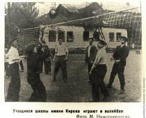
"North-Western region of Russia" - North - West. Plan for the study of the economic region. Footwear and textile industries stand out. Urbanization rate - 87%. Problems and prospects for the development of the region. Population. Physical - geographical location and Economic-geographical location. The largest are Ladoga, Onega, Chudskoye, Ilmen.
"North Caucasian economic region" - the Foothills are gradually turning into the system of mountain spurs of the Caucasus (mountainous part). natural landscapes North Caucasus are diverse. The region has fertile lands (on the plains) and natural pastures (in the foothills). Natural conditions and resources. The main disadvantage of natural conditions is uneven supply water resources.
"North-Western region" - Let's define the EGP of the North-Western region: Consolidation of the material. Map work. Summary of the lesson. Old cities - historical memory and national wealth of Russia. Area specialization. Northwestern region. Let's determine the composition of the North-Western region. Lesson topic: geographical location and nature. Equipment:
"EGP of Russia" - The vast expanses of Siberia and Far East. EGP features. Loss of large ports on the Black and Baltic Seas after the collapse of the USSR. Access to the seas of 3 oceans. Fishing in the waters of the seas and oceans. The predominance of flat territories. Question: Has the EGP of Russia changed compared to the USSR?
"North-Eastern Siberia" - Only larch grows. Rivers of Siberia - centers historical events. April 17, 1912 Angara is the daughter of Baikal, Lena is the longest river in Russia = 4400 km. Under tsarism, the Tungus were considered wandering aliens. Siberia is a place of exile. Equipment: physical map Russia, computer presentation, atlas, textbook.
"North-Western Economic Region" - Which people prevail in the tser: a. Chuvash; b. Mordva; in. Mari; Russians. Composition and EGP of the North-Western region. Area specialization. Lithuania. Question number 1. There are many lakes - the largest are Ladoga and Onega. Through a system of canals it has access to the Volga and the White Sea; Fixing the material. Finland. Specialization of St. Petersburg.
Key terms and concepts
Northwestern Federal District, its place in the country's economy Factors of regional development Sectoral and territorial structure of the economy Interregional Relations and Foreign Economic Activity Contemporary Issues and development prospects
Composition, features of the economic and geographical position, place in the country's economy
The Northwestern Federal District includes 11 constituent entities of the Russian Federation. In terms of the size of the occupied area (1/10 of the country's territory), it is in fourth place among all federal districts of Russia (see Fig. 1.1, Appendix 2).
The district is located in the European North (the republics of Karelia and Komi, the Murmansk, Arkhangelsk, Vologda regions and the Nenets Autonomous Okrug), in the Baltic part of Russia (St. The administrative center of the district is St. Petersburg. The Northwestern Federal District has an advantageous EGP, due to access to the seas - the Baltic, Barents and White, along which there are shipping routes to the west towards Western Europe and the east coast North America, as well as to the east - along the Northern Sea Route to the Russian Arctic, the USA and the Asia-Pacific countries.
The economy of the Northwestern Federal District has a significant impact on the development of the entire national economic complex of the country, as evidenced by the indicators of the share of the district in the all-Russian socio-economic indicators (Table 10.3). 1/10 of Russia's GRP is created in the Okrug. Construction, manufacturing and energy industries are actively developing here. The production of agricultural products is much less developed, which is explained by the harsh climatic conditions of a significant part of the Okrug's territory and the relatively small areas of arable land.
The Northwestern Federal District has a favorable investment climate; investments in fixed assets account for 11.5% of the total Russian volumes. However, despite the advantageous EGP, international trade here it is still underdeveloped and imports of goods exceed exports.
Natural conditions and natural resource potential of the Okrug
A significant part of the NWFD is located north of the Arctic Circle in the cold zone, so the climate of the region varies from arctic on Novaya Zemlya to temperate continental in the south; on the coast - marine, characterized by high humidity. The eastern branch of the warm North Atlantic Gulf Stream, which will penetrate into the Barents Sea, has a moderating effect on the climate of the northwestern part of the district. Here is the largest of the polar cities in the world - the ice-free port of Murmansk, whose climate is very different from the climate of most cities located beyond the Arctic Circle: the average annual air temperature is + 3, GS, the average temperature in January is 11 ° C, in July - + 17 ° FROM. On the Baltic coast, the average temperature in January is -9°С, in July - +16°С, high humidity - the amount of precipitation reaches 1600 mm per year.
Table 10.3
The share of the NWFD in the all-Russian socio-economic indicators (2012)
|
Indicator |
Specific weight, % |
Place among federal districts |
|
Territory |
||
|
Population |
||
|
Number of people employed in the economy |
||
|
Gross regional product |
||
|
Fixed assets |
||
|
The volume of shipped goods of own production: |
||
|
mining |
||
|
manufacturing industries |
||
|
production and distribution of electricity, gas and water |
||
|
Agricultural products |
||
|
Construction |
||
|
Investments in fixed assets |
||
Source: Regions of Russia. Socio-economic indicators: stat. Sat. Moscow: Rosstat, 2013.
Soils mostly podzolic, tundra, tundra-gley and peat-bog soils are also found everywhere. Natural zones change from north to south: the arctic desert ( New Earth), tundra, forest-tundra and taiga. The district (Komi and Karelia republics, Arkhangelsk and Vologda regions) contains about half forest resources European part of Russia. Forests consist mainly of spruce, pine, cedar, fir. Martens, foxes, ermines, arctic foxes, elks, wolves, brown bears, etc. live in the forests.
The county is well endowed water resources, severely ill. There are about 7 thousand lakes of various sizes here. The largest are Ladoga, Onega, Chudskoye, Ilmen. The river network is dense, but the rivers of the western part of the region are relatively short, among them the Neva stands out - one of the most abundant rivers in the European part of the country. The rivers of the eastern part (Pechora, Mezen, Onega, Northern Dvina, etc.) are among the largest in terms of length and water content, have great hydropower potential, and are used as transport routes.
The waters of the seas washing the territory of the district and numerous rivers are the habitat of many species of aquatic bioresources. The main fish species are cod, salmon, sea bass, halibut, catfish, flounder, herring, trout is found in streams.
The Northwestern Federal District is extremely wealthy minerals. Almost 72% of apatite reserves are concentrated here - raw materials for the production of phosphate fertilizers, about 77% - titanium, 45 - bauxites, 19 - mineral waters, about 18 - diamonds and nickel, 5 - power and coking coals, about 8% - hydrocarbon resources of the country .
Fuel resources lie in the Arkhangelsk region and the Komi Republic - the Timan-Pechora oil and gas province (Usinskoye, Vozeyskoye, Yaregskoye, Ukhta, Vuktylskoye and other oil and gas condensate deposits), the Pechora coal basin (Vorkutipskoye, Vorgashorskoye coking coal deposits and Inta - energy), and also in Leningrad region and in the area of the city of Ukhta - oil shale, there is peat everywhere. In the Northwestern Federal District, according to data for 2011, about 4% of coal, 7% of oil and 1% of Russia's natural gas were produced. The prospects for oil and gas production in the district are associated with the development of the resources of the Arctic shelf: the Shtokman gas condensate field (3.9 trillion m3 of gas and 56 million tons of gas condensate), located 550 km north of Murmansk, and the Prirazlomnoye oil field near the southwestern coast of Novaya Zemlya.
The balance reserves of iron ores (Kovdorskoe and Olenegorskoe deposits in the Murmansk region, Kostomukshskoe in the Republic of Karelia) are about 5% of the all-Russian, but the share of ore mining here is close to 1/5 of the all-Russian.
The deposits of copper-nickel ores exploited on the Kola Peninsula (Murmansk region) are raw material base the Severonickel and Pechenganikel plants located here, which are part of the MMC Norilsk Nickel group. In addition, ore concentrates are delivered to these enterprises by the Northern Sea Route from deposits located in the Norilsk region of the Krasnoyarsk Territory.
Bauxite deposits explored in the Arkhangelsk region and the Komi Republic are of industrial importance. In total, about 2/5 of Russian bauxites are mined on them. In addition to bauxites, nephelines are used for the production of alumina, a raw material for the aluminum industry, the balance reserves of which are huge. However, nephelines are low quality raw materials and their use is currently limited.
The largest reserves of mining and chemical raw materials of world importance are represented by the Khibiny group of deposits of complex apatite-nepheline ores (Murmansk region), which contain almost 3/4 of the Russian reserves of apatite - raw materials for the production of phosphate fertilizers, and almost all of their production in the country. In the area of Kingisepp, phosphorites occur, in the Arkhangelsk region - diamonds (Lomonosov deposit). The district is rich in building materials, limestone, glass sand, granite. There are deposits of mica in the north of the Republic of Karelia and in the Murmansk region. Gold deposits were discovered in Karelia and the Komi Republic, as well as titanium ores (Yarega, Pizhemskoye) in the Komi Republic.
chief natural wealth Kaliningrad region is amber (more than 90% of the explored world reserves). The region also has reserves of high-quality rock salt, peat, brown coal, and mineral building materials.
Region
2. ECONOMIC AND GEOGRAPHICAL POSITION OF THE REGION
Location: northwest of the European part of Russia.
Area: 1.2% of the country's area (196.5 thousand km2).
Population: 5.4% of the population of Russia (8.5 million people).
Economic environment:
a. highly developed neighboring states - Finland, Poland, Estonia, Latvia, Lithuania, Belarus;
b. highly developed economic regions of the Russian Federation - Central and Northern.
Economic characteristics:
The position of the region is borderline, coastal, the region is located near the western border, has access to the Baltic.
It is not one of the fuel, raw materials and energy bases, it is remote from all bases of the country;
Favorable transport and geographical position: the port economy strengthens the export-import functions of the region on the Baltic Sea.
Economic center: St. Petersburg is one of the most important foreign trade ports of the CIS and Russia, the largest cultural and scientific center. It contains 59% of the region's population and 68% of its urban population.
Production of consumer goods.
Highly qualified personnel, a large number of scientific institutions, 1/8 of the country's scientific workers are concentrated in the region. Personnel science intensity is almost 4 times higher than the average Russian indicators, and the science intensity of marketable products is more than 3 times higher.
Developed tourism.
Proximity to the Western free market has created favorable conditions for the concentration of financial and credit institutions of international level here.
Location: the extreme eastern region of the Russian Federation, washed by the waters of the Pacific and Arctic oceans.
Area: 36% of the country's area (6.2 million km2) with a characteristic extension from north to south and from west to east.
Economic environment:
a. Maritime borders with the USA and Japan. The Far East is separated from the United States by the narrow Bering Strait, and from Japan by the Kunashir Strait and the La Perouse Strait. Long borders with China. The southern mainland adjacent to the Sea of Japan is called Primorye. The coastal position of the region determines favorable prospects for the development of economic ties with the countries of the Pacific region.
b. In addition to the mainland, the Far East includes the islands: Novosibirsk, Wrangel, Sakhalin, Kuril and Commander.
c. District plays important role in maritime and foreign trade relations of Russia. Vladivostok, Nakhodka, Yuzhno-Sakhalinsk are the most important ports of Russia on the Pacific Ocean.
The most important features of the EGP of the Far East are its great remoteness from the central most developed regions of Russia, as well as its location at the intersection of sea and land routes to the countries of the Pacific basin.
3. NATURE OF THE REGION AND NATURAL PREREQUISITES FOR ITS DEVELOPMENT
Northwestern economic region
Relief: flat western and elevated eastern parts.
Climate: temperate continental, on the coast - maritime.
Soils: soddy-podzolic and podzolic-marsh, for agricultural use they need fertilizers. Increased swampiness of the area. Agricultural land occupies only 18% of the district.
Water resources, from here have fish resources. Hydroelectric power plants have been built on many rivers.
Forest resources occupy 45% of the district area.
Minerals:
Slates;
bauxites;
Refractory clay;
· Pure limestones;
· Quartz, abrasive glass sands;
· Salt springs;
· Granite;
· Oil and gas;
Brown coal;
· Rock and potash salts.
· 90% of the world's amber reserves are concentrated here.
The Northwestern region has unique recreational resources: outstanding monuments of history and architecture are combined with valuable ones for the organization of recreation and tourism areas natural landscapes. The recreation areas on the Karelian Isthmus, the Valdai Upland, on the coast of the Gulf of Finland and the Starorussky resort are of national importance. The network of palace and park ensembles around St. Petersburg, the Pushkin Reserve, the city-museums of Novgorod and Pskov are world famous.
Far Eastern economic region
The area is located at the junction of Eurasia and the Pacific basin. The northern parts of the territory of the Far East region are located in the Arctic zone, and in the southern coastal part, in Kamchatka and Sakhalin.
Climate: temperate, for the most part sharply continental, severe. A significant part of the territory of Yakutia and the Magadan region is located beyond the Arctic Circle. Windless, clear, frosty weather is typical in winter. Summers are hot in the continental regions and cool in the coastal regions.
Natural zones: The Far East region is replaced from north to south - the zone of arctic deserts, tundra, forest tundra, taiga.
Relief: young folded formations, volcanoes, geysers, plains and lowlands. 90% of the territory is located in the permafrost zone. On the southern plains, fertile chernozem-like and brown soils are not uncommon.
Minerals;
Forest (more than 250 million hectares, total timber stock - more than 22 billion m3).
Water resources: rivers, lakes, seas (Bering, Okhotsk and Japanese). The Far East region accounts for 60% of the fish catch in Russia. Mineral resource base: tin, mercury, Icelandic and fluorspar, rock crystal, mica, graphite; tungsten, molybdenum, lead-zinc ores, non-ferrous and rare metal ores, iron ores, diamonds, gold, coal, oil and gas, salt, sulfur, apatite, limestone, marl, refractory clay, quartz sand. cement raw material.
In the south, favorable conditions for agriculture. The main agricultural lands of the region are concentrated here. Climatic conditions favorable for growing crops of the monsoon climate - rice, soybeans. The forests are rich in valuable fur-bearing animals (ermine, sable, fox, squirrel, Siberian weasel), which are of commercial importance.
4. HISTORY OF DEVELOPMENT OF THE TERRITORY
Northwestern economic region
The history of the North-Western region begins from 9-8 millennium BC. e.
By the middle of the 1st millennium, settled Finno-Ugric tribes existed .. In the 8th century, Slavs, tribes of the Prussians, a people related to the current Latvians and Lithuanians, settled on this territory .. By the 750s, the emergence of Ladoga (from the 18th century Staraya Ladoga) - the oldest Russian settlement in Russia. In the 9th-10th centuries, Ladoga became the most important political and economic center for the formation of statehood. Ancient Russia. Only at the end of the 10th century did it lose its significance, giving way to Novgorod. In 910-1348. The Pskov principality became part of Novgorod land. In the 12th century, Novgorod gained political independence.
In 1226, the colonization of Prussia by the German knights of the Teutonic Order began. Colonization was carried out under the guise of converting the "wild" people to Christianity. During the conquest, which lasted about fifty years, the knights founded castles, which were strongholds. The first of them was Balga Castle, founded in 1239 on the shores of the Vistula (Kaliningrad) Bay and still preserved. Thus, on the territory of the present Kaliningrad region, a state of knights-crusaders arose. This state waged constant wars with Poland and Lithuania. Such a military overstrain led to a crisis in Prussia, and she even fell into vassal dependence on Poland from the second half of the 15th century.
In 1348, it received autonomy from the Novgorod Republic, in terms of choosing a posadnik, the Pskov Republic, which lasted until 1510. In January 1478, the Novgorod Republic ceased to exist due to its capture by the Moscow principality. IN early XVIII century, the region was again annexed to Russia, a new capital of the country, St. Petersburg, was built here. In 1708, the Ingrian province was formed. In 1710 it was renamed St. Petersburgskaya, in 1914 - Petrogradskaya, in 1924 - Leningradskaya.
In 1657, Prussia became part of the united Brandenburg-Prussian state and freed itself from vassalage from Poland. During the Seven Years' War, between 1758 and 1762, East Prussia was part of Russian Empire. In accordance with the Potsdam agreements, the northern part of East Prussia (about one third of its entire territory) was transferred to Soviet Union, the remaining two-thirds were transferred to Poland.
On May 16 (27), 1703, the city of St. Petersburg was founded by the first Russian Emperor Peter I. This day marks the laying of the Peter and Paul Fortress, the first building of the city, at the mouth of the Neva River on Hare Island. Peter I gave the city a name dedicated to its patron saint in heaven - the Holy Apostle Peter. The following year, in 1704, the fortress of Kronstadt was founded on the island of Kotlin to protect the sea borders of Russia. Peter I attached great strategic importance to the new city for providing a waterway from Russia to Western Europe. Here, on the spit of Vasilyevsky Island, opposite the Peter and Paul Fortress, the first commercial port of St. Petersburg was founded. From 1712 to 1918, the city was the capital of the Russian Empire (excluding the reign of Peter II, when the status of the capital returned to Moscow for a short time) and the residence of Russian emperors.
The provinces created in Russia were vast in their territory, the provincial offices could not cope with the management, and in 1719 an intermediate administrative-territorial unit was introduced between the county and the province - the province. The Pskov province was formed in 1719 as part of the St. Petersburg province, and then from 1727 was part of the newly formed Novgorod province. The Pskov province was created in 1772 by decree of Catherine II. After the abolition of the provinces, on a territory much larger than the current region, there existed for three years, from August 1927 to August 1930, the Velikoluksky and Pskov districts as part of the Leningrad and Western regions.
In 1927-1929, an administrative reform took place in the USSR (provinces were abolished), within the framework of which the Leningrad Region was formed on August 1, 1927. It included the territories of 5 provinces: Leningrad, Murmansk, Novgorod, Pskov and Cherepovets. The territory of the region was 360.4 thousand km, but subsequently it decreased significantly. During the years of the Great Patriotic War most of the territory of the region was occupied and suffered significantly. During the blockade of Leningrad, the "Road of Life" passed through the territory of the region - the only highway that connected the besieged city with the country. Made a great contribution to the victory over the enemy partisan movement: by the beginning of 1944, 13 partisan brigades were operating in the region, which consisted of 35 thousand fighters. The longest and most bloody battle in the history of World War II, connected with the blockade of Leningrad and its deblockade, unfolded on the territory of the region.
The Pskov region was formed on August 23, 1944. On July 4, 1946, the Königsberg region was renamed Kaliningrad, the city of Königsberg - Kaliningrad. The remnants of the German population were deported to Germany by 1947.
Far Eastern economic region
Archaeologists have found that ancient man settled the Far East already in the early Paleolithic. At the same time, the first archaeological sites appeared, dating from 300 thousand to 3 million years ago. The most famous and well-studied of them is the Lower Paleolithic Deering-Yuryakh site, which is located in the middle reaches of the Lena River. Beginning in the middle of the first millennium A.D. e. the ancestors of the Evens and Evenks appeared on the territory of the Far East. By the XIII century. Tungus tribes settled in the Middle Lena, Vilyui, Olekma. The arrival of the ancestors of the Yakuts in the Lena region forced them to retreat to the west and east of the Lena.
The development of the Far East by Russians begins in the 17th century. The first explorers appeared in the northern territories Khabarovsk Territory.
In 1632, on the right bank of the Lena, the Yakut prison was founded, which laid the foundation for the future city of Yakutsk. This date is considered the date of joining Yakutia to the Russian state. Prisoners were exiled to the Far East from the 1640s. Starting in the 19th century, exile became for the most part political.
The first Europeans on Sakhalin appeared in the 17th century, when the Ainu, Nivkh, and Evenks lived here. The Cossacks were the first to visit the island in 1640. At the beginning of the 18th century the process of studying and gradually joining the Kuril Islands to the Russian state began. Simultaneously with the Russian explorers, who were moving along the Kuriles from the north, the Japanese began to penetrate into the South Kuriles and the extreme south of Sakhalin. Soon Sakhalin was annexed to Russia and Russian military posts and villages began to appear on it. In the years Sakhalin was the largest penal servitude in Russia.
Kamchatka was "discovered" in 1697 by a detachment of Cossacks led by Vladimir Atlasov. Before the advent of the Russian Cossacks, the peninsula was inhabited only by local residents: Itelmens, Evens, Koryaks and Chukchi. They were engaged in fishing and reindeer herding.
In 1854, the resettlement of the Cossacks from Transbaikalia to the lower reaches of the Amur began, and the Amur region finally became part of Russia.
Khabarovsk was founded in 1858. In 1856, the Primorskaya Oblast was formed.
In 1860 the city of Vladivostok was founded.
In 1875, Russia handed over to Japan the Northern Kuriles that belonged to her, receiving in return all rights to Sakhalin.
As a result of Russia's defeat in the Russo-Japanese War of 1904-05. South Sakhalin passed to Japan, but after the end of World War II, the USSR regained this island, as well as the Kuril Islands. The dispute over the three islands of the South Kuriles continues to this day.
The beginning of the history of the Magadan Territory can be considered the 1920s, with the arrival of scientific exploration expeditions there. In the early 1930s, expeditions discovered deposits of gold placers.
Manufacture of reinforced concrete products and structures
Recreational economy:
Sanatorium and resort services;
Excursion service of international importance.
Far Eastern economic region
Industry accounts for 4.3% of the total volume of Russian industry, with mining and manufacturing industries accounting for 7.6% each. Leading Industries:
Food (fish and canned fish);
Mining;
mechanical engineering;
Non-ferrous and ferrous metallurgy:
§ mining industry - extraction and processing of tin, mercury, polymetallic ores, tungsten, gold.
§ hard and brown coal, oil.
Chemical and petrochemical industry;
timber industry
§ woodworking industry:
§ sawmilling;
§ furniture;
Agriculture:
§ Crop production:
cereals (wheat, barley, oats, buckwheat, soybeans, rice).
Potatoes and vegetables
fodder crops;
§ Livestock:
reindeer breeding;
· hunting trade;
fur farming (Sikhote-Alin, Sakhalin).
· Cattle breeding;
pig breeding;
· poultry farming;
sheep breeding.
The building materials industry is developing almost throughout the entire territory, but, despite the presence of cement plants, reinforced concrete structures plants, brick production enterprises, etc., this industry does not fully meet the needs of the region.
7. TERRITORIAL STRUCTURE OF SETTLEMENT AND ECONOMY OF THE REGION
Northwestern economic region
In St. Petersburg and the Leningrad region, which occupy less than 1/2 of the territory of the district, live 80% of its population, produce 80% of industrial and over 50% of agricultural products.
Novgorod region, occupying more than 1/4 of the district, concentrates less than 1/10 of the population. Mechanical engineering is developing here - electrical engineering, instrument making, chemical engineering, the production of medical instruments and the chemical industry - the production of nitrogen fertilizers, synthetic materials, ceramic and glass production, sawmilling, and the manufacture of matches. The main branches of agriculture are flax growing and dairy and meat animal husbandry.
Pskov region engaged in flax breeding, dairy farming and pig breeding. Electrical and radio engineering enterprises are developing, peat-mining machines, spare parts for tractors and agricultural equipment are being produced.
Kaliningrad region stands out for the fish and amber industries, the development of the resort area. In the village of Yantarny, the only amber plant in Russia operates. The pulp and paper industry operates on the timber of the Northern region. The meat and dairy industries were greatly developed.
The North-Western region owns all types of modern transport. Transport plays an important role in providing the processing industry with raw materials and fuel. The main mode of transport is rail. There is also a lot of river and sea transportation.
Far Eastern economic region
According to the level of economic development, the territory of the district is divided into three zones: Southern, Middle and Northern.
Southern zone(Primorsky Territory, southern parts of the Khabarovsk Territory, Amur and Sakhalin regions). The basis of the economy is mining, fishing, forestry, woodworking and pulp and paper industries.
Middle zone(northern regions of the Khabarovsk Territory, Amur and Sakhalin regions, the southern part of Yakutia). The main branch of specialization is the mining industry. The economy is concentrated along Baikal-Amur Mainline. The main industries are the coal industry, thermal power engineering, timber industry and, in the future, metallurgy. The South Yakutsk coal basin is located in the Aldan river basin. Near the coal basin is the Aldan iron ore basin. In the basins of the Olekma and Chara rivers, magnetite quartzites have been explored; in the zone of the South Yakutsk mineral complex, apatite deposits, deposits of mica, corundum, and slates have been discovered. The extractive industries are more intensively developed based on the selective use of minerals.
All types of transport operate in the Far East, but the main place belongs to rail transportation (up to 80% of cargo turnover). Of great importance for inter-district and intra-district transportation is sea (15% of internal transportation and 5–6% of external) and river (almost 15% of internal transportation) transport. Roads the area is poorly provided, mainly seasonal roads - winter roads, but there are also large motorways. With the help of air transport, passenger transportation and delivery of goods are carried out, including to hard-to-reach areas and islands. In the vast expanses of the north, the reindeer mode of transport is preserved. Pipeline transport is developing: the Okha-Komsomolsk-on-Amur oil pipeline has been built.
8. MAIN PROBLEMS OF THE REGION AND PROSPECTS FOR ITS DEVELOPMENT
Northwestern economic region
The region has a strong economic potential, a special transport and geographical position and great historical and cultural values.
Outlook:
Development of industries producing import-substituting products and export specialization (complex and precise engineering), scientific developments, cultural and tourist services.
Development of non-productive sphere.
Use of the scientific and socio-cultural potential of the region;
The growing international role of the St. Petersburg Seaport and the entire transport system of the region in the transit and export-import systems of Russia requires an increase in its throughput and carrying capacity through reconstruction and new construction.
Organization in the Leningrad and Novgorod regions of free economic zones, contributing to the large-scale attraction of foreign investors in various sectors of the economy.
Far Eastern economic region
District problems:
Weak development due to remoteness from the central and most populated areas;
Severe natural and climatic conditions;
Long distances complicate the development of economic ties with the Center and increase the cost of products when they are delivered from other economic regions;
The development of the richest resources of the Far East requires huge capital investments.
Expansion of the extraction of gold, titanium, tin, polymetals;
Creation of large timber industry complexes;
Creation of free economic zones, joint ventures specialized in the construction of fish breeding plants, ship repair and shipbuilding facilities, seafood farming, the creation of woodworking facilities and the pulp and paper industry.
Now foreign economic activity Far Eastern regions Russia is not only a source of replenishment of financial resources, but also the most important factor affecting the socio-economic situation of the region as a whole.
Arkhangelsk, Vologda, Murmansk regions, Republics: Karelia and Komi, Nenets Autonomous Okrug.
Economic and geographical position.
This is the northernmost economic region in the European part of Russia. The territory is large - 1643 thousand km 2. It is washed by the waters of the Arctic Ocean. Important ports of the Russian Federation are located here - Murmansk (non-freezing), Arkhangelsk. Part of the Barents Sea, warmed by a branch of the warm North Atlantic Current, does not freeze. Quite a significant part of the territory of the region is located north of the Arctic Circle in the cold zone.
The territorial distribution of the region's economy was influenced by many factors, including the proximity of the Arctic Ocean, the severity of the climate, the complex configuration of the coastline of the White and Barents Seas, as well as the direct proximity to the Central and Northwestern economically highly developed regions of the Russian Federation.
Natural conditions and resources.
A feature of the natural conditions and climate of this region is the unusual illumination and heating of the earth's surface in different seasons of the year ("polar day" and "polar night"). In the middle of winter, the duration of the "polar night" at the latitude of the Arctic Circle is 24 hours, and in areas located at the parallel of 70 degrees north latitude - already 64 days a year.
The following natural zones are represented - tundra, forest-tundra and taiga. Forests occupy 3/4 of the territory.
In the geological sense, the area includes the Baltic Shield and the north of the Russian Plain (between the Baltic Shield and the Urals), where the vast Pechora Lowland and the Timan Ridge stand out. The rivers of the region (Pechora, Mezen, Onega, Northern Dvina) belong to the basin of the Arctic Ocean.
Low mountain ranges of the Kola Peninsula (Khibiny) stand out on the Baltic Shield. The peninsula slowly continues to rise (earthquakes up to magnitude 5 occur). The peculiarity and complexity of the relief of the Northern region are due to the action of glaciers (in the Quaternary period). Karelia is called "the land of blue lakes", noting their abundance.
The area is very rich in various minerals. The extraction of granite, marble and other building materials began during the construction of St. Petersburg.
Deposits of iron and non-ferrous metal ores, as well as apatite-nepheline ores are located on the Kola Peninsula. The sedimentary rocks of the Timan-Pechora basin are rich in coal (including coking coal), oil and gas (the Komi Republic and the shelf of the Barents Sea). The Northern region is also rich in bauxites (Arkhangelsk region), as well as ores of titanium, tungsten, molybdenum, and other metals.
Population - 5.9 million people; the average density is 4 people per 1 km 2 (even less in the wrong areas). The urban population prevails (urbanization coefficient - 76%).
The population and economic development of the region is much less than in other regions of the European part of Russia. The region is poorly provided with labor resources. The Russian population prevails. Other peoples of the North also live. In the Komi Republic (1.2 million people), the Komi people make up 23% of the population; in the Republic of Karelia (0.8 million people), Karelians make up about 10% of the population. And in the Nenets Autonomous Okrug, there are 6.5 thousand Nenets people (12% of the population of the district).
Economy.
The indigenous population (Komi, Nenets, etc.) has long been engaged in hunting, fishing and reindeer herding. At present, the specialization of the region is determined by the presence of the richest natural resources, as well as the peculiarities of the geographical position.
The branches of specialization of the region are fuel, mining and timber industries. Non-ferrous and ferrous metallurgy, mechanical engineering and the chemical industry have been developed (on the basis of local resources).
This region is the main raw materials and fuel and energy base for many regions of the European part of the Russian Federation. A third of Russia's timber, paper and pulp is produced here (Arkhangelsk, Syktyvkar, Kondopoga, Segezha, Kotlas).
The mining industry is developed. On the Kola Peninsula and in Karelia, 1/4 of iron ore, 4/5 of the raw materials for the production of phosphate fertilizers (apatites), a significant part of the non-ferrous metal ores mined in Russia are produced.
In 1930, large deposits of oil were explored on the Ukhta River and coal deposits near Vorkuta. At present, heavy mine oil is being produced in the Yarega (on the right bank of the Ukhta). In the middle reaches of the Pechora, the Vuktyl gas condensate field is being developed. The reserves of the modern Pechora coal basin are billions of tons. The coking coals of Vorkuta and Vorgashor are the best in the country in terms of quality. Most of them go to the Cherepovets Metallurgical Plant, as well as to St. Petersburg and Tula.
Ferrous metallurgy is represented by the Cherepovets Metallurgical Plant. Technological fuel is Pechora coking coal, and iron ores of the Kola Peninsula (Kovdorskoye and Olenegorskoye deposits) and Karelia (Kostomuksha GOK) serve as raw materials.
Non-ferrous metallurgy is represented by enterprises in Monchegorsk (copper-nickel plant on the ores of deposits of the Kola Peninsula) and Nikel. An aluminum smelter in the city of Nadvoitsy operates on the nephelines of the Kola Peninsula and the bauxites of the Arkhangelsk Region.
The oil refining and chemical industries are developing.
An oil refinery is located in Ukhta, a gas processing plant is located in Sosnogorsk, and a chemical plant is located in Cherepovets.
An auxiliary branch of the economy of the region is mechanical engineering (Petrozavodsk, Arkhangelsk, Vologda, Murmansk).
Agro-industrial complex. Malozemelskaya (between the Timan Ridge and the Pechora Bay) and Bolshezemelskaya (east of the Pechora mouth) tundra are the best pastures for reindeer. Hunting and fishing are developed.
Animal husbandry still prevails over crop production (for the development of which conditions are unfavorable in most of the territory; the cultivation of fodder and grain forage crops prevails). Flax is grown in the south of the region (Vologda region). Floodplain water meadows (along the rivers) have long served, in the same southern part of the region, as a base for the development of dairy farming. Developed oil industry.
A significant place in the economy of the Northern region is occupied by the fishing industry (fish cannery in Murmansk).
Fuel and energy complex.
The fuel industry of the region is one of the branches of its specialization. The fuel industry is associated with the production of electricity.
In the Arkhangelsk and Vologda regions and the Komi Republic, all power plants operate on coal from the Pechora basin (Vorkuta) and gas from the Vuktylskoye field. The largest is Pechorskaya GRES.
In Karelia and the Murmansk region, electricity generation is largely concentrated in hydropower plants built on a number of rapids of small rivers. These hydroelectric stations largely ensure the development of energy-intensive industries in this part of the region.
The development of non-ferrous metallurgy and other industries was the reason for the commissioning of the Kola NPP (Murmansk region). Natural resources are also used to generate electricity. The Kislogub tidal power plant has been built.
Transport.
In conditions of poor transport development of the territory, rivers play an important role. Timber is rafted along the rivers, cargo and passengers are transported.
Railways are laid in the meridional direction from the central regions of the European part of Russia to Murmansk, Arkhangelsk and to the northeast, to Vorkuta.
A major transport hub is Cherepovets. Ports: Murmansk, Arkhangelsk, Onega, Mezen, Naryan-Mar. Murmansk (the largest of the polar cities in the world - 400 thousand inhabitants) is the most important non-freezing port of Russia in the North.
- In contact with 0
- Google+ 0
- OK 0
- Facebook 0