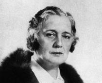
Kapustyan Xenia
Travelers who studied Siberia and the Far East:
BERG LEV SEMENOVICH
DEZHNEV SEMEN IVANOVICH
Przhevalsky Nikolai Mikhailovich
SEMENOV-TIAN-SHANSKY PETER PETROVICH
FERSMAN ALEXANDER EVGENIEVICH
Download:
Preview:
Theme: Travelers,
studied Siberia and the Far East.
Completed by: student 5A
class MBOU lyceum №1
Kapustyan Xenia
- BERG LEV SEMENOVICH……………………………………………...1
- DEZHNEV SEMEN IVANOVICH……………………………………….2
- PRZHEVALSKY NIKOLAI MIKHAILOVICH…………………………..3
- SEMENOV-TIAN-SHANSKY PETER PETROVICH…………………….....5
- FERSMAN ALEXANDER EVGENIEVICH…………………………...…..7
BERG LEV SEMENOVICH (1876-1950)
Domestic biologist and geographer, created classic works on ichthyology (the study of fish), lake science, and the theory of the evolution of life.
L.S. Berg traveled a lot and participated in expeditions,explored lakes Western Siberia , Ladoga, Balkhash, Issyk-Kul, Baikal , Aral Sea. He was the first to measure the temperature at different depths of this large lake-sea, studied the currents, the composition of the water, geological structure and relief of its coasts. He established that standing waves - seiches - are formed in the Aral Sea.
L.S. Berg wrote more than 1000 works; the largest of them are "Nature of the USSR", " Geographical zones USSR", thanks to which the doctrine of natural zones was raised to a high scientific level. “... And when did he manage to find out all this and think it over so seriously?” - Professor of Moscow University D.N. Anuchin wrote about his friend and student L.S. Berg. Berg's work "The Aral Sea" was presented by the author in 1909 to Moscow University as a master's thesis. At the suggestion of D.N. Anuchin L.S. Berg was awarded degree doctor of geographical sciences;
He devoted a lot of time to pedagogical and social work, was an honorary member of many scientific societies, foreign and Russian.
Berg's name was given to a volcano on the Kuril Islands, glaciers in the Pamirs and in the Dzungarian Alatau.
DEZHNEV SEMYON IVANOVICH (c. 1605 - 1673)
Russian polar sailor.
S.I. Dezhnev was probably born in Veliky Ustyug. In the early 1940s he went to Siberia and with a detachment of Cossacks he ended up in Yakutsk, from where he made long trips to the rivers Yana, Kolyma, etc .; sailed by sea from the mouth of the Kolyma to the mouth of the Lena River. But he was especially attracted to the Anadyr River, where, according to rumors, there were many walrus tusks. The Cossacks more than once tried to go by sea to Anadyr, but the harsh ocean met people with impenetrable ice. The first attempt, made by Dezhnev's detachment in the summer of 1647, ended in failure.
In June 1648, a detachment under the command of S.I. Dezhnev decided to repeat his last year's path. At first, the voyage was successful, but beyond Shelagsky Cape, sailors got into a severe storm, two kochas (small ships) were washed ashore. The remaining five ships managed to reach the cape, later named after Dezhnev.
The sailors made their next stop at the Chukchi Cape, but the Chukchi met the sailors unfriendly. Then on September 20 they went to sea and again fell into a storm. The ships were scattered in the roaring sea. The ship on which Dezhnev was on October 1 was thrown ashore in the region of Olyutorsky Bay. 25 people went ashore. Soon they set off in search of the Anadyr River. On the way there, half of the explorers died, and only 13 people reached the mouth of the Anadyr.
At the mouth of the Anadyr River, S.I. Dezhnev founded a prison, where he lived for 10 years. Not far from this place, he found a scythe studded with walrus tusks. Twice S.I. Dezhnev traveled to Moscow to deliver furs and tuskswalrus. During his first stay there, in 1665, he was "turned over for blood and wounds" to chieftains and appointed clerk in Olenyok. During the second journey, in 1673, he fell ill and died.
Dezhnev's main merit is that he opened the strait between Asia and America; named after him extreme point Eurasia on Chukotka Peninsula- Cape Dezhnev; a ridge in Chukotka, a bay on the coast of the Bering Sea.
Przhevalsky Nikolai Mikhailovich
(1839-1888) - Russian traveler who participated in the exploration of Central Asia.
At the age of sixteen, after graduating from high school, N.M. Przhevalsky volunteered for military service, and after 6 years he was enrolled as a student at the Academy of the General Staff. Having brilliantly finished it, the young officer began to teach geography and history at the Warsaw Junker School. All his free time he prepared for travel: he studied botany, zoology, and compiled herbariums.
His first trip was toUssuri region,where he studied nature and population. Przhevalsky saw amazing places. After all, no step, no look - everything is new, unusual. A northern spruce stands entwined with southern grapes, like a New Year's garland, a mighty Siberian cedar is next to a cork tree, a sable darts in search of prey, and a tiger immediately hunts - this can only be seen in the Ussuri taiga. N.M. Przhevalsky spoke about the results of his expedition in a book-report. During the journey, he collected the richest collection of plants and animals. It was very difficult to keep it: either it rained on the neck in the taiga day and night and moisture penetrated everywhere, or it was cold, it hindered movements, not letting go far from the fire.
After a successful Ussuri journey, the Russian Geographical Society sends N.M. Przhevalsky to Central Asia. From 1867 to 1888, he led five large expeditions, during which 33 thousand km were covered. the giant ridge Ti-Altyn-Tag, the northern outskirts of the Tibetan Plateau, was discovered. Przhevalsky himself later described the difficulties of the route: giant mountains, frosts, storms, snowfall, which not only blinded the eyes of travelers, but also hid the sparse vegetation - food for camels. And yet, no matter how difficult it was, not for a day did not stop scientific work: weather observations were made, maps were made, heights were determined, rare plants were collected, calendars were compiled.
Przhevalsky was the first of the scientists to visit Lake Lobnor. Geographers have been tormented by the mystery of this lake for centuries. They knew about him only by hearsay. It turned out that it was located in the desert lands, where the Tarim River was losing strength and spread widely over the sands. Lopnor turned out to be a shallow lake, on the banks of which nomads lived. If you look for a lake modern maps, then it may not be found. In the hundred years that have passed since then, the lake has migrated a hundred kilometers to the north and has become even larger. This happens because the Tarim River, unable to fight the desert, changes its course, flows in a different way and overflows in a new place.
In his studies of Central Asia, N.M. Przhevalsky visited both the sources of the Huang He and the upper reaches of the Yangtze, passed through the sandy Takla-Makan desert. At the beginning of the fifth expedition on the shores of Lake Issyk-Kul in 1888, Przhevalsky died of typhoid fever. The city where this happened is now called Przhevalsk.
The expeditions of N.M. Przhevalsky were of great importance and enriched science with knowledge about the regions of Central Asia by discovering, describing and mapping many ridges of Asia, rich collections of flora and fauna. He discovered in Asia a wild camel and a wild horse, previously unknown. From his companions, Przhevalsky brought up major researchers (M.P. Pevtsov, P.K. Kozlov, etc.). The works of the scientist were published in many languages.
Many geographical objects are named after the Russian traveler.
SEMENOV-TIAN-SHANSKY PETER PETROVICH
(1827-1914) - Russian geographer, zoologist, statistician, public and statesman, one of the greatest travelers of the mid-19th - early 20th centuries.
The Russian Geographical Society offered P.P. Semenov to translate the work of the German geographer K. Ritter "Geography of Asia". As he worked on the translation, his interest in the endless expanses of Asia flared up more and more. He was attracted by the then unexplored Tien Shan. European explorers have long been planning a trip to the Tien Shan. The great Alexander Humboldt also dreamed of this. But in mid-nineteenth century, little was known about the Tien Shan mountain range (in Chinese - “ sky mountains”), it was even assumed that these were mountains of volcanic origin.
Young P.P. Semenov, who studied at the University of Berlin in 1853-1854, shared with A. Humboldtwith his project of organizing a trip there. 27-year-old Semenov was already quite well known in scientific circles: he made a great trip around European Russia, was the secretary of the department of physical geography of the Russian Geographical Society. A conversation with A. Humboldt finally strengthened him in his decision to go to the Heavenly Mountains.
The expedition required careful preparation, and only in the autumn of 1856 did Semyonov and his companions reach the shores of Lake Issyk-Kul. Thanks to this expedition, it was established that this lake is drainless (it was previously believed that the river, Chu, flows out of this lake). Research has made it possible to map its exact outlines. The following year, on June 21, 1857, P.P. Semenov with a large detachment set off on an unexplored path along the Tien Shan. This expedition, perhaps, was unique in the entire history of geographical discoveries. It lasted less than three months, but its results are truly amazing: 23 mountain passes were surveyed, the heights of 50 peaks were determined, 300 rock samples were collected, insect collections, 1000 plant specimens (many of them were unknown to science), natural areas were described in detail , two transverse geological sections of the Tien Shan were obtained, which helped a deeper study of the geology of Central Asia. It was also possible to determine the height of the snow line in the mountains, to refute the idea of A. Humboldt about the volcanic origin of the mountains.
Returning to St. Petersburg, he actively participates in the preparation for publication of a map of European Russia and the Caucasus, edits the fundamental "Geographical and Statistical Dictionary" and writes important articles for it; develops the project of the All-Russian population census (1897), heads the Russian Geographical Society. With the direct participation of P.P. Semenov, many large expeditions were organized and carried out: N.M. Przhevalsky, G.N. Potanin, P.K. Kozlov.
In 1899, the first volume of the multi-volume detailed geographical description of the country “Russia. Complete geographical description of our Fatherland”, in the preparation of which P.P. Semenov and his son took part. Of the planned 22 volumes, only 13 were published, but even in an unfinished form, this fundamental work remains unsurpassed.
In 1906, 50 years have passed since the first trip of P.P. Semenov to the Tien Shan. In a special decree, it was reported that "from now on, he and descending offspring are allowed to continue to be called Semyonov-Tien-Shansky."
He completed his journey as a world famous scientist. More than 60 academies in Europe and Russia have elected Semenov-Tien Shan as its honorary member. His name is immortalized in 11 geographical names in Asia, North America and on Svalbard, and one of the peaks of the Mongolian Altai bears the name "Peter Petrovich".
Accidental pneumonia on February 26, 1914 brought the scientist and traveler to the grave.
FERSMAN ALEXANDER EVGENIEVICH
(1883-1945) - a well-known geochemist who devoted his life to discovering the wealth of the bowels, a full member of the Academy of Sciences since 1919.
In 1902, he entered Moscow University, where the famous V.I. Vernadsky, the founder of a new, genetic direction in mineralogy, which revealed the origin of minerals, became his teacher. Since Fersman entered the university, teacher and student have been working together; they create a new science - geochemistry, study chemical composition Earth.
A.E. Fersman devotes his life to revealing the riches of the earth's bowels of his homeland. He seeks to know the laws of occurrence and distribution of minerals in various types of pegmatite bodies, the results of which are reflected in his generalizing classic work - "Pegmatites" (1931).
A.E. Fersman did not conceive of a science divorced from practice. As early as 1917, he took part and was the leader of many expeditions to the Urals, Central Asia and other regions. Under his leadership, since 1920, the study of the Khibiny Mountains began, where a deposit of apatite was discovered - a raw material for obtaining phosphorus fertilizers, which are of great importance in agriculture. On the Kola Peninsula, the scientist also discovered deposits of copper, iron and nickel ores. Since 1924, A.E. Fersman organizes expeditions to the Karakum desert, where he discovers deposits of sulfur in its center, later in 1932 in Kyzylkum he discovers deposits of ores with various rare metals.
Geochemical ideas completely changed the idea of minerals - the riches of Central Asia. Being the scientific director of the Tajik-Pamir expedition, Fersman skillfully directs its detachments, which discover deposits of non-ferrous and rare metals where, as previously thought, they should not be. It is difficult to find a corner in our country where there is no scientist.
AE. Fersman wrote about 700 works. For the development of geochemistry as a science, the four-volume work of the academician "Geochemistry" is of particular importance.
In 1842-1845. on behalf of the Academy of Sciences, A.F. made his great trip to Siberia. Middendorf. His Siberian expedition had to solve two problems: the study organic life practically unexplored Taimyr and the study of permafrost. The journey covered a huge territory: through the southern part of Western Siberia to Krasnoyarsk, then along the Yenisei to Dudinka, along the North Siberian lowland to the mouth of the Khatanga and further work on Taimyr, with routes within it.
Returning to Krasnoyarsk, A.F. Middendorf continued his journey through Irkutsk to the Lena, then to Yakutsk, where he studied the permafrost in boreholes and wells, but he failed to assess the thickness of the frozen layer. From Yakutsk, the expedition set off along the Aldan River, across the Stanovoy Range to the Uda Valley and along it to the southwestern shores of the Sea of Okhotsk. After surveying the coast, the Shantar Islands and the Tugur Bay, A.F. Middendorf, together with his companions, went up the Tutur River, through the Bureinsky Mountains to the Amur basin, then along the Amur to the confluence of the Shilka and Argun, and from there through Nerchinsk and Kyakhta returned to Irkutsk.
Thus, the wonderful journey of A.F. Middendorf covered the northernmost regions of Eurasia and the vast expanses of Siberia and the Far East, right up to the shores of the Sea of Okhotsk, the Shantar Islands and the Amur basin. This expedition was not an ordinary complex expedition, but an expedition for specific problems. However, in addition to solving the main problems, Middendorf was the first to describe the relief of the vast Yenisei-Khatanga lowland and the Byrranga mountains, and characterized the geology of the mountains. And among the results of the trip to the east, in addition to studying the permafrost, were the first accurate data on the geology of the southwestern coast of the Sea of Okhotsk and the Amur basin. Middendorf correctly described this region as a mountainous country.
Siberian expedition of A.F. Middendorf played a big role in the further development of Russian geography and the organization of systematic scientific research.
Research in the south of the Far East was continued by G.I. Nevelskoy . In 1849, he passed through the Tatar Strait and established that Sakhalin was an island. Appointed in 1850 as the head of the Amur expedition, Nevelskoy organized exploration of the vast territory of the Amur region, as well as Sakhalin and the Tatar Strait, on both banks of which the Russian flag was raised. In the lower reaches of the Amur in 1850, the Nikolaevsky post (Nikolaevsk-on-Amur) was laid. The expedition explored the Lower Amur region, discovered the Burensky ridge, lakes. Chukchagirskoye and Evoron, the first accurate map of South Sakhalin was compiled. In 1853, Nevelskoy raised the Russian flag in South Sakhalin. The conclusion of an agreement with China in 1858, and then in 1860, finally secured the Russian borders in the Far East.
Continued in the XIX century and the study of the extreme north-east of the country. In 1821-1823. two expeditions were organized to study the northeastern coast of Russia and coastal waters: Ust-Yanskaya and Kolyma. The reason for this was the receipt of more and more new reports about unknown lands located to the north of these coasts ("Andreev's Land", "Sannikov's Land", the New Siberian Islands were discovered and briefly described). The Ust-Yansk expedition was led by P.F. Anzhu, and Kolymskaya - F.P. Wrangell. Both later became admirals,
The Anzhu expedition left Zhiganovsk on the Lena, described the northern shores between the river. Olenyok and the mouth of the Indigirka, paid much attention to the description of the New Siberian Islands. Anjou by compiling a relatively accurate map of this archipelago. The Kolyma expedition set off from Yakutsk through the Verkhoyansk Range, Sredne- and Nizhnekolymsk. She described the coast from the mouth of the Indigirka to the Kolyuchinskaya Bay, Bear Islands, explored the basin of the river. Bolshoy Anyui and described the tundra east of the mouth of the Kolyma and north of the river. Small Anyui (see Fig. 3).
An important role in the further study of the territory of Russia and a number of foreign regions was played by the creation in 1845 in St. Petersburg Russian Geographical Society(RGO). Similar societies began to emerge in a number of countries of the world starting from the 20s of the 19th century (Paris, Berlin, Royal in London, etc.). Russian geographical society was among the first of them. The initiators of the creation of the Russian Geographical Society were such famous scientists and navigators as F.P. Litke (headed the society for 21 years), K.M. Baer, F.P. Wrangel, K.I. Arseniev and others. This society later became the organizing and coordinating geographical center in the country. Somewhat later, its branches were opened in Irkutsk, Omsk and other cities.
The founders of the Russian Geographical Society set the knowledge of their fatherland as the very first and most important task, although the society organized expeditions to other regions. the globe(to Central Asia, to New Guinea, to Iran, to the Pacific Ocean, to the Arctic). Expeditions of the Russian Geographical Society explored vast territories modern Russia in the Urals and Altai, in the Turukhansk Territory, in the Baikal and Ussuri Territories, in Sakhalin, Kamchatka, Chukotka, not to mention Tajikistan, the Pamir-Alai and Tien Shan, the Aral Sea, Balkhash and Issyk-Kul, now foreign, and in at that time constituting the southern outskirts of Russia. The first expedition organized by the Russian Geographical Society was the expedition of the geologist Professor E.K. Hoffmann to the Northern and Polar Urals (1848-1850).
The greatest fame of the Russian Geographical Society was brought by expeditions organized to Central Asia, to its hard-to-reach regions. In fact, the expeditions of the Russian Geographical Society (N.M. Przhevalsky, M.V. Pevtsov, G.N. Potanin, P.K. Kozlov, G.E. Grum-Grzhimailo and others) opened Central Asia for Europeans.
In the Asian part of Russia, such well-known researchers as R.K. Maack, F.B. Schmidt (Eastern Transbaikalia, Amur Region, Primorye, Sakhalin), I.A. Lopatin (Vitim plateau and the lower reaches of the Yenisei) and many others.
A lot of bright pages in the history of Siberia were written by pioneers who from the first half of the 17th century set off to explore unknown lands, risking their lives in the process. Such pioneers, to whom we owe success in the development of Siberia, were Vasily Poyarkov and Yerofey Khabarov. Their life and the discoveries made during their travels deserve a separate story. Unfortunately, due to the lack of archival information, the year and place of birth of Vasily Danilovich Poyarkov are not known to us. We only know that he was originally from the northern regions of the European part of Russia and ended up in Siberia in the second half of the 30s of the 17th century. He was a smart and educated man, so he soon became an official for special assignments under the Yakut governor Pyotr Golovin. It was by his decree that in July 1643, Poyarkov, at the head of a party consisting of 132 Cossacks, “eager people” and industrialists (fur-bearing animals), went to the southeast of Siberia to explore the mysterious region at that time, called Dauria. In fact, it was a reconnaissance expedition in order to collect information and prepare for the annexation of these lands to Russia.
The first stage of the Poyarkov expedition's journey took place on plows along the Lena and Aldan rivers and further, to the limits of the Stanovoy Range. Here the party was divided into two parts. The first, numbering 90 people, went to the Zeya River, where the Daurian lands began. In anticipation of the arrival of the rest, Poyarkov carried out reconnaissance of the area, being especially interested in ores and furs. After wintering and waiting for the approach of the second party, in the spring of 1644 the expedition went further along the Zeya. Having reached the Amur in the summer of the same year, Poyarkov decided to go to its mouth. The voyage, as a result of which new information was obtained about the lands along the Amur up to Pacific Ocean, was not easy. Several dozen people died during clashes with local residents and as a result of accidents. Having reached the mouth in late autumn, Poyarkov and the remaining members of the expedition stayed for the winter, and in the spring of 1645, on a built ship, went to the Sea of Okhotsk and headed north. Having reached the Ulya River in autumn and wintered at its mouth, in the spring of the next year the expedition headed west, to the Aldan. Having gone to the river, Poyarkov reached the Lena in a few weeks and returned to Yakutsk on June 12, 1646. Together with him, only 20 people remained alive by that time. But as a result of this expedition, for the first time, information was obtained about the vast space lying between Baikal and the Pacific Ocean.
Poyarkov's case was continued by Yerofei Pavlovich Khabarov. He was born around 1603 in the Arkhangelsk region, in the family of a Cossack. He made his first known trip to Siberia back in 1625, when he went to the Siberian city of Mangazeya on a Pomeranian koche. Then new travels to Tobolsk followed. Settling then in the Siberian lands, Khabarov was engaged in agriculture, salt mining and trade for several years, not differing in any way from other Russian industrialists who lived in those days in these parts.
However, in 1648 he submitted a petition to the Yakut governor Dmitry Frantsbekov to organize an expedition to Dauria. This request was granted, and in the summer of 1649, Khabarov, at the head of a detachment of 80 people, set out from Yakutsk to the south. The first expedition was quite successful. Having scouted the territory in detail up to the Amur and returning back the following year, Khabarov recovered on the second campaign already at the head of a detachment of 180 people. With such forces, he managed to gain a foothold on the Amur and take local residents into Russian citizenship. After waiting for the approach of a new detachment of 130 people, in 1651 Khabarov went downstream, making detailed maps terrain and taking into the composition of Russia the lands lying along the Amur.
The campaign lasted almost two years, with stops for wintering. During this time, there was a rebellion of part of the detachment, which refused to go further. He was suppressed, but this slowed down progress. The strength of the party that remained with Khabarov was not enough to keep such a vast territory under control. Therefore, a detachment was sent to help him, sent by special order of Tsar Alexei Mikhailovich. In August 1653, he met with the expedition of Khabarov. However, as a result of intrigues, the latter was soon removed from leadership and accused of abuse of power. Being taken to Moscow, he was under investigation for more than a year. Finally, all charges against him were dropped, and Erofei Khabarov himself was appointed to manage the newly formed Ust-Kutsk volost. Here he went in 1655 and stayed until his death in 1671.
It is known that in 1667 Khabarov filed a new petition to organize an expedition along the Amur to the shores of the Pacific Ocean, but the fate of this petition is unknown.
It was in the 17th century that it became widespread. Enterprising merchants, travelers, adventurers and Cossacks were heading east. At this time, the oldest Russians were founded, some of them are now megacities.
Trade in Siberian furs
The first detachment of Cossacks appeared in Siberia during the reign of Ivan the Terrible. The army of the famous ataman Yermak fought with the Tatar Khanate in the Ob basin. It was then that Tobolsk was founded. At the turn of the XVI and XVII centuries. started in Russia Time of Troubles. Due to the economic crisis, famine and the military intervention of Poland, as well as peasant uprisings, the economic development of distant Siberia was suspended.
Only when the Romanov dynasty came to power, and order was restored in the country, did the active population again direct their gaze to the east, where vast spaces were empty. In the 17th century, the development of Siberia was carried out for the sake of furs. Fur was valued in European markets worth its weight in gold. Those wishing to cash in on trade organized hunting expeditions.
IN early XVII centuries, Russian colonization affected mainly the regions of taiga and tundra. Firstly, it was there that valuable furs were located. Secondly, the steppes and forest-steppes were too dangerous for the settlers because of the threat of invasions by local nomads. Fragments of the Mongol Empire and Kazakh khanates continued to exist in this region, the inhabitants of which considered the Russians to be their natural enemies.
Yenisei expeditions
On the northern route, the settlement of Siberia was more intense. At the end of the 16th century, the first expeditions reached the Yenisei. In 1607, the city of Turukhansk was built on its shore. For a long time it was the main transit point and springboard for the further advancement of Russian colonists to the east.
Industrialists were looking for sable fur here. Over time, the number of wild animals has decreased significantly. It became an incentive to move on. The Yenisei tributaries Nizhnyaya Tunguska and Podkamennaya Tunguska were guiding arteries deep into Siberia. At that time, cities were just winter quarters where industrialists stopped to sell their goods or wait out severe frosts. In spring and summer, they left the camps and hunted for furs almost all year round.
Pyanda's journey
In 1623, the legendary traveler Pyanda reached the banks of the Lena. Almost nothing is known about the identity of this man. A few information about his expedition was passed by industrialists by word of mouth. Their stories were recorded by the historian Gerard Miller already in the Petrine era. The exotic name of the traveler can be explained by the fact that he belonged to the Pomors by nationality.
In 1632, on the site of one of his winter quarters, the Cossacks founded a prison, which was soon renamed Yakutsk. The city became the center of the newly created voivodeship. The first Cossack garrisons faced the hostile attitude of the Yakuts, who even tried to besiege the settlement. In the 17th century, the development of Siberia and its most distant frontiers was controlled from this city, which became the northeastern border of the country.

Character of colonization
It is important to note that colonization at that time was of a spontaneous and popular nature. At first, the state practically did not interfere in this process in any way. People went east on their own initiative, taking all the risks on themselves. As a rule, they were driven by the desire to make money on trading. Also, peasants who fled from their native places, fleeing from serfdom, rushed to the east. The desire to get freedom pushed thousands of people into unexplored spaces, which brought huge contribution in the development of Siberia and the Far East. The 17th century made it possible for peasants to start new life on the new earth.
The villagers had to go to a real labor feat in order to start a farm in Siberia. The steppe was occupied by nomads, and the tundra turned out to be unsuitable for cultivating the land. Therefore, the peasants had to arrange arable land in dense forests with their own hands, winning plot after plot from nature. Only purposeful and energetic people could cope with such work. The authorities sent detachments of service people after the colonists. They did not so much discover lands as they were engaged in the development of those already open, and were also responsible for security and tax collection. That is how a prison was built in the southern direction, on the banks of the Yenisei, to protect civilians, which later became the rich city of Krasnoyarsk. This happened in 1628.

Dezhnev's activities
The history of the development of Siberia imprinted on its pages the names of many brave travelers who spent years of their lives on risky ventures. One of these pioneers was Semyon Dezhnev. This Cossack ataman was from Veliky Ustyug, and went east to engage in fur hunting and trade. He was a skilled seafarer and most spent an active life in the north-east of Siberia.
In 1638 Dezhnev moved to Yakutsk. His closest associate was Pyotr Beketov, who founded such cities as Chita and Nerchinsk. Semyon Dezhnev was engaged in collecting yasak from the indigenous peoples of Yakutia. It was a special type of tax imposed by the state for the natives. Payments were often violated, as local princes periodically rebelled, not wanting to recognize Russian power. It was for such a case that detachments of Cossacks were needed.

Ships in the Arctic seas
Dezhnev was one of the first travelers who visited the banks of rivers flowing into the Arctic seas. We are talking about such arteries as Yana, Indigirka, Alazeya, Anadyr, etc.
Russian colonists penetrated into the basins of these rivers in the following way. First, the ships descended along the Lena. Having reached the sea, the ships went east along the continental coasts. So they fell into the mouths of other rivers, rising along which, the Cossacks found themselves in the most uninhabited and outlandish places in Siberia.
Opening of Chukotka
Dezhnev's main achievements were his expeditions to Kolyma and Chukotka. In 1648 he went to the North to find places where he could get valuable walrus bone. His expedition was the first to reach here Eurasia ended and America began. The strait separating Alaska from Chukotka was not known to the colonialists. Already 80 years after Dezhnev, Bering's scientific expedition, organized by Peter I, visited here.
The journey of desperate Cossacks lasted 16 years. It took another 4 years to return to Moscow. There, Semyon Dezhnev received all the money due to him from the tsar himself. But the importance of it geographical discovery became clear after the death of the brave traveler.

Khabarov on the banks of the Amur
If Dezhnev conquered new frontiers in the northeast direction, then in the south there was a hero. They became Erofey Khabarov. This discoverer became famous after he discovered salt mines on the banks of the Kuta River in 1639. was not only an outstanding traveler, but also a good organizer. Former peasant founded salt production in the modern Irkutsk region.
In 1649, the Yakut governor made Khabarov the commander of a Cossack detachment sent to Dauria. It was a remote and poorly explored region on the borders with the Chinese Empire. Natives lived in Dauria, who could not offer serious resistance to Russian expansion. Local princelings voluntarily passed into the citizenship of the king, after a detachment of Erofei Khabarov turned out to be on their lands.
However, the Cossacks had to turn back when the Manchus came into conflict with them. They lived on the banks of the Amur. Khabarov made several attempts to gain a foothold in this region by building fortified fortresses. Due to the confusion in the documents of that era, it is still not clear when and where the famous pioneer died. But, despite this, the memory of him was alive among the people, and much later, in the 19th century, one of the Russian cities based on the Amur was named Khabarovsk.

Disputes with China
The South Siberian tribes, passing into the citizenship of Russia, did this in order to escape the expansion of the wild Mongol hordes, who lived only by war and the ruin of their neighbors. Duchers and Daurs suffered especially. In the second half of the 17th century, the foreign policy situation in the region became even more complicated after the restless Manchus captured China.
The emperors of the new Qing Dynasty began aggressive campaigns against the peoples who lived nearby. The Russian government tried to avoid conflicts with China, because of which the development of Siberia could suffer. In short, diplomatic uncertainty in the Far East persisted throughout the 17th century. It wasn't until the next century that states entered into a treaty that formally defined the borders of countries.

Vladimir Atlasov
In the middle of the 17th century, Russian colonists learned about the existence of Kamchatka. This territory of Siberia was shrouded in secrets and rumors, which only multiplied over time due to the fact that this region remained inaccessible even to the most daring and enterprising Cossack detachments.
"Kamchatsky Ermak" (in the words of Pushkin) was the explorer Vladimir Atlasov. In his youth, he was a yasak collector. public service was given to him easily, and in 1695 the Yakut Cossack became a clerk in the distant Anadyr prison.

His dream was Kamchatka... Having found out about it, Atlasov began to prepare an expedition to a distant peninsula. Without this enterprise, the development of Siberia would be incomplete. The year of preparation and collection of the necessary things was not in vain, and in 1697 the trained detachment of Atlasov set off.
Exploration of Kamchatka
The Cossacks crossed the Koryak Mountains and, having reached Kamchatka, were divided into two parts. One detachment went along the western coast, the other studied the east coast. Having reached the southern tip of the peninsula, Atlasov saw from afar the islands previously unknown to Russian explorers. It was the Kuril archipelago. In the same place, among the Kamchadals in captivity, a Japanese named Denbey was discovered. was shipwrecked and fell into the hands of the natives. The liberated Denbey went to Moscow and even met with Peter I. He became the first Japanese that the Russians had ever met. His stories about his native country were popular subjects of conversation and gossip in the capital.
Atlasov, having returned to Yakutsk, prepared the first written description of Kamchatka in Russian. These materials were called "fairy tales". They were accompanied by maps compiled during the expedition. For a successful campaign in Moscow, he was awarded a reward of one hundred rubles. Atlasov also became a Cossack head. A few years later he returned to Kamchatka once again. The famous pioneer died in 1711 during a Cossack riot.

Thanks to such people, in the 17th century, the development of Siberia became a profitable and useful enterprise for the whole country. It was in this century that the distant land was finally annexed to Russia.
Youth of Ivan Dementievich Chersky
Ivan Dementievich Chersky, a Pole by origin, was born in $1845$. At the age of $18$ he took an active part in the Polish uprising of $1863$.
After the suppression of the uprising, Chersky was exiled to Siberia and enlisted as a private in the Omsk linear battalion. At the stage, the young man met Alexander Chekanovsky, and later Grigory Potanin. Under their influence, he took up zoology and geology.
In the autumn of $1871, on the recommendation of Chekanovsky, Dmitry Chersky was introduced to the director of the Siberian branch of the Geographical Society, Usoltsev. Soon the young exile received the position of conservator and librarian of the museum.
First expedition
In $1873, the Geographical Society commissioned the twenty-eight-year-old Chersky to explore the mountainous part of the Irkutsk province. All summer the expedition explored the Eastern Sayan and Kuznetsk Alatau. Accurate measurements of the heights of these mountains were made. They turned out to be higher than previously thought. Ethnographic materials about the Soyot tribe were collected. In addition, the expedition collected rich collection material on zoology and geology. In the summer of the following year, Chersky again explores the Tunkinsky Goltsy ridge, tries to establish their connection with the Sayan Mountains, studies the vicinity of the Biryusa River, and heads to the Nizhneudinsk region.
Ready-made works on a similar topic
- Coursework 420 rubles.
- abstract Ivan Dementievich Chersky, explorer of Siberia, geographer, geomorphologist, geologist 270 rub.
- Test Ivan Dementievich Chersky, explorer of Siberia, geographer, geomorphologist, geologist 230 rub.
In the Nezhneudinsk region, he manages to find caves with preserved remains of extinct animals. After two months of work in these caves, Chersky returns to Irkutsk. For the work done and the large number of exhibits brought, the St. Petersburg Academy of Sciences awarded Ivan Chersky with a silver medal.
Research in the Baikal region
In May 1877, a young scientist went to Kultuk to unravel the origin of Lake Baikal. Moving along the banks of this unique reservoir, the researcher collects Buryat legends and beliefs. Chersky completed his seven-month research at the mouth of the Barguzin.
The next year, the scientist goes to explore the northern tip of the lake. He pays special attention to the study of the Angara. During this expedition, Chersky was finally convinced that Baikal was formed as a result of prolonged subsidence earth's crust which continues to this day. Before that, it was believed that Baikal was once a bay of the Arctic Ocean.
At the third stage of the expedition, Chersky decided to explore the northwestern coast of the lake. Upon returning from a trip, he leaves the museum and begins processing the collected materials.
Remark 1
In the winter of $1880, Ivan Dementievich Chersky completed his work on Baikal. His work, containing drawings and geological maps, refuted the hypotheses of Humboldt and Middendorf about the origin of the lake. This work aroused great interest in scientific world, and the scientist himself was awarded a gold medal.
Exploration of North-Eastern Siberia
In the summer of $1891$, the Academy of Sciences sends Chersky to study the basins of the Yana, Indigirka, and Kolyma. The scientist gets through Yakutsk to Verkhoyansk. He studies the Verkhoyansk Range, the Oymyakon Plateau, the Tas-Kystabyt Range. During the expedition, heights are measured, the direction of the ridges is specified, and the watershed between the Indigirka and Kolyma basins was discovered.
The expedition was designed for three years. But at the end of $1891, first an early winter, and then the scientist's illness, delayed the expedition. The route was continued only in May $1892$. But Chersky's illness worsened. After the death of Ivan Dementievich Chersky in June $1892, the expedition continued under the leadership of the scientist's wife, Mavra Pavlovna Cherskaya. She fully fulfilled the research plan outlined by Ivan Dementievich.
The results of Chersky's expedition
Remark 2
Over the course of many years spent in Siberia, Ivan Dementievich Chersky explored in detail the region of Lake Baikal, North-East Siberia. He made accurate drawings and maps of the studied regions. Expeditions under his leadership collected the richest mineralogical, zoological and botanical collections. Ethnographic materials are of great value for studying the life, way of life, and beliefs of the peoples of Siberia.
- In contact with 0
- Google Plus 0
- OK 0
- Facebook 0